Rapid
TX
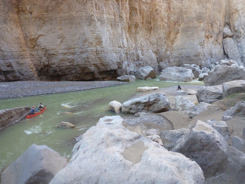
Mouth of Santa Elena Canyon / Terlingua Creek Confluence
Save this feature with the run it belongs to.
Gauge Conditions
Runnable: 150.0 – 10,000.0 CFS
Too low for reasonable whitewater trip.
Data from American Whitewater & USGS
Description
Some people choose to access the river here for "boomerang trips" (paddling upstream to Fern Canyon at low water levels-- generally < 150 cfs), but accessing the river here requires hiking your boat about 250-300 yards through sand (and sometimes through Terlingua Creek, if it is running.)
Location
Other Rapids on This Run (10)
View Full Run
3. Santa Elena Canyon: Lajitas to Santa Elena Canyon River Access (20 miles)
Rio Grande
II(III)
20.6 mi
Current Conditions
5-Day Forecast
Whitewater data from
American Whitewater
American Whitewater