Gauge Conditions
Likely 'fish flow' of 350 cfs.
Photo
Description
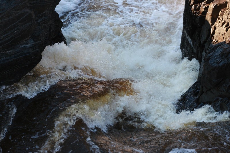
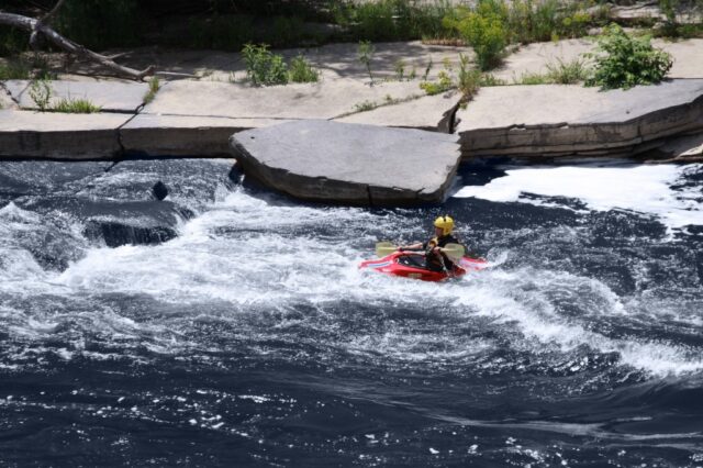
After the second sister, you will see a horizon line which signals Octopus, a class V puzzle best scouted (or portaged) river left.
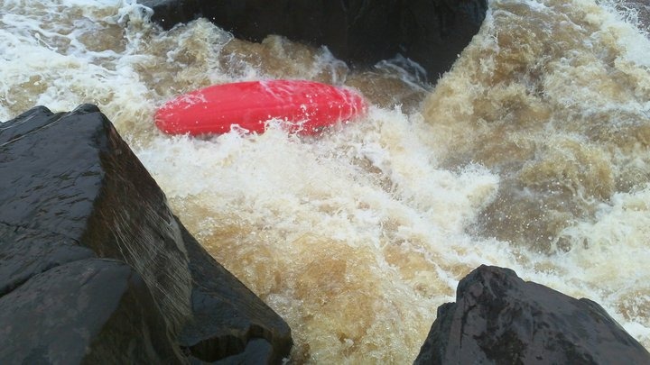
Octopus starts off with a transverse dike of rock funneling most of the water off to river left, where a slot exists through which the river is twisted and falls into a pool below. Some boaters may choose to run this route (known as "The Beak"), but most will slide down a (often barely water-slicked) steep-faced rock far to the right, into a pool below.
Following this, the river is immediately funneled down between parallel splines of rock leading off to the left. Numerous routes are possible, though tight right (staying high, then 'boofing' into a potentially sticky hole) or well to the left (losing a bit more elevation, with tricky 'trip-rocks' en route, before dropping over a slightly smaller ledge into a slightly smaller hole (beware the rock slightly underwater in the hole).
As I understand it, the name "Octopus" derives from (by some count or exaggeration) as many as eight different holes, one waiting to catch you virtually no matter where you run this drop.
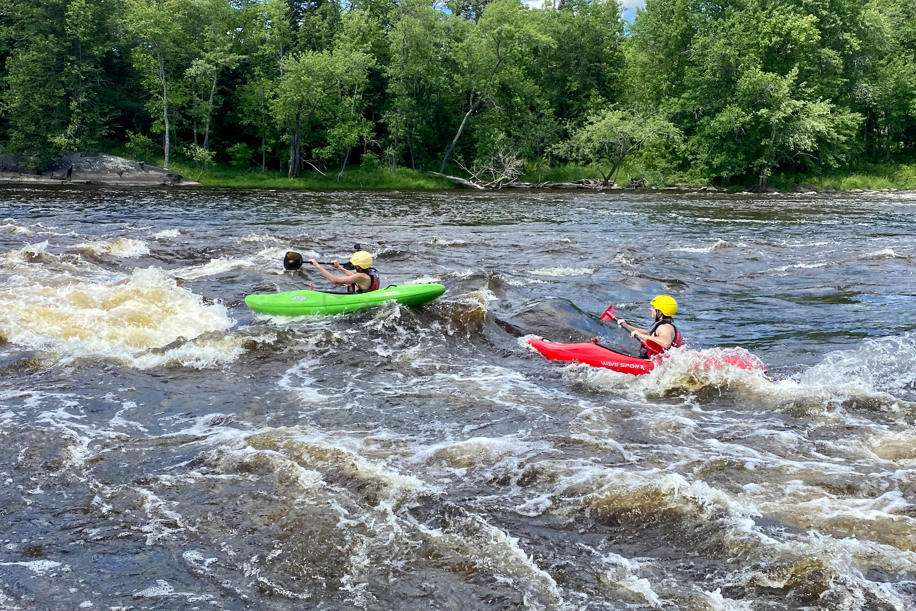
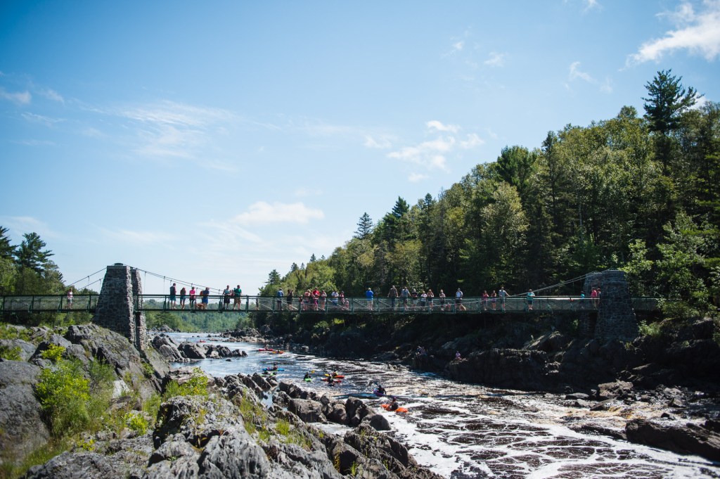
Downstream, wide easy rapids and flatwater lead to the island above the Swinging Bridge at Jay Cooke State Park.
Location
Other Rapids on This Run (13)
 Waterfall
IV+
Waterfall
IV+
 Rapid
N/A
Rapid
N/A
 Playspot
III
Playspot
III
 Playspot
III
Playspot
III
 Waterfall
IV
Waterfall
IV
 Playspot
N/A
Playspot
N/A
 Rapid
IV+
Rapid
IV+
 Rapid
N/A
Rapid
N/A
Current Conditions
5-Day Forecast
American Whitewater