Rapid
WI
Rush City Ferry Landing
Save this feature with the run it belongs to.
Gauge Conditions
Runnable: 1,000.0 – 5,000.0 CFS
Uncertain! Help us out! Add a comment about boatable range!
Data from American Whitewater & USGS
Photo
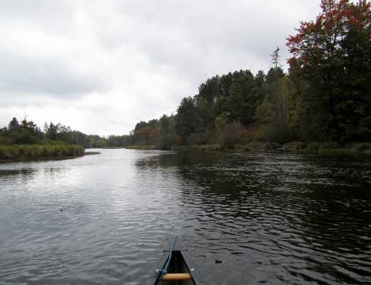
Photo courtesy of American Whitewater
Description
At Rush City Ferry Landing, paddlers encounter a straightforward section of the St. Croix River with a convenient boat ramp on river right. While no specific technical challenges are noted, boaters should be prepared for standard river conditions and use the boat ramp for easy access and potential put-in or take-out opportunities.
Location
Interactive river map
Loads as you approach this section.
Other Rapids on This Run (20)
Rapid
I
State Line Rapids
Rapid
N/A
Lower Tamarack Landing
 Rapid
I
Rapid
I
Ledge Drop
Rapid
N/A
Thayers Landing
Rapid
N/A
Little Yellow Banks Landing
Rapid
N/A
St. Croix State Park Main Landing
Rapid
N/A
Sand Creek Landing
Rapid
N/A
Norway Point Landing
Rapid
N/A
Nelsons Landing
Rapid
I
Pike Rapids
Rapid
N/A
Head of the Rapids Landing
Rapid
II
Big Beef Rapids
Rapid
I
Upper Kettle Rapids
 Rapid
N/A
Rapid
N/A
Fox Landing
Rapid
I
Lower Kettle Rapids
Rapid
II
August Olson Rapids
Rapid
N/A
Soderbeck Landing
Rapid
N/A
Snake River Landing
Rapid
N/A
Sandrock Cliffs
Rapid
N/A
Highway 70 Landing
View Full Run
B) Riverside Landing to St. Croix Falls (up to 77 miles)
St. Croix
I-II
77.0 mi
Current Conditions
5-Day Forecast
Whitewater data from
American Whitewater
American Whitewater