Sliding Chicane / Rooster Tail Wave
Save this feature with the run it belongs to.
Gauge Conditions
Too low. Boat and paddle abuse (scraping down a cement ditch and rocky rapids).
Photo
Description
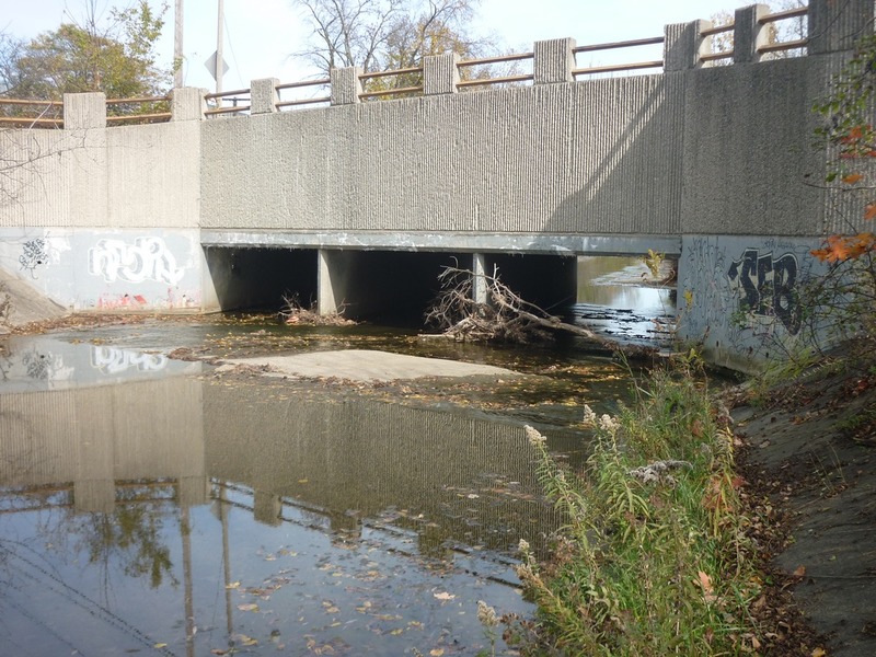
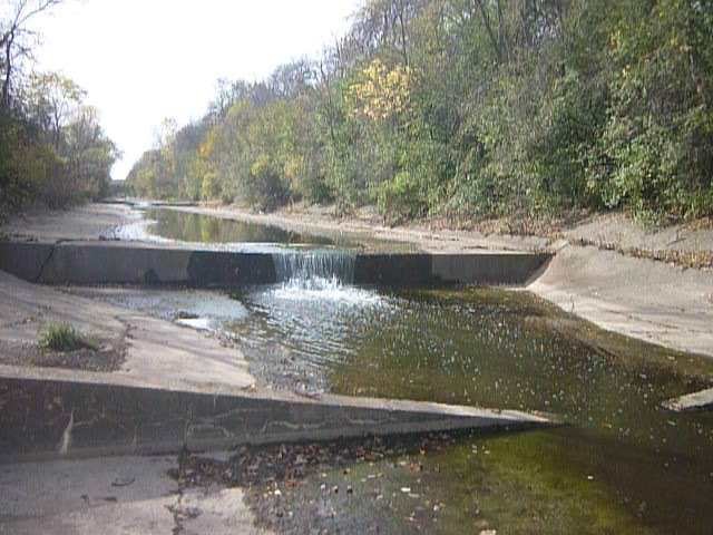
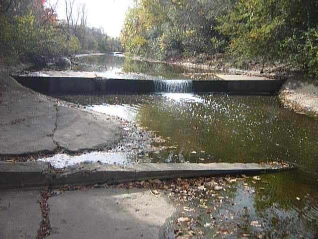
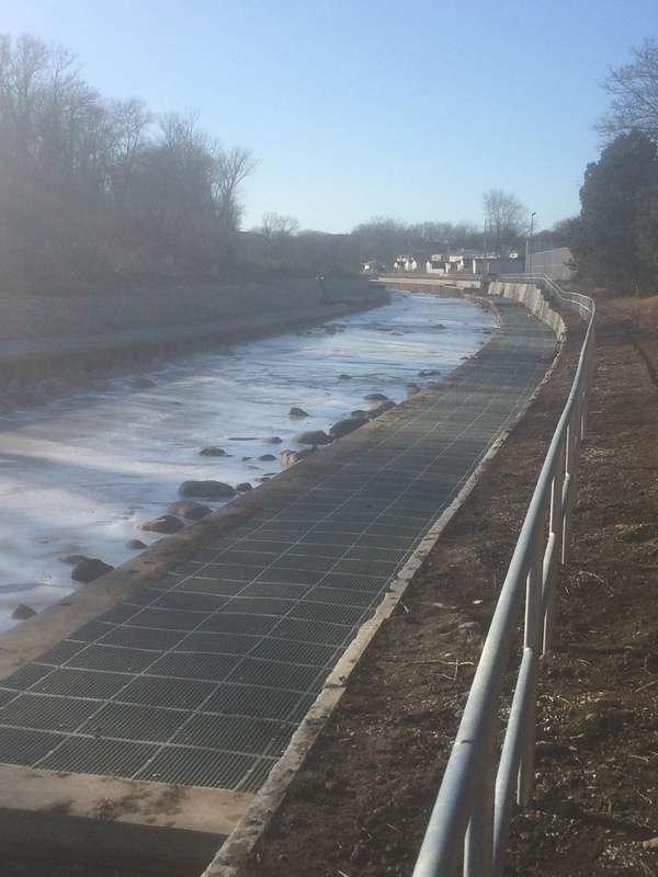
The river heads toward and passes under the railroad tracks just downstream of Watertown Plank Road. (There are actually two levels of tracks, one parallel to the creek, the other on the trestle overhead relatively perpendicular to the creek.) The cement channel slopes a bit and heads toward a vertical corregated steel wall which sends the water careening right before it careens back left in the cement channel below.
At moderate flows, a sweet surfable (catch-on-the-fly) wave forms before you accelerate into the chicane. (Note: at low-to-moderate flows, rather than accelerate, you will grunge and grind through here, as the water sheets so fast and shallow across the wide cement slab.)
Below the chicane, at moderate boatable flows, a sweet rooster-tail wave forms. A strong eddy forms to the inside of the bend, facilitating paddlers who want to eddy-out to try for surfs on the wave.
While there is not a vertical 'jump' here, don't take this area lightly! The jumps may look a bit more intimidating, but they are generally pretty straightforward -- paddle hard, paddle over, and paddle out. However, at moderate-to-high flows, to successfully negotiate this chicane and wave, you will have to be able to pick a path and hit it! (Paddle, maneuver, and be ready to brace!) You could just 'go with the flow', but that strategy is likely to send you careening into the wall midway through the drop, likely missing the rooster-tail wave, and then careening into a very uncomfortable spot against the sloping cement sides downstream. If you flip and end up out of your boat, it will be very awkward to try to recover your gear and remount (floating in the 'inside the bend' eddy) to continue.
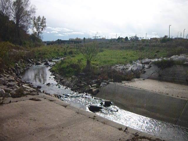
Since the remediation projects have so diminished all the action downstream, anyone who opts to do this run has two choices:
1) Finish the 'full run', knowing that the rest of Underwood Creek is merely a minor class II rock-dodge/rock-bash, followed by a mile+ of MenWesTosa which is flatwater, minor riffs and rips, (or, more likely continuing all the way to run MenTosa, for ~7 mile total on the water)
-- OR --
2) Risk a 'park-and-huck'/'park-and-play', putting in from the parkway near 115th Street, running to just under Hwy.100/Mayfair Road, to get out there and carry (~0.6 mile) back up the bike path. Trying to exit your boat gracefully within the steep-sloped sides of the cement ditch here will not be easy.
I say 'risk' because this is a super-high-visibility location. Unless you are running it during cold, miserable weather, there is likely to be walkers, joggers, and bikers on the path, and plenty of traffic around both put-in (115th and the parkway road) and take-out (Hwy.100/Mayfair Road and Watertown Plank Road). This means high potential that someone 'official' might take issue with you paddling this stretch of cement ditch. For that reason, I have never been tempted to try the PnP.
Location
Other Rapids on This Run (20)
 Playspot
I
Playspot
I
 Rapid
I
Rapid
I
 Waterfall
II
Waterfall
II
 Waterfall
II
Waterfall
II
 Waterfall
II
Waterfall
II
 Rapid
N/A
Rapid
N/A
 Waterfall
II
Waterfall
II
 Waterfall
II
Waterfall
II
 Waterfall
N/A
Waterfall
N/A
 Waterfall
N/A
Waterfall
N/A
 Hazard
II
Hazard
II
 Waterfall
N/A
Waterfall
N/A
Current Conditions
5-Day Forecast
American Whitewater