Hazard
MI
Weir/Dam
Save this feature with the run it belongs to.
Gauge Conditions
Runnable: 400.0 – 4,000.0 CFS
Almost certainly too low for reasonable boating. (Likely less than 100 cfs.)
Data from American Whitewater & USGS
Photo
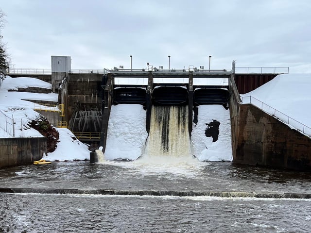
Photo courtesy of American Whitewater
Description
It appears there is a small dam or weir crossing the river at this point. At some flows it may form a rather uniform hydraulic which may require scouting and possible portage. More likely, at most flows, it appears likely to allow passage (especially to one shore or the other), and could (at some flows) even create some play opportunity (with appropriate caution regarding flows and retentiveness).
Location
Interactive river map
Loads as you approach this section.


View Full Run
B) Hickey Creek to Hwy.41 (5.7 miles)
Sturgeon (Baraga)
II(III)
5.5 mi
Hazard — Exercise extreme caution. Portage recommended — scout before running.
Current Conditions
5-Day Forecast
Whitewater data from
American Whitewater
American Whitewater