2. Bear Creek (Drum-beater) to South Fork confluence
Gauge Conditions
Runnable: ? – ? CFS
Approximate reading: This gauge is 13.3 miles away on Skykomish. Use as a general reference only.
Data from American Whitewater & USGS
Run Map
Run Time Estimate
Select put-in and take-out to estimate time.
Plan This Trip
See wind-adjusted speed maps, forecast planning, and detailed time estimates.
Sign in to generate an AI timing estimate for this run.
Whitewater timing varies with scouting, portages, and group pace. Use as a planning baseline.
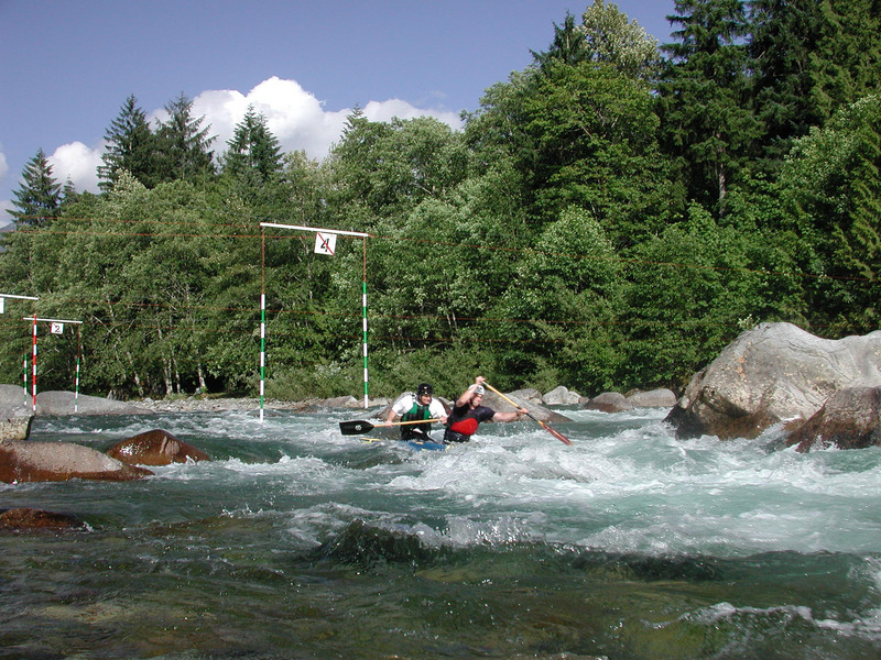
Description
The North Fork offers a diverse range of paddling experiences over a relatively short reach of river. It is typically flowing during the first fall rains and during snowmelt. The run starts with a technical class IV+ canyon and ends on a large river. The typical put-in is at the pool below Drum Beater. The last pitch of Drum Beater is fairly straightforward, but don't make the mistake of putting in too high. Depending on a flow, a terminal hydraulic near the middle of the rapid can make for a bad start to the day. Be sure you have safety set if you plan to run this rapid just above the standard put-in. Most just put in at the beautiful pool at the base of the rapid.
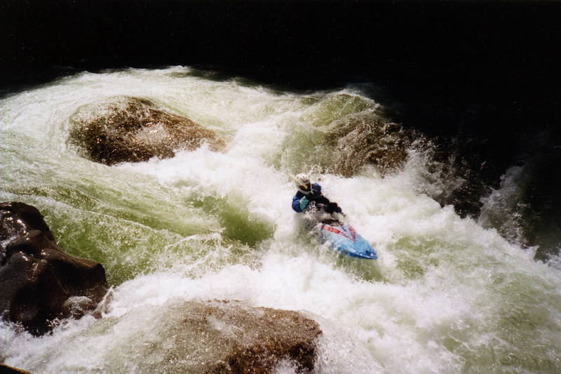
The crux rapid, Let's Make a Deal, comes near the end of the canyon. Paddlers have a choice of several slots between a series of boulders lined up across the channel. It is common to see wood blocking at least one of the slots so it's wise to scout or get a wood report. The far left slot is often the easiest to boat scout. After Let's Make a Deal the river opens up as Troublesome Creek enters from the right and you pass through a boulder garden with the Troublesome Creek Campground and road to your right.
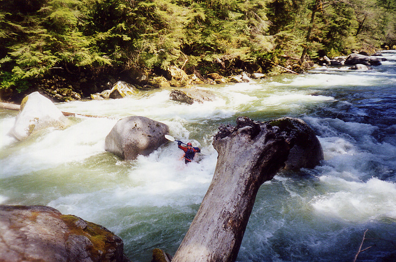
As you parallel the road, the next horizon line marks Rooster Tail. Rooster Tail underwent signficant changes in the 2006 flood. Pull out along the road (where the bank has been armored with rocks to protect the road) and continue along the trail through the woods to scout or portage the rapid. Paddlers that make it over the first pitch come through shining, but those who have trouble at the top compound their troubles as they continue through the rapid. The whitewater is very continous from the base of this rapid down to the next bridge.
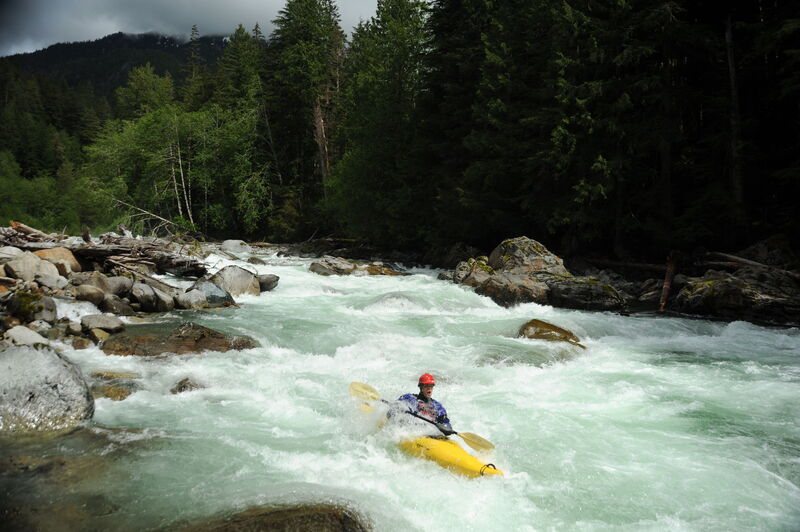
After Rooster Tail the river calms down a notch to class IV and the rest of the run can be boat scouted. The main hazards are occasional trees and a few rapids that contain some significant holes that increase in size with the flow.
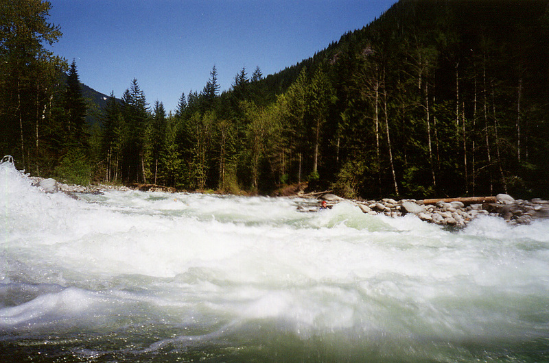
The next major rapid is El Nino. You will know you are getting near when you pass under a one-lane private bridge and several cabins. The rapid begins shortly after the confluence of Silver Creek which enters from river right. El Nino can be easily scouted from the road and the typical route hugs river left along the road. A great surfing wave awaits at the bottom of El Nino on river right.
After El Nino, the river picks up a notch in power although the rapids don't get any more difficult. Three rapids with some big, but mostly friendly, holes called the Minefield are the highlight of this section. Kayakers often take out at Seven Mile Bridge (public access) or Trout Creek (private access).
Boaters who want to make a longer day or those who want to put-in here for a less challenging class III run can continue from Seven Mile Bridge down to Index or even on to the South Fork confluence for another six miles of whitewater (use caution and check in with locals for current beta as there have been log jams in this section requiring a portage). On this stretch, the Index Bridge is one potential access point that is also a put-in for those running the main stem of the Skykomish. Below the bridge, the river continues for another mile and a half with more good class II and III rapids, including Llama Ledges, before joining with the South Fork Skykomish.
Logistics:
A major flood in 2006 damaged the road in several places with repairs finally completed in 2023 when the reroute from mile 6.4 to 6.9 was finished. During this time the river was only unavailable by a long detour up the Beckler and up and over Jacks Pass, which made the river inaccessible for much of the winter rainy season.
Now that the repairs are complete, you can access the run from Index. From Highway 2 mile 35.6 turn north up the North Fork Road (becomes FR 63) at the Mt. Index Cafe. For a longer run, one potential access point for a take-out is at the Index Bridge 1 mile up the road (upstream river right). There is another public parcel at mile 2.4 that is owned by State Parks and may one day be developed into a day use site (at levels above 4000 cfs at Goldbar this is a decent put-in for a run continuing on down to the Railroad Bridge on the main Sky).
A private access point and campground is owned and managed by Outdoor Adventure Center at mile 6.1 at the Trout Creek Bridge (elevation 840'). Permission must be obtained to use this access point. A public take-out on Forest Service land is available at a pull-out upstream at mile 6.9 at Seven Mile Bridge.
You will pass a turn-off for Forest Road 6330 at mile 9.1 that crosses the river. If you want to scout El Nino, it is a couple hundred yards upstream of this turn-off. Continue on FR 63. You will find a lower put-in near mile 10.7 where the river closely parallels the road (if you're putting in here you'll probably want to launch downstream of Rooster Tail). Continue on FR 63, 0.4 miles past the Troublesome Creek Bridge to mile 11.6 and the put-in to the upper canyon section at Drum Beater (elevation 1335'). You'll be able to see the canyon through the trees past this bridge and there is a short trail once you get to a point where the river starts to become less visible. There is shoulder space for a couple cars; additional vehicles will need to find parking downstream. Check road conditions with Mt. Baker - Snoqulamie National Forest; follow link to the Roads and Trails Conditions report under the Visit Us menu.
For additional information see:
Bennett, J. and T. Bennett. 1997. A guide to the whitewater rivers of Washington, second edition. Swiftwater Publishing. Portland, OR.
Difficulty
Class IV
Length
12.4 mi
Gradient
72 ft/mi
max 130
Rapids
10
Access Points
Difficulty Classes
I Easy
II Novice
III Intermediate
IV Advanced
V Expert/Extreme
VI Unrunnable
Current Conditions
5-Day Forecast
Whitewater data from
American Whitewater
American Whitewater