2. Soda Springs to Deadline Falls Recreational
Gauge Conditions
Runnable: 500.0 – 4,000.0 CFS
Data from American Whitewater & USGS
Run Map
Put-in
Take-out
Rapids/Hazards
Recreational
Run Time Estimate
Select put-in and take-out to estimate time.
Plan This Trip
See wind-adjusted speed maps, forecast planning, and detailed time estimates.
Sign in to generate an AI timing estimate for this run.
Whitewater timing varies with scouting, portages, and group pace. Use as a planning baseline.
Description
This is an ideal class III river with several different sections to choose from providing opportunities for 6-8 mile day trips or longer during the times when the water is high. The rapids are closer together near the top and slowly get farther apart. A standard intermediate run and the classic whitewater section is from Horseshoe Bend to Gravel Bin, but anything above Susan Creek is good fun. The beauty is great, the isolation is good, and the season is long. This river is best after the first heavy rain in the fall and in most years the season lasts all the way through Memorial Day weekend. Flows start to drop after that and interest in fishing increases.
This run splits conveniently into five sections as identified by BLM and well labeled on river maps. Paddlers often combine sections or do portions of sections depending on flows and level of whitewater challenge desired. The river makes a great destination for trips where a big group can subdivide into smaller groups that paddle different segments before all coming back together in the evening. Before embarking on any section of the North Umpqua, check the BLM guidelines to avoid conflict with fishermen.
_Segment 0: Soda Springs to Boulder Flat (1.25 miles)_
The put-in is a little rugged for rafts but is an add on enjoyed by kayakers. This section is more continuous and a lot of fun.
The free-flowing Wild and Scenic North Umpqua River Corridor begins just below the Soda Springs Power House.
* * *
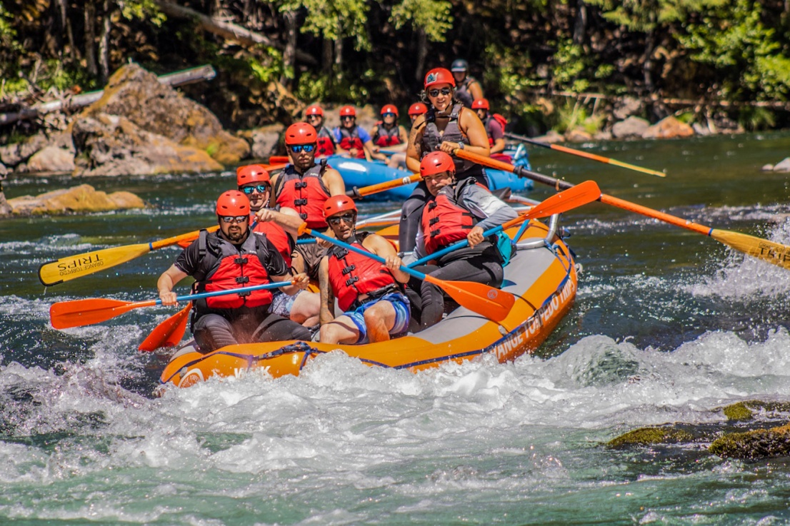
Segment 1: Boulder Flat to Horseshoe Bend (6.5 miles; float time 2-3 hours)
This is a beautiful 6-mile section of class II-III river with fast clear water, rock cliff vistas and intimate nooks with ferns on shore and salmon in the water. It also has a highway shuttle and a campground at the takeout (Horseshoe Bend CG). It's a touch easier than the segment downstream but still requires class III skills to navigate successfully.
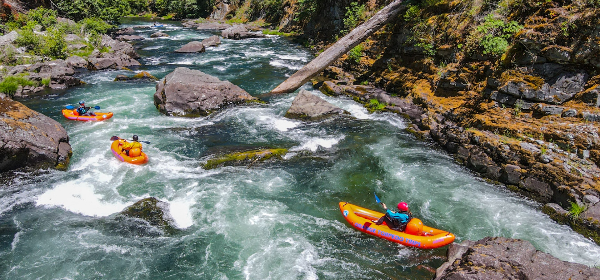
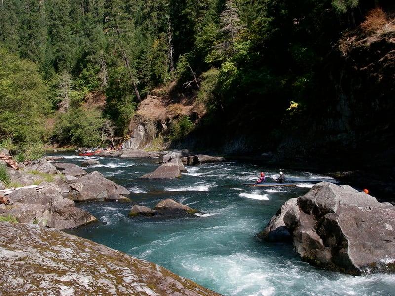
Launch at Boulder Flat Campground where a paved boat ramp is the usual put-in for rafts and summer runs. The whitewater starts right away and intensifies down to Boulder Hole, then lets up a bit. Still there are regular interesting drops, lots of amusing play spots, and gorgeous scenery the whole way. The agency map says this section to Oxbow has five Class II+ and four Class III rapids. One favorite surfing wave/hole is underneath Marster's Bridge, and there's a spin spot just above the Old Marsters Bridge abutments. This section ends with a bang: Dog Wave, Puppy Wave, Happy Rock, Cardiac Arrest (aka Secret Garden), and Weird Weir. Cardiac arrest is named that way because it collects wood and is not always a runnable option: scout first! Weird Weir is also a rapid to respect: there is a sneak on the left over the ledge that prevents quite a few swims.
The first good takeout is river right immediately after Weird Weir. On google maps it is named the Horseshoe Bend Raft Launch. There is ample parking and a toilet here, as well as some picnic tables. No camping is allowed here but downstream in Horseshoe Bend Campground there are several campsites that access the river.
Spawning chinook salmon can be seen from September into November at the Weeping Rocks Watchable Wildlife site, and throughout the run. Please do not disturb the fish or their spawning gravels. To avoid conflicts with fishermen, the BLM requests we boaters restrict our floating hours on this segment to daytime: between 10am and 6pm from July 1 to October 31 on this segment.
Several trails, including the North Umpqua Trail, can be accessed from this segment.
* * *
Segment 2: Horseshoe Bend to Gravel Bin (7.5 miles; float time 2-3 hours)
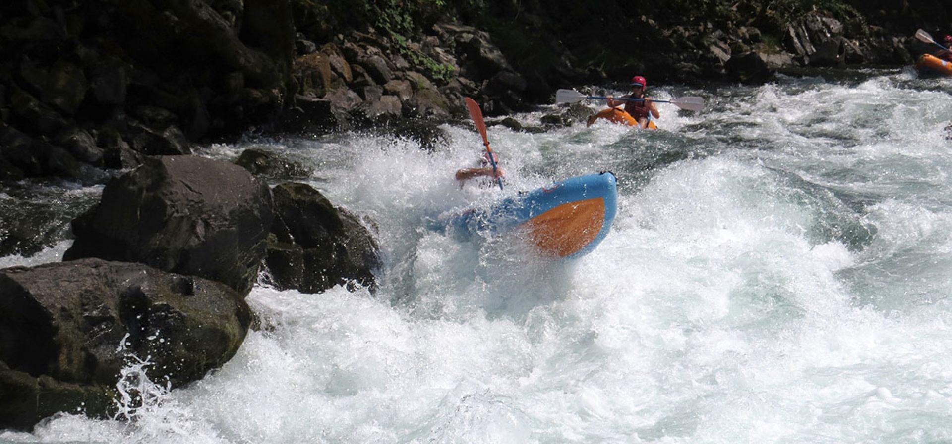
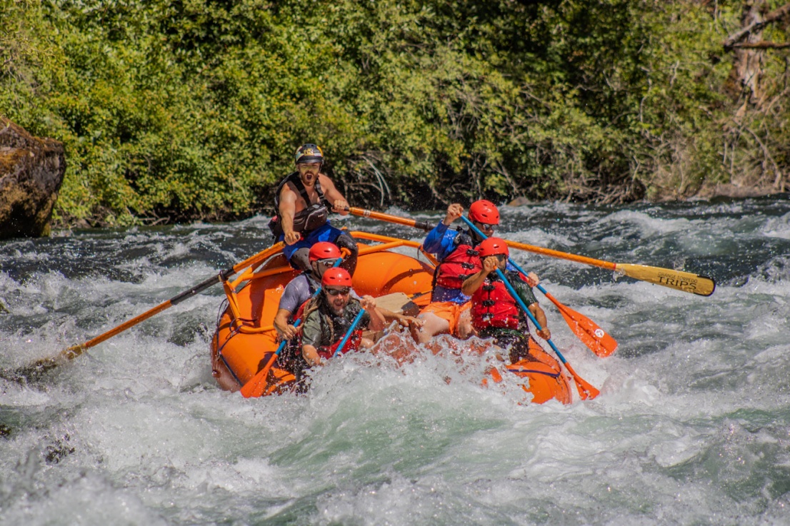
This segment has the most excitement, having one Class IV rapid and eight Class III rapids according to the official map. It's great fun if you have the right skills. The gradient is over 30 feet per river mile, and it stays interesting and moves well easily down to 1,000cfs on the gauge, though we will run it lower. It can be run at very high water but gets less interesting as it washes out and gets dangerous.
The first heads-up rapid is after the river bends left below the Horseshoe Bend. The Froggers run together and get very continuous at high water. It just keeps coming. When you see a rock tower well above the highway on river right you are approaching Eiffel Rapid, a notable constriction rapid that forms powerful waves and holes.
When you go under Panther Creek Bridge you should know that you are approaching Alligator and Pinball, the class IV. Alligator is easy to recognize by the giant quiet pool above it. The calm before the storm. Alligator is a tricky lead-in drop with a diagonal hole/seam that flips more than its share of small boats. It's not a bad idea to set rope river left below it if you have a group with lots of potential swimmers. The river slows briefly when it hits the left bank, then veers straight into Pinball which is a long, technical rapid. There's not a great way to portage it either, so if you're running this section, you need to be ready to run Pinball--or don't launch. There's a nice break spot river right below Pinball, and people tend to think they're nearly through the trip, but in reality you're about halfway.
There are quite a few more horizons downstream but it's easier than what you've already run. Watch out for a few significant holes. At the very end of the run there's Wave City, a great surfy section close to Island Campground. Save some strength for this.
Gravel Bin is an ugly name for a pretty spot. The takeout at Gravel Bin has several good get-out spots downstream from the main boatramp where the rafts go. There's a toilet and a changing room here. The shuttle is fast on the highway. This is indeed whitewater heaven, right here at Gravel Bin.
To avoid conflicts with fishermen, the BLM requests that boaters avoid floating from 6pm to 10am from July 1 to October 31 on this segment.
* * *
Segment 3: Gravel Bin to Bogus Creek (5 miles; float time 2 hours)
The segment has one Class III rapid and five Class II+ rapids. This section is best in the spring when the water is higher and before the summer fish closure.
Renowned for its excellent summer steelhead fly-fishing opportunities, the Gravel Bin to Bogus river segment provides a unique challenge to anglers from all over the world. Popular since the early 1900’s, fly fishing for the elusive summer steelhead is the primary use of this segment from July through October. Over two dozen named fishing holes are found in the section near the Steamboat Creek confluence.
To protect the fly angling experience, the BLM requests that floaters avoid this segment from 6pm to 10am July 1 through July 14, and completely from July 15 through October 31 each season.
* * *
Segment 4: Bogus Creek to Susan Creek (7 miles; float time 3-4 hours)
This area offers multiple recreation opportunities from great whitewater adventures to steel head and trout fly-fishing. hiking in old-growth forests and waterfall viewing.
In this segment boaters will experience four Class III rapids and five Class II+ rapids. The river takes on a 'pool-drop' nature as the rapids are separated by long stretches of flat water.
The Class III rapids are very challenging at all flows and include a portage at Bathtub rapid at lower flows (below 1000 CFS). Rafters should scout carefully. At high flows in the spring. the rapids feature huge waves and holes that can flip a raft.
To avoid conflicts with fishermen, the BLM requests that boaters avoid floating from 6pm to 10am from July 1 to October 31 on this segment.
* * *
Segment 5: Susan Creek to Cable Crossing above Deadline Falls (6 miles float time 3-4 hours)
Whitewater enthusiasts looking for an easier run may enjoy this segment. There are only two Class III rapids and five Class II+ rapids with long flat sections in between.
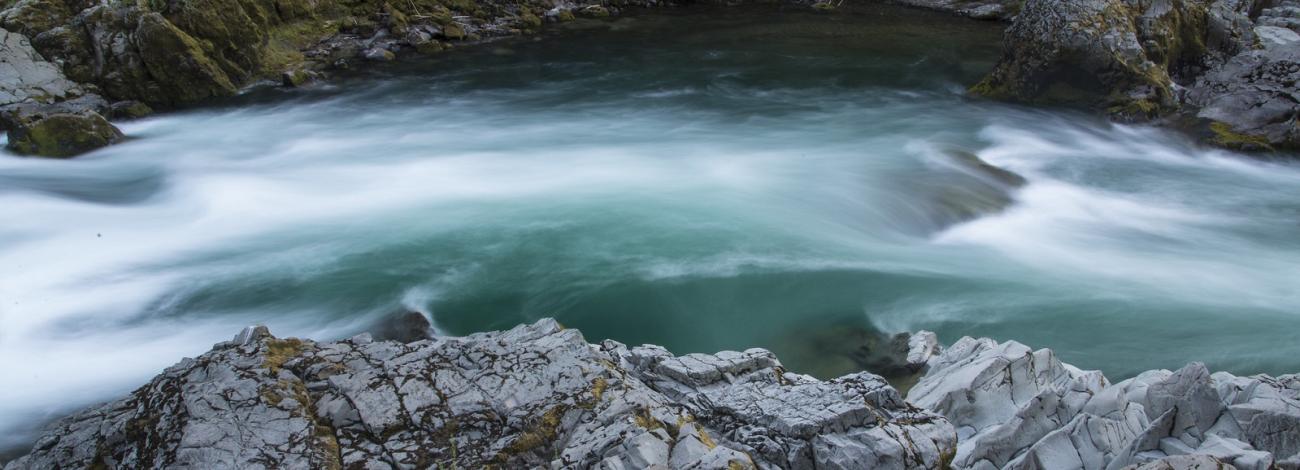
Scouting Baker Falls is a must as the prescribed drop is only about 6 to 8 feet wide. Perilous unseen boulders are on the right and a pour-over ledge, capable of flipping a raft, shoots off the left side of the falls. Below is a boil and hydraulic that may high-side a raft or roll a kayak and a whirpool which can circulate rafts or swimmers.
Do not float below Cable Crossing unless you are planning to run class V Deadline Falls or scramble up the bank immediately above it. You should find it easy to recognize from the highway.
To avoid conflicts with fishermen, the BLM requests that boaters avoid floating from 6pm to 10am from July 1 to October 31 on this segment.
* * *
Logistics:
Most access the river from the downstream end from I-5 Roseburg exit 124. Follow the signs to State Highway 138 east toward the community of Idleyld Park.
Deadline Falls or Cable Crossing: Go east past Swiftwater Park (mile 22.2) and plan to take out just upstream at Deadline Falls (mile 22.6), requiring a scramble up the bank, or a little farther upstream at Cable Crossing (mile 23.1) depending on the size of your boat and how athletic you feel. The access at Cable Crossing is better for bigger boats or a group. It is easy to miss located at a short break in the guard rail where a dirt drive leaves the highway at a steep angle.
Susan Creek: Access is available at the Susan Creek Day Use Area (mile 28.6), that is separate from the Susan Creek Campground (mile 29.2). The river access for loading and unloading is straight ahead down the dirt road, but please park in the day use area parking lot after loading. If you plan to take out here, check the beach so you can recognize it as it is inconspicuous from the river.
Bogus Creek: The Bogus Creek Access (mile 34.9) has ample parking and turn around space making it a good location to leave the majority of vehicles.
Gravel Bin: Most trips either start or finish at Gravel Bin (mile 39.7). This take-out is suitable for rafts and well marked with ample parking and turn around space making it a good location to leave the majority of vehicles. You will also find a toilet and changing screens.
Panther Creek Bridge: The FR 4714 Panther Creek Bridge (mile 43.5) near Apple Creek Campground is an intermediate access point just upstream of Alligator and Pinball that kayakers can use for a short run down to Gravel Bin.
Horseshoe Bend: The Horseshoe Bend access is reached by turning off the highway at mile 46.5 onto FR 4750 and continuing 0.2 mile down to the access on river right near the campground. This is also a good lunch spot for Boulder Flat to Gravel Bin runs. Parking is limited at Horseshoe Bend so plan accordingly for your shuttle to minimize cars at this location.
Dry Creek Store: Not a river access but sometimes used as a rendevous point (mile 47.0).
Marsters: An alternate access on the east side of the bridge across the North Fork Umpqua (mile 50.1).
Boulder Flat: Enter Boulder Flat Campground (mile 52.4) and turn right following the river access signs. Parking is free if you do not take up a camp space but spaces are limited so plan ahead to minimize shuttle cars at this location.
Soda Springs: Turn onto Medicine Creek, FR 4775 (mile 55.1) and then turn left again onto Soda Springs Road. Take this road back past the dam to the power house. Just upstream of the power house is a poor trail to the pool above the tailrace.
Rapids in this Run (46)
Rapid
Boulder Flat Campground Access
 Rapid
III
Rapid
III
Boulder Hole
 Rapid
II
Rapid
II
Snag Rock
 Rapid
II
Rapid
II
The Wall
 Rapid
Rapid
Marsters Access
 Rapid
III
Rapid
III
Weepers
 Rapid
II
Rapid
II
Lunch Counter
 Rapid
III
Rapid
III
Dog Wave
Rapid
III
Cardiac Arrest aka Secret Garden
 Rapid
III
Rapid
III
Weird Weir
Rapid
Horseshoe Bend Access
 Rapid
III
Rapid
III
Toilet Bowl
 Rapid
III
Rapid
III
Frogger I
 Rapid
III
Rapid
III
Frogger III
 Rapid
III
Rapid
III
Rollout
 Rapid
III
Rapid
III
Eiffel Tower (African Queen)
Rapid
Panther Creek Bridge Access
 Rapid
III
Rapid
III
Alligator
 Rapid
IV
Rapid
IV
Pinball
 Rapid
III
Rapid
III
Headknocker Moe
 Rapid
III
Rapid
III
Headknocker Curly
 Rapid
III
Rapid
III
Silks Hole
Rapid
Gravel Bin Access
 Rapid
III
Rapid
III
Steamboat
 Rapid
II
Rapid
II
Divided
 Rapid
II
Rapid
II
Steamer Lane
 Rapid
II
Rapid
II
Burnham
 Rapid
II
Rapid
II
Wildcat
Rapid
Bogus Creek Access
 Rapid
II
Rapid
II
Bogus
 Rapid
III
Rapid
III
Burial
 Rapid
III
Rapid
III
Bathtub
 Rapid
II
Rapid
II
Mailbox
 Rapid
II
Rapid
II
Burnt Creek
 Rapid
II
Rapid
II
Elevation Drop
 Rapid
III
Rapid
III
Island Rapid
 Rapid
II
Rapid
II
Rooster Tail
 Rapid
III
Rapid
III
Ledges
 Rapid
Rapid
Susan Creek Day Use Area
 Rapid
II
Rapid
II
Hogback
 Rapid
II
Rapid
II
Battle Roll
 Rapid
III
Rapid
III
Slap Stick
Rapid
III
Upper Baker
Rapid
III
Baker Falls
 Rapid
II
Rapid
II
Baker Alley
 Rapid
II
Rapid
II
Upper Cable
Difficulty
Class III
Length
33.0 mi
Gradient
36 ft/mi
Rapids
46
Access Points
Difficulty Classes
I Easy
II Novice
III Intermediate
IV Advanced
V Expert/Extreme
VI Unrunnable
Current Conditions
5-Day Forecast
Whitewater data from
American Whitewater
American Whitewater