8) Snelling diversion to San Joaquin confluence
Gauge Conditions
Runnable: ? – ? CFS
Approximate reading: This gauge is 2.4 miles away on Merced. Use as a general reference only.
Data from American Whitewater & USGS
CDEC Flow Data California
Data from California Data Exchange Center (CDEC)
Run Map
Run Time Estimate
Select put-in and take-out to estimate time.
Plan This Trip
See wind-adjusted speed maps, forecast planning, and detailed time estimates.
Sign in to generate an AI timing estimate for this run.
Whitewater timing varies with scouting, portages, and group pace. Use as a planning baseline.
Description
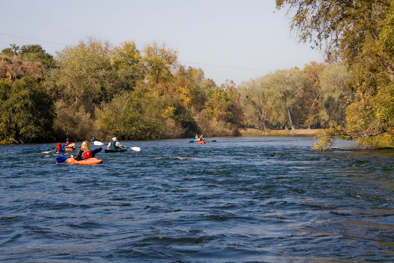
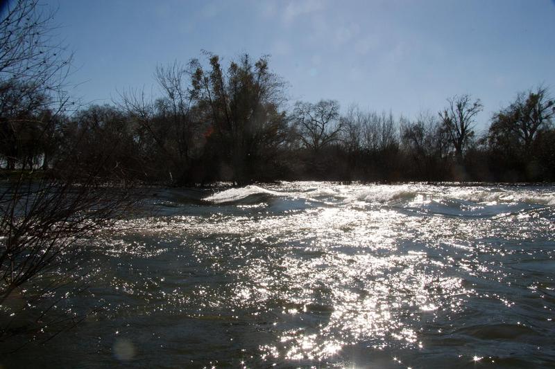
This is a wonderful class 1 section of river, with nice scenery, busy and frequent rapids, and frequent maneuvering in the narrow channels. It is suitable for canoes and recreation kayaks, but there appear to be plenty of spots for whitewater playboat action as well. This may be one of the nicer sections of valley rivers for beginning whitewater boaters. The ratio of rapids to flatwater is very favorable.
This section is not suitable for unsupervised beginners, except at very low flows. There are many rapids and sections of swiftwater. While the rapids are not large, they can tip a novice and and sweep the unwary into trees and branches.
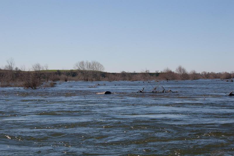
The Merced River below Merced Falls Dam also shows the incredible devastation from past uncontrolled dredging. Miles and miles of tall river rock mounds were left by huge mechanical dredging barges over a century ago. A thousand years from now, after upstream dams have washed away, the river will probably erode the dredging piles back into natural riverbed. Even now though a beautiful riparian zone has developed along the tamed river, attracting wildlife, fishermen, sightseers and boaters.
Each year a small salmon run returns to the limited spawning grounds below Snelling Diversion (Crocker Huffman Dam). Salmon and Steelhead are reared at the Merced River Hatchery which is operated by the Dept of Fish and Game.
Put in: There is public river access just below Snelling diversion dam. Elevation here is about 293 feet. There is a large turnout along Merced Falls Road and a small ramp down to the water at this spot. It is about 2.5 miles east of Henderson Park. Most of the land between Henderson Park and Merced Falls, appears to be private and posted No Trespassing, with the exception of a few fishing access areas.
You can also explore the next section upstream, Merced— 6) Merced Falls to Snelling Diversion Dam. Merced Falls, is a small dam and hydroelectric plant operated by PG&E under FERC license 2467. There is fishing access only next to the dam. A short ways upstream along the small reservoir at the junction of Merced Falls and Hornitos Roads (where a bridge crosses the reservoir) there appears to be legal access to the reservoir. At least there were no signs prohibiting boat launching. Elevation here is about 348 feet. One can paddle across to the south side of the dam and portage around to access the river downstream of the dam. From Merced Falls it is about 3 miles to the Snelling Diversion Dam which is another portage. Most of the gradient seems to be lost portaging the two dams.
Access points:
Henderson Park is about 2.5 miles below Snelling diversion and provides public access to the river as well as picnic areas.
In the town of Snelling there is access to the river from 4th street.
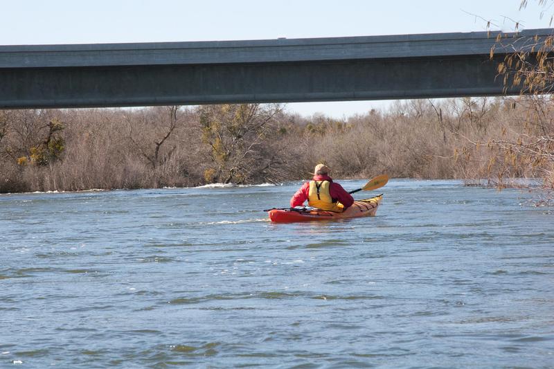
The Snelling Road bridge has access on the north side of the bridge (river right). There is plenty of parking space on the shoulder of the road. Elevation here is about 234 feet.
Highway 59 now has shoulders for parking on the northwest side of the Merced River bridge. A large area along the river banks have been landscaped just upstream of this bridge.
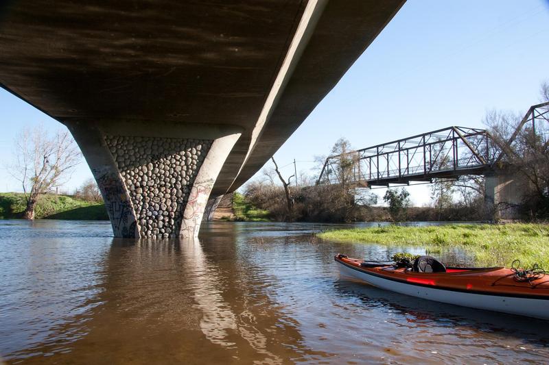
The Oakdale Road bridge has a public lot on the northwest side so people can walk across the historic Schaffer Bridge. However, the river access is completely fenced off, with prominent No Trespassing signs. (penal code 602) There is of course a nice big hole in the fence where the public has been accessing this public river, via what is probably public land.
Highway 37 / Santa Fe Ave Bridge appears to have de facto access.
McConnell State Recreation Area is on the Merced River just east of Highway 99. The river is scenic flatwater in this area.
Hagaman County Park. The valley Oaks from here to Hatfield are reported to be especially remarkable.
George J. Hatfield State Recreation Area is on the river near its junction with the San Joaquin River.
In March of 2013 Merced Irrigation District (MID) provided American Whitewater a preliminary project desciption and site plan for access below Crocker-Huffman Diversion Dam (Snelling) - River Boating Access Improvements Crocker-Huffman Diversion Dam and Merced County's Henderson Park. MID has since proposed to design and construct a formal non-motorized boating facility below Crocker-Huffman Diversion Dam (Snelling Diversion Dam) and as of July 2014 has been rewarded grant funding through the Merced Integrated Regional Water Management Plan (MIRWMP) under the Merced River Education and Enhancement Project. American Whitewater looks forward to working with MID on final project design and construction.
Overview:
The small opening at the put-in below Snelling diversion, opens onto a large slow water pool that is nice for warming up and paddling upstream. Once boaters turn downstream, they immediately encounter the first of many significant small rapids. The river alternates between wide sections of slow water and narrow sections of swiftwater and/or rapids. Rapids are often on curves or S turns. Maneuvering is critical to stay out of trees and frequent overhanging branches. The section down to Henderson Park seemed to have the bigger rapids, but perhaps more flatwater as well. The section from Henderson to the take out bridge has more narrow sections and more fast current, but more tree hazards as well. At least in the Fall of 2007.
The difficulty of this section seems to be similar to or slightly easier than the Kings River from Pine Flat Dam to Centerville (Route 180) in the Piedra area, though with higher danger from strainer trees. Flow at 3200 cfs on the Merced felt similar to 7,000 or more on the Kings River.
Other Information Sources:
Merced River Hatchery is open to the public, weekdays from 8 AM to 5 PM. They raise salmon and steelhead. However, the drive in is a couple miles of rough gravel road without direction signs. The fish pens are locked up and there may not be anyone there unless you call ahead. It might quicker and easier to paddle the short distance upstream from the put-in, especially during periods of low flow.
Merced Irrigation District
Merced Irrigation District Parks Department
9090 Lake McClure Road
Snelling, CA 95369
209-378-2521
San Joaquin River Group Authority
Merced River Watershed Library
Lower Merced River and Mustang Creek Watersheds Study
FERC Information:
Merced Falls Project: FERC # P-2467, license expires in 2014, so PG&E is probably starting or getting ready to start their relicensing process. It is a small run of the river project, but in water year 2005-2006, this project generated 13,806,300 KWH of electricity.
To search for documents related to this project go to the FERC elibrary. Enter P-2467 into the Docket number box.
Merced River Hydroelectric Project, Federal Energy Regulatory Commission (FERC) Project No. 2179, also has effects on this reach. " The Project is located on Merced River in Mariposa County, California, and consists of 2 reservoirs (Lake McClure and McSwain Reservoir), 2 powerhouses (New Exchequer and McSwain powerhouses) and various recreation facilities on Lake McClure and McSwain Reservoir. The Project does not include any transmission lines, canals or open conduits. The installed capacity of the Project is 103.5 megawatts. "
Rapids in this Run (15)
Rapid
Put in and largest rapid
 Rapid
Rapid
Henderson Park
Rapid
Snelling access
Rapid
Snelling Road bridge
 Rapid
Rapid
Start of Restoration Area
 Rapid
Rapid
J59 Bridge
Rapid
Bridge (private)
Rapid
Big Island split
Rapid
Weir
 Rapid
Rapid
Oakdale Road Bridge
Rapid
Road 37 / Railroad trestle
Rapid
McConnell Park
Rapid
Highway 99 bridge
Rapid
Hagaman Park
Rapid
George Hatfield State Rec Area
Playspots (1)
Difficulty
Class I(II)
Length
51.7 mi
Gradient
5 ft/mi
max 11
Rapids
15
Access Points
Difficulty Classes
I Easy
II Novice
III Intermediate
IV Advanced
V Expert/Extreme
VI Unrunnable
Current Conditions
5-Day Forecast
Whitewater data from
American Whitewater
American Whitewater