F) Sec.4: Otter Slide to Big Smokey Falls (5.96 miles) ** Access Fee **
Gauge Conditions
Runnable: 150.0 – 1,000.0 CFS
~6-12"; medium runnable flow.
Data from American Whitewater & USGS
Run Map
Run Time Estimate
Select put-in and take-out to estimate time.
Plan This Trip
See wind-adjusted speed maps, forecast planning, and detailed time estimates.
Sign in to generate an AI timing estimate for this run.
Whitewater timing varies with scouting, portages, and group pace. Use as a planning baseline.
Description
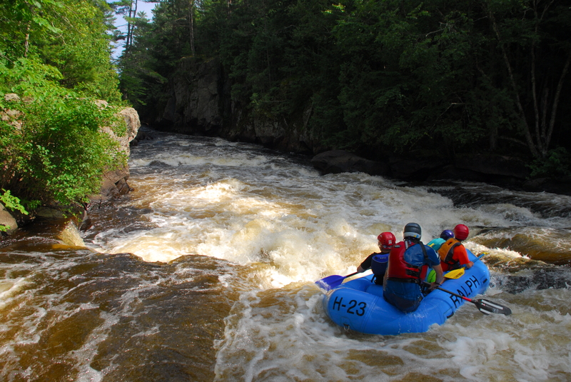
This is the most challenging segment on the Wolf River. The character of the river changes dramatically ... from (generally) longer boulder-garden style rapids (upstream of the reservation and the upper/prior stretch in the reservation) to shorter but steeper drops in this section. In all cases, fairly long flatwater pools separate the main rapids.
Access is controlled by the Menominee Indian Tribe, and permits are required. As of 2019, its $45 up front (with $5 back when you return your wristband at the end of the run), which covers your 'trespass fee' and includes a shuttle to the put-in (so all your vehicles await you at the end of your run).
Permits may be purchased from Big Smoky Falls Rafting (715-799-3359) located at the take-out, and are generally available from Memorial Day through Labor Day. Trips perhaps a month before or a couple months after this time frame can usually can be arranged by calling the outfitter in advance. ( Outfitters are generally NOT on-site outside the summer season unless they have confirmed bookings, so _always call ahead for non-summer permits_.)
By local ordinance, all cars must now remain in the upper parking area (at Big Smokey), to leave lower lot clear. You may drive down to park only briefly, to load boats, if you don't want to carry up to upper parking lot upon arrival at the end of your run.
Permits are also sometimes available at Shotgun Eddy Campground and Rafting (715-882-4461), but this lacks the convenience of leaving your car at the take-out.
Most trips start at the Otter Slide access, on Highway 55 south of County Highway B (though you may be able to request other options when you arrange your shuttle, particularly in non-summer or slack days).
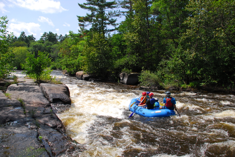
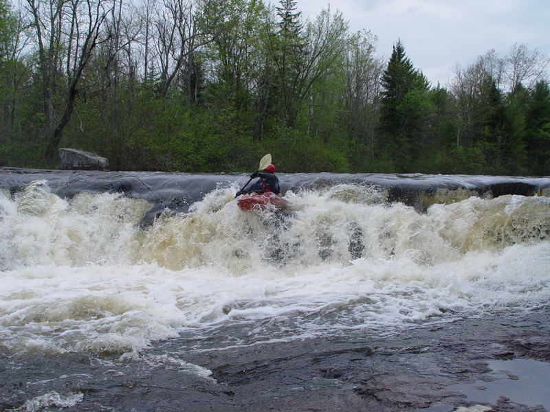
The first rapid is Sullivan Falls, a 7-foot tall, river-wide falls. You can scout on river left. In years past, a concession stand operator at this location was often confrontational with private boaters, making it unwise to dally here in or out of the river (I.E., scouting or playing the hole at the bottom of the rapid) when the concession owner was present. A new operator is now in charge and is reportedly much more boater-friendly. Still, it wouldn't hurt to carry some cash to buy a snack here (when the concession stand is in operation), or at least be VERY courteous and express thanks for being able to enjoy this spot.
An alternate Class II channel containin a drop called Evergreen Rapids (branching off to the right, just upstream of Sullivan Falls) provides an option to avoid the main falls entirely, or provides an option after running Sullivan a time or two, should anyone elect to do so.
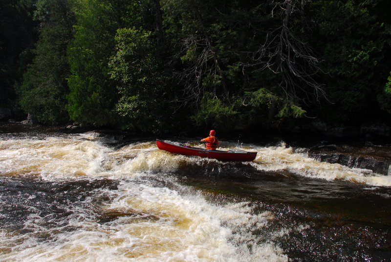
Shortly downstream you'll arrive at Duck's Nest, a solid Class III drop. The rapid is divided into two sections ( Upper Duck's Nest and Lower Duck's Nest), with a short pause between. At the exit of the lower part of the drop lies Dave's Wave, a very playable surfing wave. Better have a solid roll here, as the outflow fans out across a shallow boulder field which will be brutal to any who are slow to roll or are out of their boat. Also be aware that at high water levels, the rock wall on river left (before the final pitch into Dave's Wave) can become a dangerous undercut.
About 3/4 mile downstream is Lunch Rock, large, gently sloping shore rocks that make a perfect lunch stop and sunning spot on warm summer days. A narrowing of the river forms a tongue and wave (at higher flows) followed by a couple crease wave/holes. Those not beaching and eating may entertain themselves playing these features.
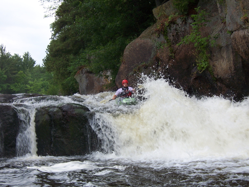
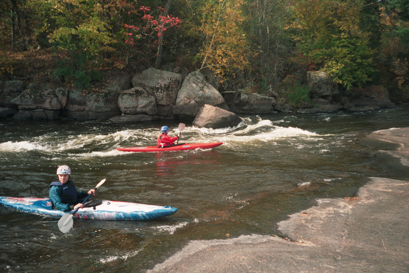
One mile further the river twists to the right and enters another Class III rapid called Tea Kettle or the Upper Dells which contains a very dynamic ledge/hole which can provide some interesting play. The exit of this stretch spills across a shallow spline of rock (river left) and into what can be a somewhat aggressive (or interesting) hole and rock (river-right). At moderate to high flows (~500+cfs), a few very agressive holes and wrapping waves form through here. A short bit of flatwater downstream brings you to the Lower Dells, one of the most challenging rapids on the stretch. It is recommended to scout the Dells on the left, as the entrance can be choked with strainers (or rafts!). This is one of the most impressive areas of the river, as near-vertical rock walls rise 20-30' from the river (for those with presence of mind to notice, while busy negotiating the water!), and the river trips through some complex waves and holes.
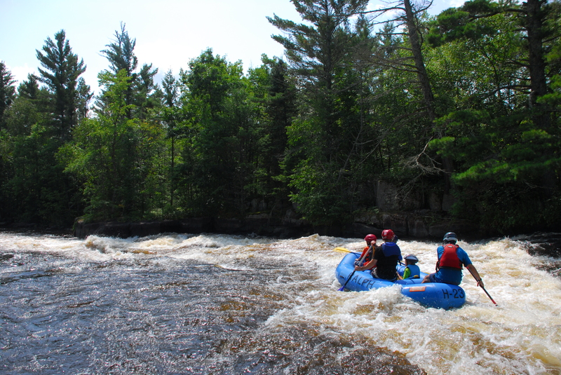
Very nearly two miles of flatwater ensue before the culmination of the trip at Big Smokey Falls. As you approach you'll see an island and a sign indicating 'Footbridge' to the left, and 'Falls' to the right. To the left of the island, the river stays high, then tumbles down a nasty boulder sieve that has claimed at least one life. All traffic to this side must take out at an easy landing above the footbridge to the island. For those running the right-side drop, you may scout the rapid from the river right bank. Big Smokey Falls is a somewhat extended Class II-III slide leading into a a ledge-drop kicker into the final pool. A flip or swim early in this sequence can be nasty, so make sure you're confident in arriving at the ledge upright before you commit to this drop! Once in the pool below, paddle to the left shore to the take-out.
For additional recommended reading, pick up a copy of _Paddling Northern Wisconsin_, by Mike Svob. Wisconsin Trails Press, Madison, WI.
In June of 2010, MnktoDave put together a great Boater's-Eye video (from a whitewater canoe) with all the drops on this run, from runs at 350 cfs and 230 cfs.
For those unfamiliar with the run, the following guide identifies the various drops by the timestamp on the video:
0:00 Intro (Bear Paw Outfitters kayak tree, after a tornado devastated the area
0:08 Big Smokey Falls (take-out), wide-angle and close-up of final 'kicker'
0:18 Sullivan Falls
0:44 Upper Ducknest
0:54 Lower Ducknest, leading to, ending at ...
1:25 Dave's Wave
1:35 Lunch Rock
1:51 Upper Dells
2:13 Lower Dells (scouting overview, video from shore, then helmet-cam video)
2:52 Big Smokey Falls (entrance, slide, rooster-tail/kicker)
3:20 closing scene
_Helmet Cam Section IV_
Rapids in this Run (2)
Waterfalls (2)
Difficulty
Class II-III(IV)
Length
5.9 mi
Gradient
16 ft/mi
max 37
Rapids
2
Access Points
Shuttle Info
A shuttle will be provided for you and your boat(s) upon payment of the 'trespass fee' and receipt of your wrist band. Do not even think about 'poaching' this run by setting your own shuttle without paying this fee.
This section lies wholly within Menomonee Tribal lands. Trespass is punishable by fines, jail time, and (possibly) confiscation of all gear and tangible goods used in commission of the trespass, I.E., your shuttle vehicle(s).
I have been told that driving tribal roads (virtually anything other than State Highways 55 & 47 or County Trunk Highways M & AA), getting out of your car and 'exploring' beyond the _immediate_ road shoulders, or parking/leaving any (non-tribal-plated) vehicle on any roadside _could_ be found to be in violation of tribal trespass laws. (Interestingly, non-tribal 'tourists' are allowed to drive the tribal road to view Sullivan Falls, Big Smokey Falls, and the Dells. There is (or was usually) a nominal fee charged to access these areas.)
It is therefore recommended that boaters ignore this shuttle information below. The only exception might be boaters looking for a l-o-n-g day, first **purchasing a trespass wristband**, leaving a vehicle at the take-out and using their own shuttle to start in Langlade County (likely on "Short Section 3"), to then continue with "Upper Section 4" and (Lower) "Section 4".
Difficulty Classes
I Easy
II Novice
III Intermediate
IV Advanced
V Expert/Extreme
VI Unrunnable
Current Conditions
5-Day Forecast
Whitewater data from
American Whitewater
American Whitewater