Friant Dam to Mendota Pool Dam
Gauge Conditions
Runnable: 150.0 – 15,000.0 CFS
Good for canoes and beginners.
Data from American Whitewater & USGS
CDEC Flow Data California
Data from California Data Exchange Center (CDEC)
Run Map
Run Time Estimate
Select put-in and take-out to estimate time.
Plan This Trip
See wind-adjusted speed maps, forecast planning, and detailed time estimates.
Sign in to generate an AI timing estimate for this run.
Whitewater timing varies with scouting, portages, and group pace. Use as a planning baseline.
Description
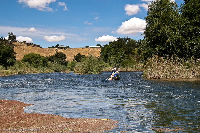
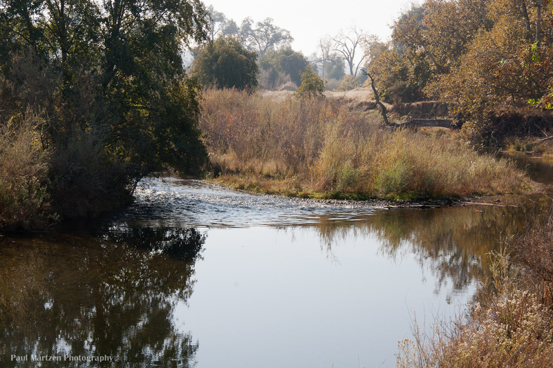
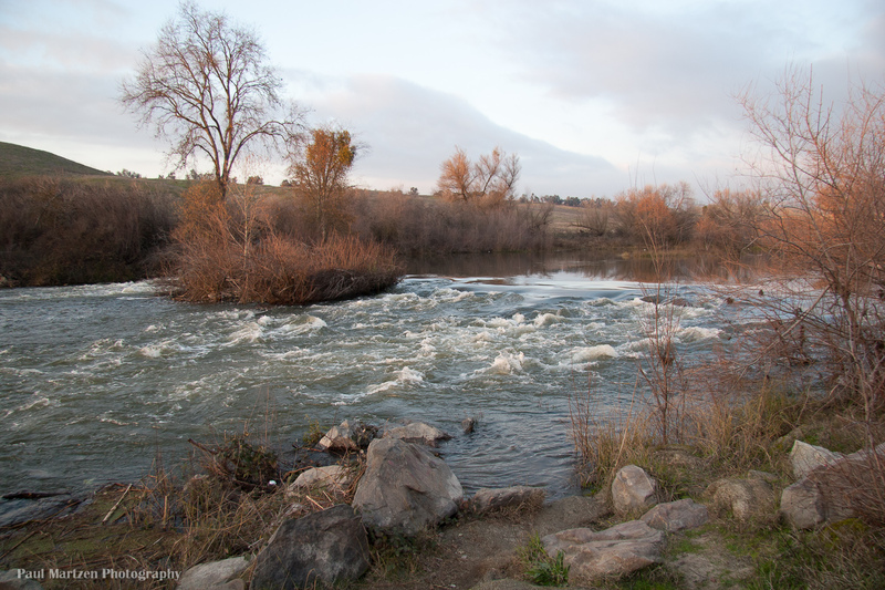
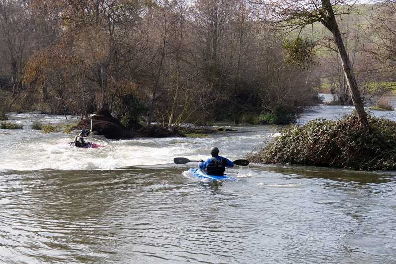
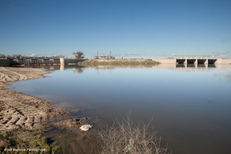
The San Joaquin River below Friant is a flat, valley river with occasional riffles in the upper reaches and even some class 1 rapids near Friant and Lost Lake. At summer low flows it is the safest introduction to river paddling in the Fresno area. At high flows it is the closest whitewater to Fresno, even if there is only a small amount. The main attraction of this reach is its proximity to Fresno, the nice scenery, the birdlife and occasional wildlife sightings, such as deer and beaver. This section is significantly easier than the Kings River at Piedra and is really more similar to the Kings River from Sanger to Reedley, though with more brush hazards because of the usual lack of high flows.
The river from Friant to Skaggs Bridge is typically broken into 3 sections which will take about 4 to 6 hours each at low flows. Allow 2 or 3 hours per section at high flows:
Friant to Highway 41 area - 10 miles.
Highway 41 area to Highway 99 area - 10 miles.
Highway 99 area to Skaggs Bridge - 10 miles.
There are a few access options for each of these sections.
From Skaggs to Mendota is divided into two sections.
Skaggs Bridge to San Mateo avenue is 22 miles. This will take most of the day at high flows and probably more than a day at low flows.
San Mateo to Mendota Dam is 7 miles. Allow 3 hours at 950 cfs. (the last 2.5 miles had no current)
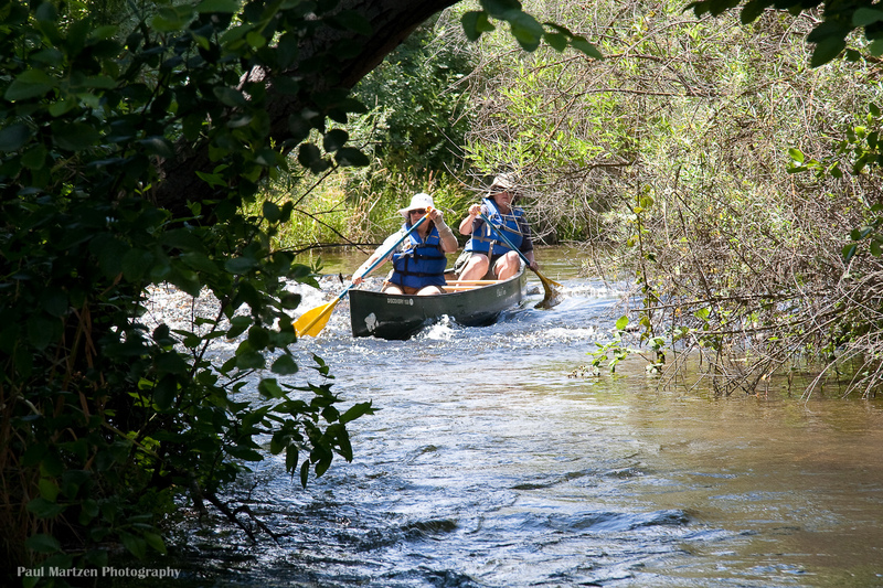
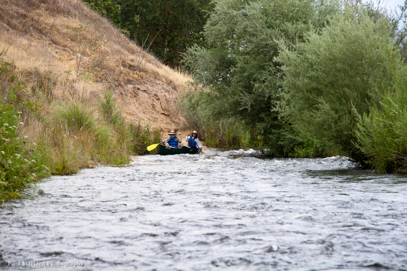
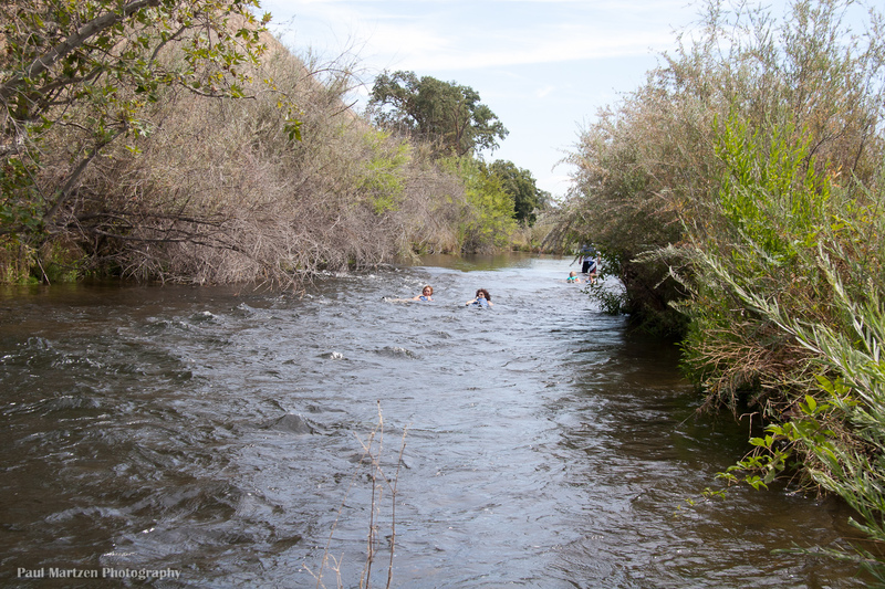
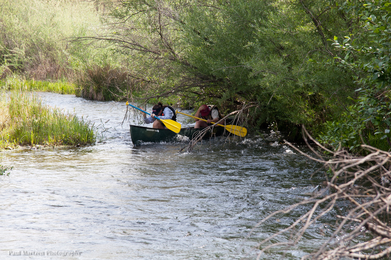
Brush and Tree Hazards: Because Friant seldom releases more than a couple hundred cfs, vegetation tends to crowd into the channel wherever there are shallow riffles. The river is mostly wide, slow pools alternating periodically with narrow, swift riffles where the current often swings close to trees or brush. First time canoers will find many opportunities to tip over where the current pushes them into trees or brush. At high flows such dangers are increased for beginners. At low flows tipping and swimming will have minimal consequences. At high flows boaters should have swiftwater rescue skills or be with a group that has such skills.
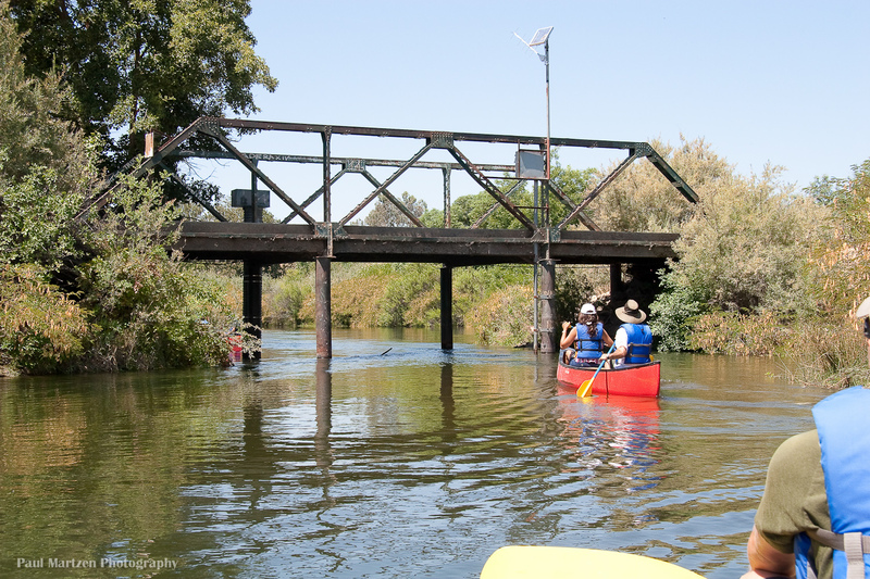
Put-in: Friant Bridge, elevation 315 feet. This access is not used all that often, but there is easy river access on the Fresno side of the bridge. It may be best to leave any cars up in the large area near the highway. Upon putting in, paddlers must immediately manuver past the remains of an old bridge, then find the narrow channel through all of the trees. At typical low flows it is fun and easy. At high flood release flows this is one of the most dangerous sections on the river and less experienced paddlers should not launch here. Paddlers with any whitewater experience will have few problems but should scout carefully from the road. It is also fun to paddle 1/2 mile upstream from this bridge to a short steep rapid just below the dam. google map
Lost Lake Co. Park, river access. Mile .7 to mile 2.7 This park is probably the most frequently used put-in. It is also a nice place to just paddle around with out going very far downstream. There are three small rapids along the nearly 2 mile length of the park which can provide fun practice. The upper two rapids are next to the road, but the third rapid, towards the furthest end of the park is down a hill and hidden by trees. Paddlers can boat the length of the park, then carry through some trees and up a small hill to return to the road. google map
Bridge, mile 4.5, was used by a gravel mining company to access quaries on both sides of the river.
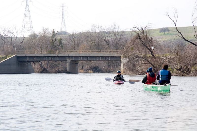
High voltage power lines cross river, Mile 4.8
First Mansion, Mile 6.4, The river splits into a long island and a short island, forming 3 channels for a short distance. The left channel is narrow at a sharp left-right bend with snags on the left. The middle channel is the most open and straight. The right channel splits off early and leads to the Cobb channel diversion. Don't go down the tiny Cobb channel, but make a sharp (and awkward) left to rejoin the main stream.
Donaghy Mansion, 6.7 miles.
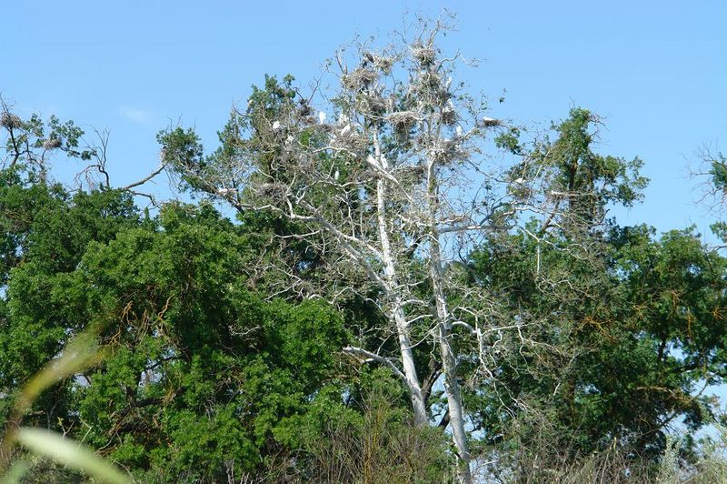
Heron & Egret Rookery, Mile 7. Just before the river picks up speed and flows around a concrete pipe, Look at the tall sycamore trees on river right. Herons and Egrets make their large nests out of sticks. You will see the most activity in spring and early summer.
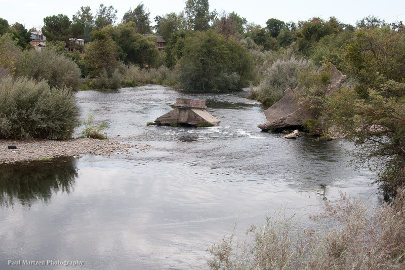
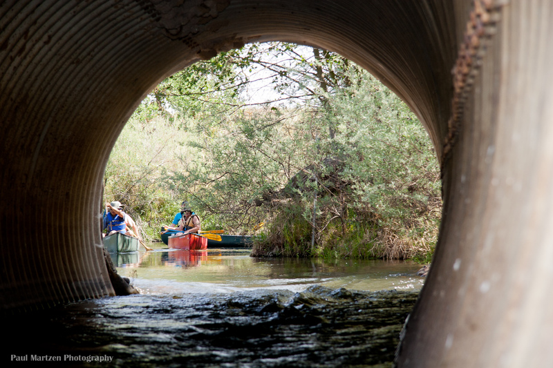
Causeway Culvert, mile 8.2 A road crosses the river, but instead of a bridge, the gravel company just piles enough dirt to form a dam which they can drive across. A number of concrete pipes allow the water to flow under the road, but a final corrugated culvert is large enough to allow the passage of canoes. Paddle along the river left till you come to the final pool with the culvert. If you do not want to paddle through the culvert, you must carry up a steep bank over the road and down the other side. Immediately below the culvert (at typical summer low flows) there is a short pool, then a sharp right and left turn into a narrow channel with overhanging brush. Beginning paddlers often tip over here. Whenever flood releases occur, the causeway tends to wash out and boaters can paddle through a break upstream of the culvert. In January of 2006, at 1,000 cfs there was still plenty of room to float canoes and a raft through the culvert.
Ft Washington Beach Campground, 9.8 miles, elevation 266 feet. Closed and no longer available for public use.
Highway 41 Bridge. Wildwood Park river access on the north side of the river (Madera side). Mile 10.9, elevation 260 feet. Just upstream of the bridge, the river splits into several small channels. The right channel leads past a mobile home park to the Wildwood Park river access underneath the bridge. The river left channel is accessible by pedestrians or bicyclists from Woodward Park. Below the bridge, the river flows through average narrow channels for a ways then opens out onto a large lake formed by former gravel mining pits. google map.
Sycamore Island. River access from Madera side. Mile 13.6, elevation 256 feet. The lake ends at a bridge used by the gravel company. In some years there has also been a causeway with a culvert that canoeists had to go through, or portage. Shortly after, the river narrows considerably and trees hanging out into the channel can be a problem Sycamore Island Ranch was owned by the Moen family who allowed public access on weekends. In Nov. of 2005 they sold this 347 acre property to the San Joaquin Conservancy. The area is open on weekends through the summer.
Scout Island; Fresno County Schools facility. No public access. Mile 15, elevation 250 feet. There tend to be multiple channels in this area with various degrees of brush and tree hazards.
Milburn Unit (fish and Game reserve) Mile 17.7, elevation 240 feet.
Santa Fe Railroad bridge. Unofficial river access. Mile 20, elevation 227 feet.
Camp Pashayan at highway 99, river access on weekends, April to September. Mile 21.75, elevation 227 feet. google map.
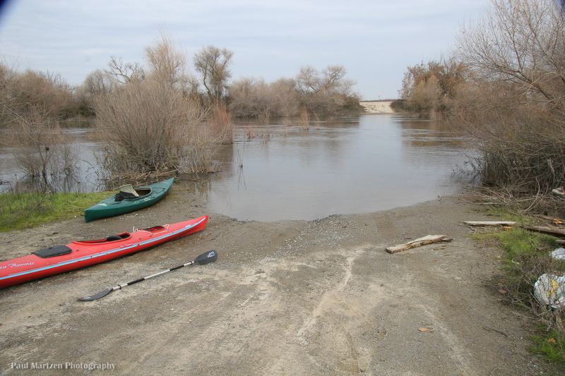
Skaggs Bridge Park, Highway 145, river access. Mile 30.8, elevation 217 feet. google map.
Links of interest
2014: John Sutter kayaks and walks the San Joaquin from Friant to San Fransisco
Fresno Bee: Rescuing the San Joaquin River
Photos of River Cleanup volunteers
Dumna Indian Tribe is the Yokuts tribe that lived along the San Joaquin River.
Fresno County parks has information and directions to Lost Lake and Skagg's Bridge as well as for all other county parks.
NRDC is a lead organization in a legal and political battle to restore sufficient water back into the San Joaquin River so that it does not dry up and so that salmon can once again swim up the river.
San Joaquin River Management Program
Friant Dam technical information page lists information such as size and elevations.
Friant Water Authority
San Luis and Delta-Mendota Water Authority
Contacts
Fresno Kayak Club (Meetup Group)
NEW Kayak club(Yahoo Group)
SJPaddlers (Yahoo Group)
San Joaquin River Parkway and Conservation Trust
Revive the San Joaquin
River Tree Volunteers
Rapids in this Run (22)
Rapid
I
Lost Lake: Long Riffle
 Rapid
I
Rapid
I
Ledger Island Riffle (Beaver Riffle)
 Rapid
I
Rapid
I
Concrete Bridge Riffle
Rapid
I
Shady Riffle
 Rapid
I
Rapid
I
Cobb Channel Diversion
Rapid
Mansion
 Rapid
Rapid
Heron and Egret Rookery
 Rapid
I
Rapid
I
Upper Owl Hollow Riffle
Rapid
Owl Hollow
 Rapid
I
Rapid
I
Rock and Roll
 Rapid
I
Rapid
I
Swimmers Riffle
 Rapid
I
Rapid
I
Wildwood Riffles
Rapid
I
Wildwood River Access
Rapid
I
Protruding Stump Riffle
Rapid
Sycamore Island Access
Rapid
Palm Avenue Access
Rapid
I
Scout Island
Rapid
Camp Pashayan
 Rapid
Rapid
Donny Bridge gauge
Rapid
Gravelly Ford Gauge
 Rapid
Rapid
San Mateo Avenue
Rapid
Mendota Pool Park
Hazards & Portages (5)
Caution: The following locations may require scouting or portaging. Always check current conditions.
Difficulty
Class I
Length
61.6 mi
Gradient
3 ft/mi
max 13
Rapids
22
4 Hazards
1 Portage
Access Points
Shuttle Info
If you wish to find directions from a specific location to the put-in, type a street address into the entry box and then click on the "Calculate from Zip" button. GPS coordinates also work in this entry box. If you type a zip code it tends to map to somewhere in the middle of the zip code which in rural areas could be far from where you want to go.
Limitations of the direction map, below. Clicking on the "nearest town' button sends you off to O'neals, even though the put in is in the middle of Friant, so ignore that button. The map shows a good route from Friant to Skagg's Bridge, but it is of limited use since few paddlers will travel that entire distance in one trip.
Difficulty Classes
I Easy
II Novice
III Intermediate
IV Advanced
V Expert/Extreme
VI Unrunnable
Current Conditions
5-Day Forecast
Whitewater data from
American Whitewater
American Whitewater