Point Rock to Taberg
Gauge Conditions
Runnable: 1,000.0 – 6,000.0 CFS
Min and max ranges are an educated guess.
Data from American Whitewater & USGS
Run Map
Run Time Estimate
Select put-in and take-out to estimate time.
Plan This Trip
See wind-adjusted speed maps, forecast planning, and detailed time estimates.
Sign in to generate an AI timing estimate for this run.
Whitewater timing varies with scouting, portages, and group pace. Use as a planning baseline.
Description
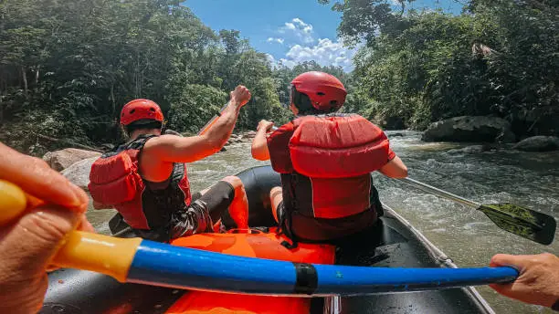
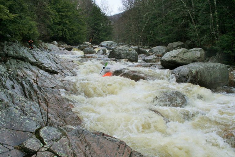
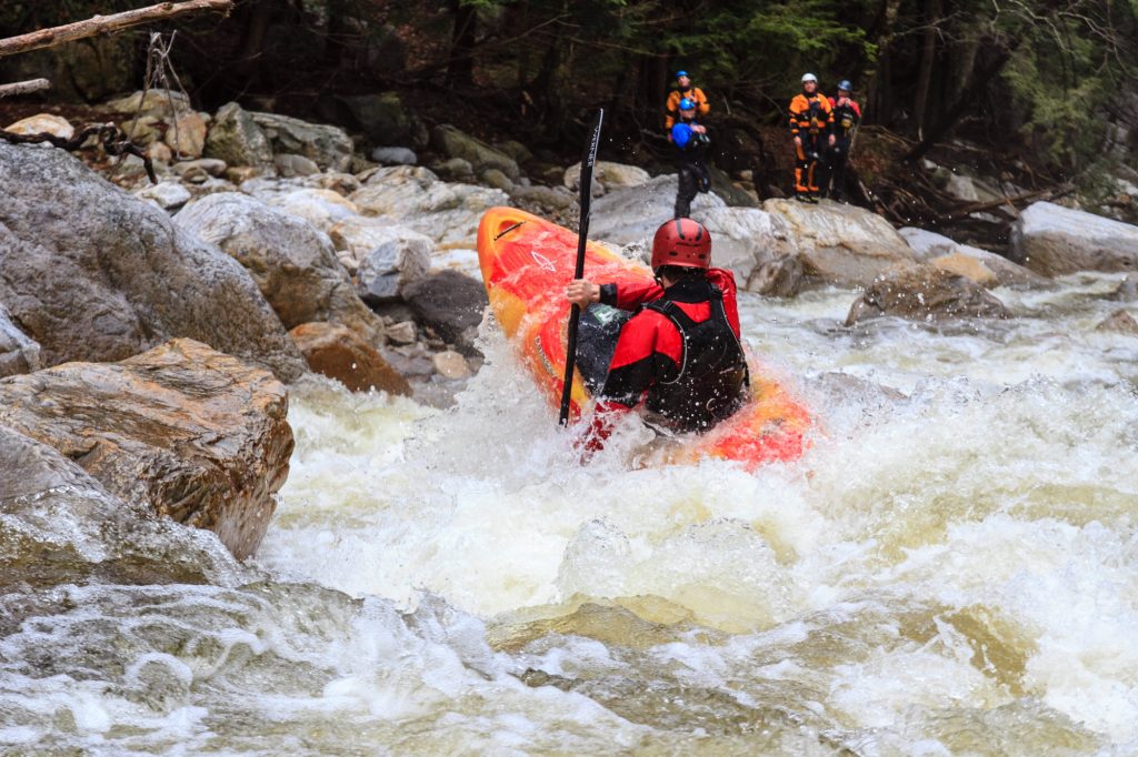
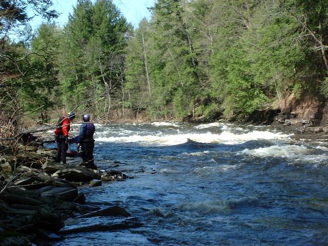
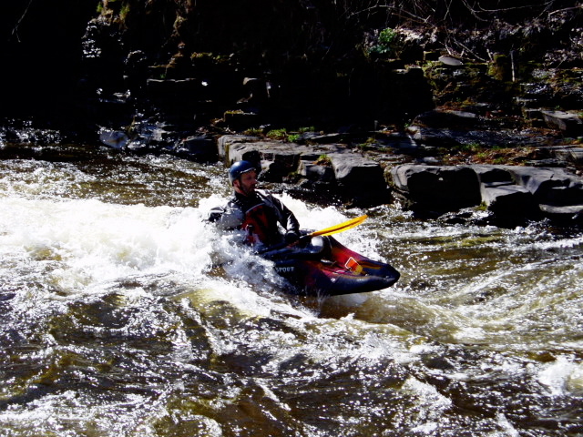
Fish Creek may be the finest play river in the Northeast, with big, fast waves and holes that range from purring pussycat to sneering tiger. Paddlers may put in below the City of Rome dam (Lat: 43.3377991 Lon: -75.5815353) or at Point Rock (coords given below); the takeout is 1/2 mile below the town of Taberg along Blossvale Road (4.5 miles from the dam, feels like 10 miles).
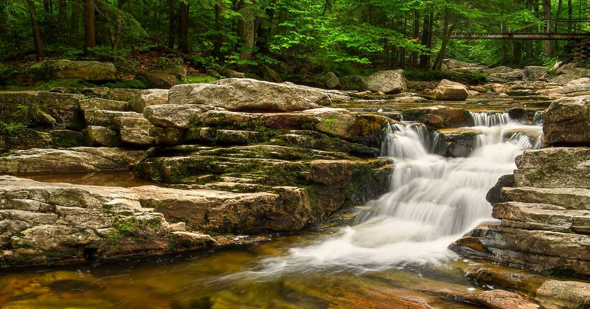
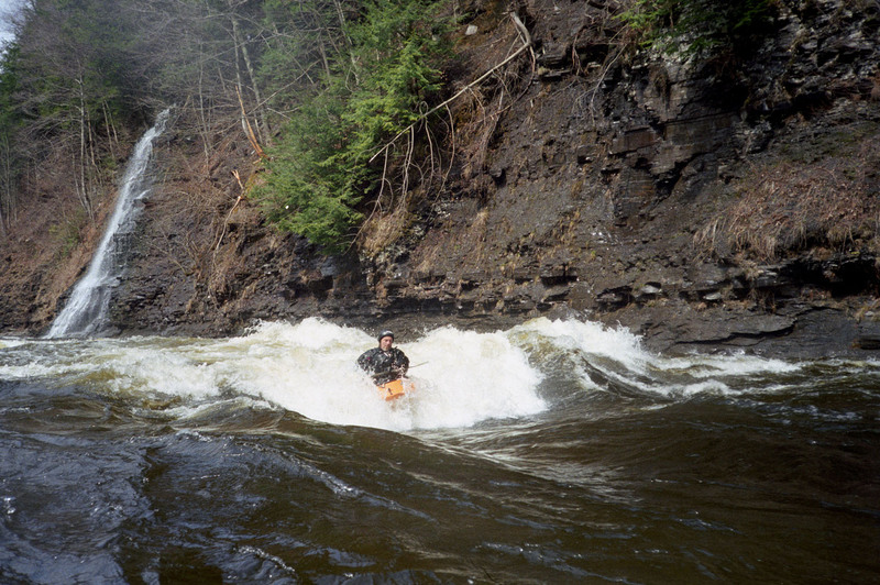
Most of the action takes place below the dam; you get a shorter, concentrated run, but you have to walk your boat down to put in. The stretch from Point Rock to the dam is more mellow, but many paddlers use it, especially at higher levels (3 feet and above), because that avoids the long walk to the dam; also, the upper section does have good play and some beautiful scenery, with waterfalls (icy in the early spring) cascading down the steep gorge walls at every turn.
Important: The takeout is located on private property, and relies on the generosity of the land owner. During the year the area is used by fisherman who litter and make a mess. If you use the takeout please pick up any trash, and be friendly if approached by the elderly gentleman who owns the property. He takes great pride in the distances boaters come to boat the river and has been a friend to the community for decades. Please show him the respect he deserves.
Directions to takeout:
From the West (Syracuse and Thruway West):
Take Exit 34 (Canastota), head North on Rte. 13 toward Vienna.
Where Rte. 13 T's into Rte. 49 (North of Sylvan Beach), head Right onto Rte. 49.
After about 2.2 miles, just after Kimball Rd., take a Left onto Pine Rd. (If you miss this turn, take the Left, three miles farther, onto Herder Rd.)
Pine Rd. will T into Blossvale / Herder Rd. Take a Left, toward Taberg.
After about 3 miles, the road will follow E. Br., Fish Creek. Park where a takeout looks convenient.
The takeout is about 1/2 mile South of Taberg; if you miss it and hit the stop sign in town, turn Right and get a look at the gage on the Bridge, upstream river left.
From the East (Utica, Albany):
Take Exit 32 (Westmoreland / Rome); head North on Rte. 233 toward Rome.
In Rome, head Northwest on Rte. 69 toward Taberg.
Follow Rte. 69 about ten miles
After the bridge over the creek (check out the gage!), take a Left onto Blossvale Rd. Head about half a mile and park here for the takeout.
Directions to Point Rock putin from takeout:
From Blossvale Rd., cross Rte. 69 onto Main St.
Take your first Right onto Coal Hill Rd.
After about 8 miles on Coal Hill Rd., you'll come to a T intersection. Take a Right onto Yorkland Rd.
Cross the Creek, park, and put in on River Left.
To Rome Dam putin from takeout:
As above, cross 69, take Main St., and a Right onto Coal Hill Rd.
After about a mile on Coal Hill Rd., take a Right onto Palmer Rd.
After about a mile on Palmer Rd., take a Left onto Boyd Rd.
After maybe 1.5 miles on Boyd Rd., pretty much across from Streun Rd. is a small, gated road on the Left, leading to the dam. Park on Boyd Rd. and walk your boat downhill to the putin.
Syracuse Area Runs:
Butternut Creek Chittenango Creek (Cazenovia)
Chittenango Creek (Chittenango) Fish Creek E. Branch (Taberg)
Limestone Creek (Edwards Falls) Oriskany Creek (Oriskany Falls)
Oriskany Creek (Clinton) Owasco River (Outlet)
Salmon River (Section 1) Salmon River (Section 2)
Tug Hill - Old Forge Area Reaches
Beaver (1. Moshier)Beaver (2. Eagle) Beaver (3. Taylorville)
Black (1.) Black (2.) Black (3.)
Black (4.) Black (5.) Black, S. Branch
Cincinnati Creek Crystal Creek Deer River (Section 1)
Deer River (Section 2) Fish Creek, E. Branch Independence River (1. Upper)
Independence River (2. Main) Indian (S.Br. Moose trib.) Little Black Creek
Little Woodhull CreekMad River Mill Creek
Mohawk (1.) Moose (1. Middle) Moose (2. Lower)
Moose (3. Bottom)Moose, Middle Branch Moose, S. Branch (1.)
Moose, S. Branch (2.) Negro Brook Otter Creek
Roaring Brook (Brokeback Gorge) West Canada Creek (1.) West Canada Creek (2. Ohio Gorge)
West Canada Creek, S. BranchWoodhull Creek (Upper) Woodhull Creek (Middle)
Woodhull Creek (Miracle Mile)
Mohawk Valley Area Reaches
Canajoharie Creek Caroga Creek Cincinnati Creek
East Canada Creek Fish Creek, E. Branch Ninemile Creek
North Chuctanunda Creek Nowadaga Creek Mohawk (1.)
Oriskany Creek (Clinton)Oriskany Creek (Oriskany Falls) Schoharie Creek
Sprite Creek (Upper) Sprite Creek (Lower) Spruce Creek
Timmerman Creek West Canada Creek
Google Map of New York Whitewater
New York Whitewater Paddlers Facebook Group
Rapids in this Run (3)
Waterfalls (1)
Playspots (5)
Hazards & Portages (4)
Caution: The following locations may require scouting or portaging. Always check current conditions.
Difficulty
Class II-IV
Length
9.3 mi
Gradient
48 ft/mi
Rapids
3
3 Hazards
1 Portage
Access Points
Shuttle Info
**Directions to takeout:**
From the West (Syracuse and Thruway West):
Take Exit 34 (Canastota), head North on Rte. 13 toward Vienna.
Where Rte. 13 T's into Rte. 49 (North of Sylvan Beach), head Right onto Rte. 49.
After about 2.2 miles, just after Kimball Rd., take a Left onto Pine Rd. (If you miss this turn, take the Left, three miles farther, onto Herder Rd.)
Pine Rd. will T into Blossvale / Herder Rd. Take a Left, toward Taberg.
After about 3 miles, the road will follow E. Br., Fish Creek. Park where a takeout looks convenient.
The takeout is about 1/2 mile South of Taberg; if you miss it and hit the stop sign in town, turn Right and get a look at the gage on the Bridge, upstream river left.
From the East (Utica, Albany):
Take Exit 32 (Westmoreland / Rome); head North on Rte. 233 toward Rome.
In Rome, head Northwest on Rte. 69 toward Taberg.
Follow Rte. 69 about ten miles
After the bridge over the creek (check out the gage!), take a Left onto Blossvale Rd. Head about half a mile and park here for the takeout.
**Directions to Point Rock putin from takeout:**
From Blossvale Rd., cross Rte. 69 onto Main St.
Take your first Right onto Coal Hill Rd.
After about 8 miles on Coal Hill Rd., you'll come to a T intersection. Take a Right onto Yorkland Rd.
Cross the Creek, park, and put in on River Left.
To Rome Dam putin from takeout:
As above, cross 69, take Main St., and a Right onto Coal Hill Rd.
After about a mile on Coal Hill Rd., take a Right onto Palmer Rd.
After about a mile on Palmer Rd., take a Left onto Boyd Rd.
After maybe 1.5 miles on Boyd Rd., pretty much across from Streun Rd. is a small, gated road on the Left, leading to the dam. Park on Boyd Rd. and walk your boat downhill to the putin.
Difficulty Classes
I Easy
II Novice
III Intermediate
IV Advanced
V Expert/Extreme
VI Unrunnable
Current Conditions
5-Day Forecast
Whitewater data from
American Whitewater
American Whitewater