State Rte. 132 to Confluence with Todd's Fork
Gauge Conditions
Runnable: ? – ? CFS
Approximate reading: This gauge is 8.8 miles away on Second Creek. Use as a general reference only.
Data from American Whitewater & USGS
Run Map
Description
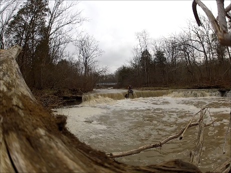
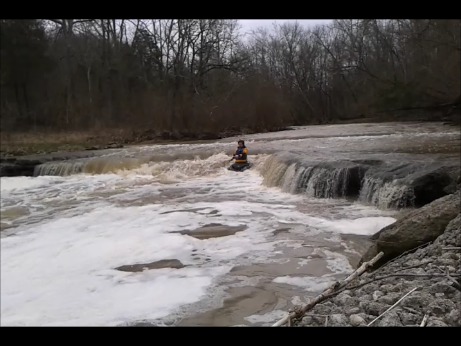
This creek needs a big storm. It starts out as a small stream rolling through the woods, then starts to drop over limestone ledges and even has some serious holes. There is an ever present risk of strainers so be careful.
It should be noted that the cited length of the run is a bit misleading. The listed mileage is _just_ for Second Creek down to the confluence with Todd Fork. Actually, it is nearly another quarter-mile to the true confluence, since Second Creek runs parallel to Todd Fork (at what is likely to be an island at higher flows). However, there is no access/egress from there, so you will proceed down Todd Fork some distance. The take-out listed here is the take-out for the Todd Fork run (in Morrow), which essentially doubles the listed length, although there are takeout options before you get to that point.
This has a similar character to First Creek. See also Todd Fork, since you will be running at least some stretch of that run. Obviously it would be easy to make a daily-double or -triple by setting up to run a combination of these in a day, since it is entirely likely (though not guaranteed) that if one is running, they all are.
Enjoy the following video of a run on this creek, with video ending at the Todd Fork confluence (courtesy Scott Puthoff via YouTube):
Difficulty
Class II-III
Length
6.3 mi
Gradient
35 ft/mi
max 50
Rapids
6
Access Points
Shuttle Info
There are options for take-out short of running to the Todd Fork take-out (as is our default here).
Difficulty Classes
I Easy
II Novice
III Intermediate
IV Advanced
V Expert/Extreme
VI Unrunnable
Current Conditions
5-Day Forecast
Whitewater data from
American Whitewater
American Whitewater