Rapid
OH
Confluence: Todd Fork
Save this feature with the run it belongs to.
Gauge Conditions
Runnable: ? – ? CFS
Approximate - nearest available gauge. Use as general reference only.
Data from American Whitewater & USGS
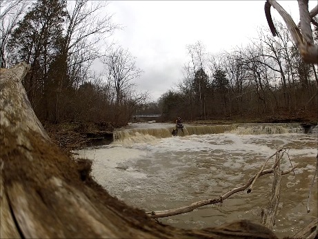
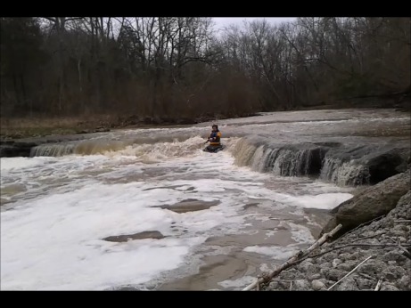
Photo

Photo courtesy of American Whitewater
Description
The Confluence of Second Creek and Todd's Fork creates a complex water transition with potential for unpredictable currents and hydraulic interactions. Limited information is available about specific navigational challenges, so scouting and local knowledge are recommended before attempting this stretch. Paddlers should be prepared for potential debris and variable water conditions typical of small Ohio watershed confluences.
Location
Interactive river map
Loads as you approach this section.


View Full Run
State Rte. 132 to Confluence with Todd's Fork
Second Creek
II-III
6.3 mi
Current Conditions
5-Day Forecast
Whitewater data from
American Whitewater
American Whitewater