U.S. 201 to Cathance Rd
Gauge Conditions
Runnable: ? – ? CFS
Approximate reading: This gauge is 14.4 miles away on Cathance (Sagadahoc Co.). Use as a general reference only.
Data from American Whitewater & USGS
Run Map
Interactive run map
Loads as you approach this section.
Run Time Estimate
Select put-in and take-out to estimate time.
Plan This Trip
See wind-adjusted speed maps, forecast planning, and detailed time estimates.
Sign in to generate an AI timing estimate for this run.
Whitewater timing varies with scouting, portages, and group pace. Use as a planning baseline.
Description
Not to be confused with Cathance Stream in Washington County.
Posted by Justin Manter on 4/4/02
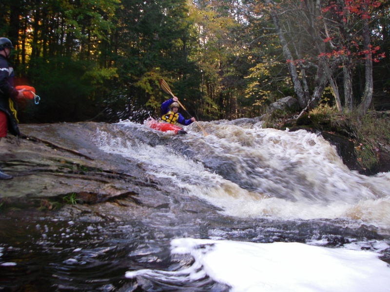
This is a gorgeous class III- IV creek run with 2 optional class-V waterfalls for the stout of heart. The river is very wild despite its location and the scenery is excellent.
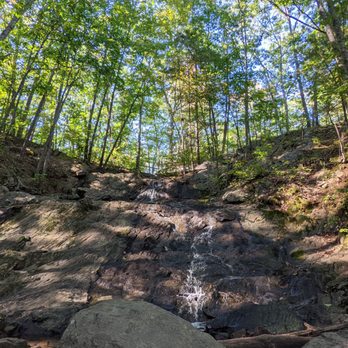
There is a walking/hiking trail along river right for most of the rapids in this stretch great for scouting or doing laps. This river is rather uncharacteristic of many in the area, as it is mostly made up of short, rocky, often very steep rapids separated by long sections of barely moving flatwater. The rapids are the river stepping down from ledge to ledge as it makes its way to the ocean at the takeout.
Rapid distances are calculated from the Rt 201 bridge and are approximate.
Video of some folks paddling a few years back (rapids not pictured in downriver order): https://www.youtube.com/watch?v=mAqMT0LRBpI
Rapids in this Run (6)
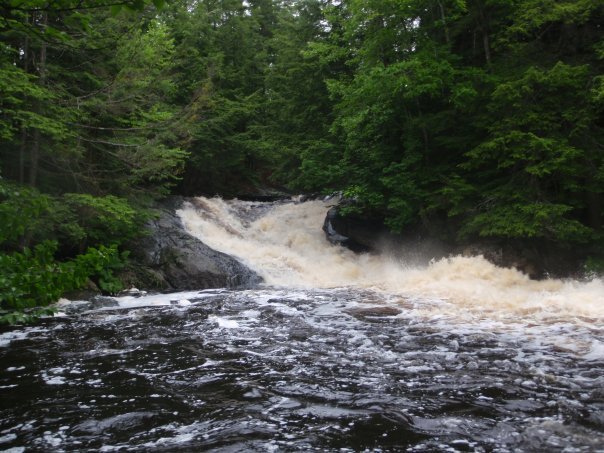
Waterfalls (1)
Difficulty
Class III-IV(V)
Length
3.5 mi
Rapids
6
Access Points
Shuttle Info
While the listed put in and take out work, there is also a put in on [Old Augusta Rd](https://goo.gl/maps/mcEDKJhKyQxLua7F7) where 295 crosses the river. This is also the location for the gauge, which is painted on the bridge.
Alternatively, if one would prefer to eliminate the flatwater before and after the rapids (about a mile at each end), you can park at the [Cathance River Trails parking area](https://goo.gl/maps/7th5wmtwo7MSLnyt6) in the Highland Community and hike in from there. Carry your boat down past the Ecology Center and take the Barnes Leap Loop Trail to the left. This will take you right down to midway through the first rapid, carry up above that rapid and put in there. Hiking out has changed slightly with new construction. Carry up the trail from the last rapid and you'll soon reach a cul-de-sac. You can stash your boat there and walk back up the road to get your vehicle. Please be respectful of private property and speed limits, as this is a retirement community. Folks are typically friendly, curious about what boaters are doing, and often appreciate a chat!
Difficulty Classes
I Easy
II Novice
III Intermediate
IV Advanced
V Expert/Extreme
VI Unrunnable
Current Conditions
5-Day Forecast
Whitewater data from
American Whitewater
American Whitewater