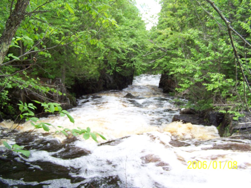
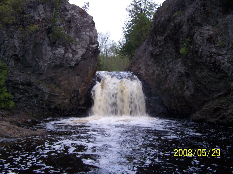
Dells
Save this feature with the run it belongs to.
Gauge Conditions
Likely too low for reasonable whitewater trip. (New gauge! We need your input to establish/refine best flows! Add a comment or report.)
Photo
Description
The "dells" of the Tyler Forks (local name unknown) is reached by carrying about a quarter-mile upstream from the end of Moore Park Road. The river drops over 40' in about a quarter-mile through a sequence which begins with fast class III, feeding into a stepped ledge of 8-10 feet, and finishing with a fun drop through a small rockwalled canyon. This is the most challenging drop on this reach! (It may push into class IV territory at good flows!) Those who don't wish to run this drop should put-in at the Hwy 77 bridge, as there is only flat water between the bottom of this drop (at the end of Moore Road) and the bridge.
The following YouTube video (courtesy of 'edo0776') shows multiple runs through the dells:
Location
Other Rapids on This Run (19)
 Waterfall
IV
Waterfall
IV
 Rapid
N/A
Rapid
N/A
Current Conditions
5-Day Forecast
American Whitewater