Rapid
WI
Jennings Falls
Save this feature with the run it belongs to.
Gauge Conditions
Runnable: 200.0 – 1,000.0 CFS
Too low for reasonable whitewater. (May be paddled as a scenic float trip, but all gradient will be a scrape or carry.)
Data from American Whitewater & USGS
Photo
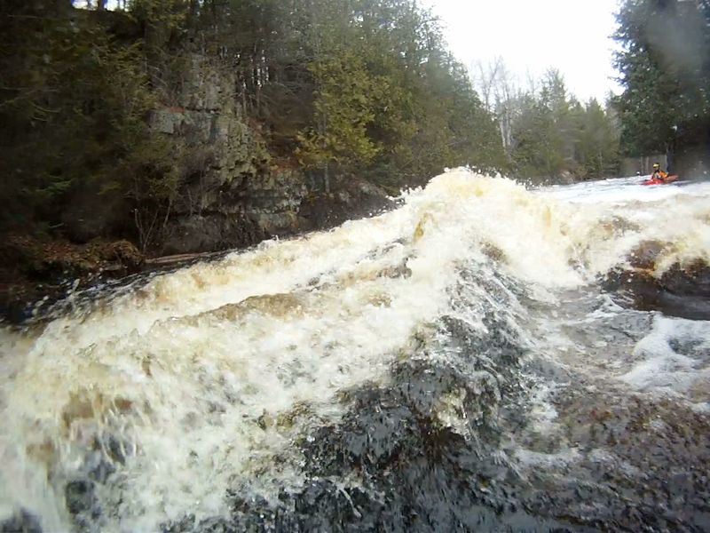
Photo courtesy of American Whitewater
Description
Passing just to the left of the 1st haystack, a boat will deflect towards the rock wall. I have not yet seen anyone hit the wall but it will come by fast and very close. Passing on the right of the 1st haystack increases the odds of tip-over (experienced paddler or not) because of the height of rise to the standing wave and the depth of the hole just to the right of it (see photo).
Location
Interactive river map
Loads as you approach this section.
View Full Run
D) Hwy 101 to Pine River (6.4 miles)
Popple
II(III)
6.1 mi
Current Conditions
5-Day Forecast
Whitewater data from
American Whitewater
American Whitewater