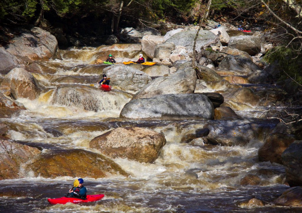
Waterfall
VT
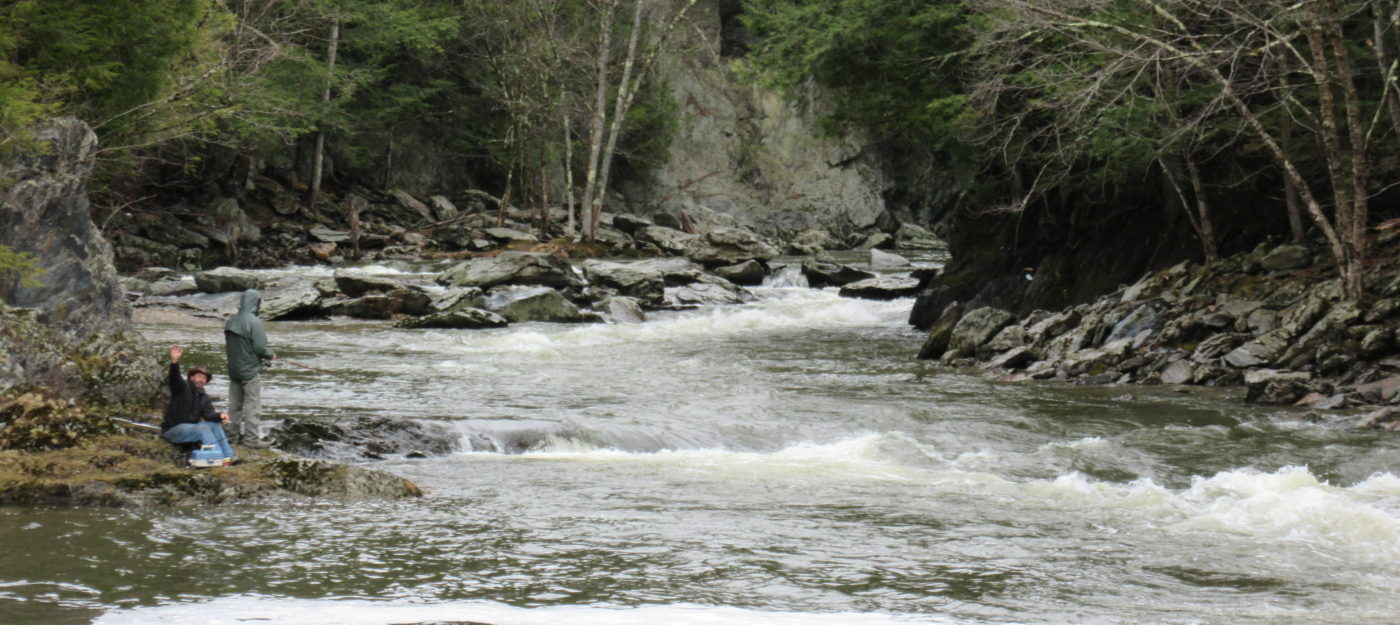
John Little Falls
Save this feature with the run it belongs to.
Gauge Conditions
Data from American Whitewater & USGS
Photo
Photo courtesy of American Whitewater
Description
J Little Falls: River wide ledge, you can see where river broke thru 20 foot rock band in geologic times. A 7 foot drop usually run on right. Is a big backwash on left center to left shore above 1400 cfs. Can scout R or left, portage left. When river is high ^1800 cfs Raven's Roost and JL Falls run together, get to the right above JL Falls
Location
Interactive river map
Loads as you approach this section.
Other Rapids on This Run (10)

View Full Run
River Road (near oxbow) to Big Falls State Park
Missisquoi (Troy) MINT
II-IV
4.2 mi
Current Conditions
5-Day Forecast
Whitewater data from
American Whitewater
American Whitewater