Kimball Falls
Save this feature with the run it belongs to.
Gauge Conditions
Runnable: ? – ? CFS
Approximate - nearest available gauge. Use as general reference only.
Data from American Whitewater & USGS
Photo
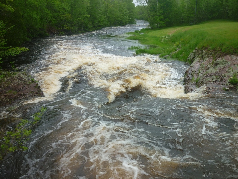
Photo courtesy of American Whitewater
Description
Located in a county park, the lead-in is a bit less-than straightforward. Get out (river-left) to scout well-before the bridge. As you pass under the bridge (which no longer allows vehicular traffic, but provides access to the park) the main drop has a steep wrapping wave to the right, a fine tongue leading to a diagonal wave/hole below.
Location
Interactive river map
Loads as you approach this section.
View Full Run
B) Gile Falls to Hwy.2 (6.3 miles)
Montreal, W.Fk.
II-IV
6.1 mi
Current Conditions
5-Day Forecast
Whitewater data from
American Whitewater
American Whitewater