Rock Cut (Railroad) Falls
Save this feature with the run it belongs to.
Gauge Conditions
Runnable: ? – ? CFS
Approximate - nearest available gauge. Use as general reference only.
Data from American Whitewater & USGS
Description
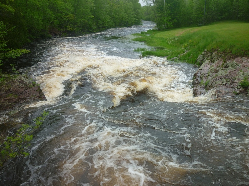
Just past a short zig-zag you'll come to a powerline crossing/clearing. Almost immediately you'll want to get out and scout from river-right (where the "Iron Horse Trail" passes through). This is one of Wisconsin's (and among the upper Midwest's) longest class IV rapids (nearly an unrelenting quarter-mile). The narrow channel is filled with action, with only a brief pause right at the (defunct) railroad bridge (now part of the "Iron Horse Trail"). Downstream of the bridge, the channel is slightly wider and the action slightly more manageable than above the bridge.
Location
Interactive river map
Loads as you approach this section.
View Full Run
B) Gile Falls to Hwy.2 (6.3 miles)
Montreal, W.Fk.
II-IV
6.1 mi
Current Conditions
5-Day Forecast
Whitewater data from
American Whitewater
American Whitewater