Lower Dam ====================== PART III ==
Save this feature with the run it belongs to.
Gauge Conditions
Approximate - nearest available gauge. Use as general reference only.
Photo
Description
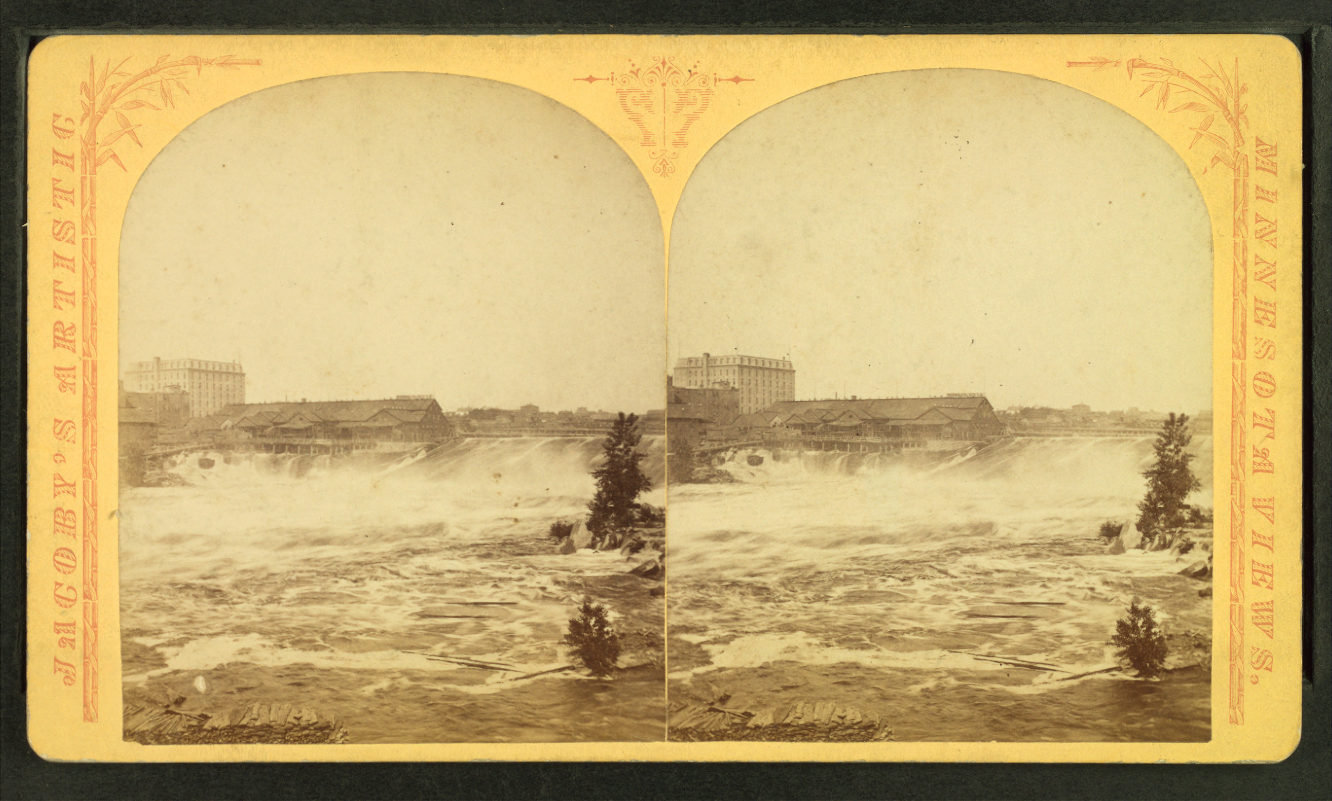
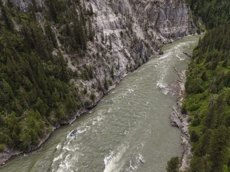
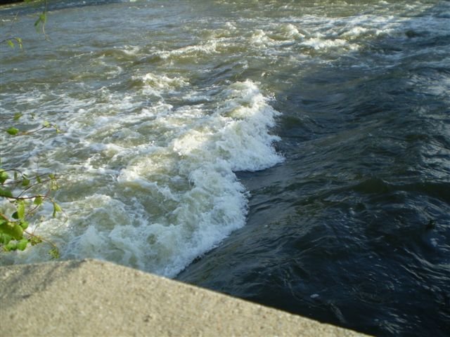
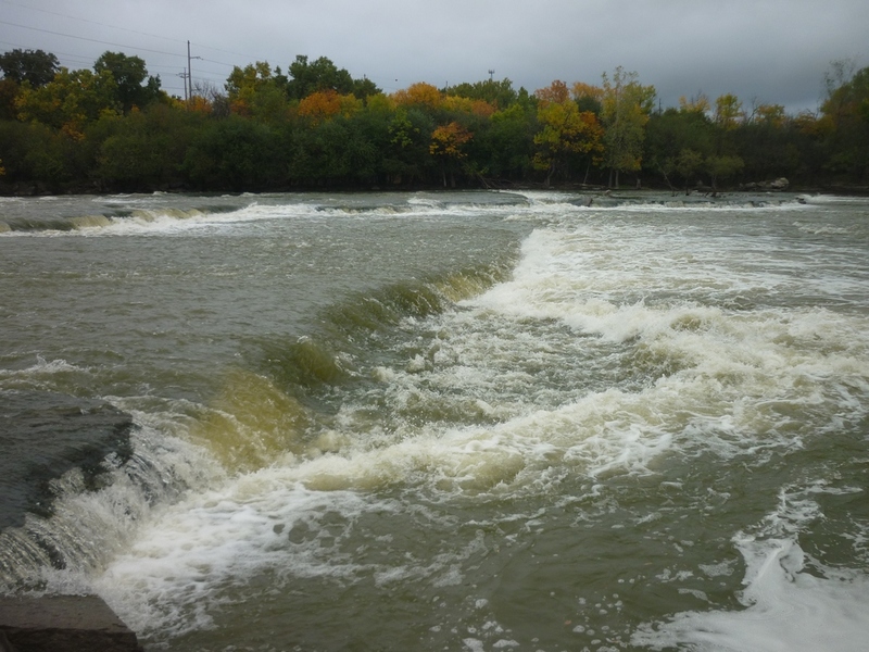
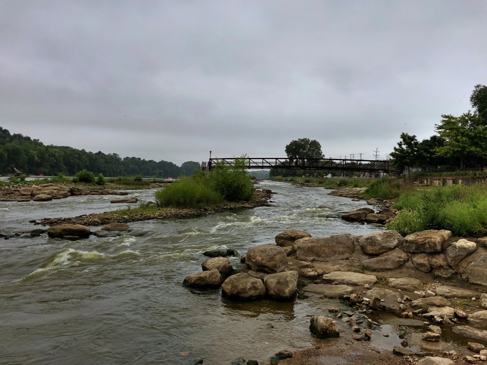
After having whatever fun you care to have on the center-section routes, a crucial decision must be made of how and where to run the lower dam to get to the third section of this run. This dam can be among the most fun and yet the most potentially dangerous parts of the run. All boaters (or at least one or more experienced boaters in your group) should have a firm visual impression of what they will need to do to successfully negotiate this area. Done correctly, it can be a piece of cake; done incorrectly it could really ruin your day (and cause significant scramble for your rescuers)!
While technically, it is not a true 'class IV' drop, it is the reason for that rating in the listing, so less experienced paddlers are aware of the potentially serious hazard it represents. There are quite a number of options which may be done by reasonably skilled boaters, with adequate caution, awareness of flows, and at least one guide-paddler having prior familiarity with this run. The only way for novice boaters to safely, thoroughly, and properly scout these routes is at lower flows ('one-gate' levels: less than 3000 cfs). At higher flows, these routes should be done only in the company of someone well-familiar with this section. It is highly recommended all first-time-on-this-run-boaters (on the water without a very experienced-with-this-run boater) take a close look from shore (before putting on the water) by walking up to the dam from within Thousand Islands Environmental Center before running any part of this dam.
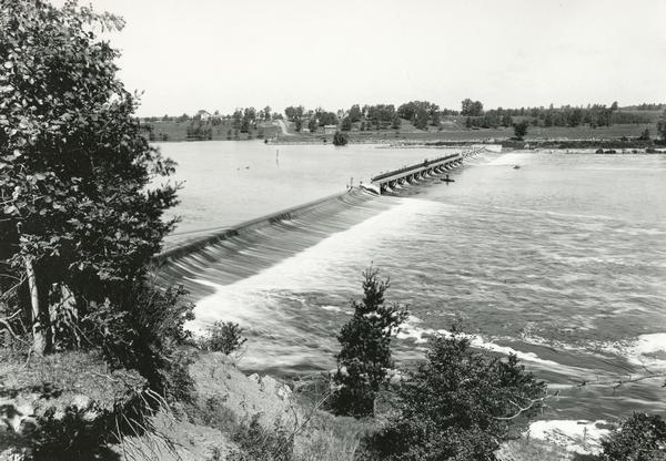
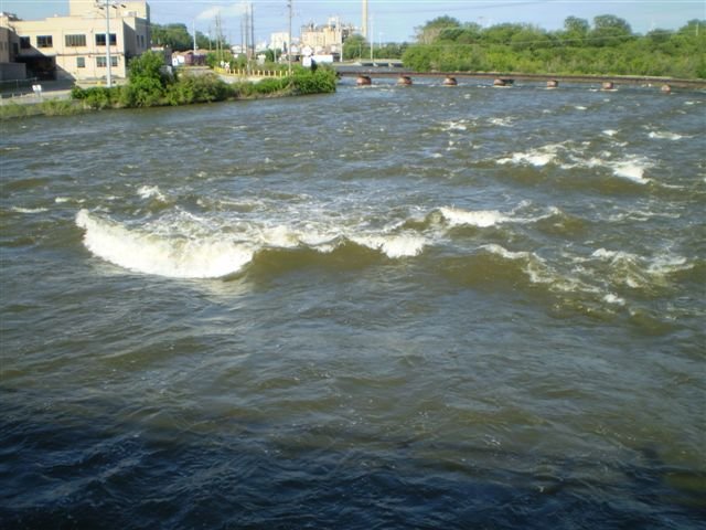
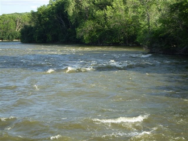
A) Far Right (Thousand Islands Channel) (the only option(s) which lead to the far right channel below, nearest the Thousand Islands Environmental Center building): At some flows, the center of this rightmost section of the dam can be run, dropping about 2' onto slab, sheeting the flow horizontally 10'(+/-) into a shallow wave/hole. Even at flows up to three-gates (6200 cfs), the water sheets so shallow and swiftly (across the bedrock below the dam) that you will almost certainly feel and hear the boat impact on the bedrock. While it will sound nasty, it is unlikely to cause meaningful damage (to boat or body). However, being off center (especially to the left, but potentially to either side!) will drop you into a uniform boil. At higher water levels (mostly above 3-gates/7000 cfs), the entire width will increasingly become a uniform low-head-dam/boiling hole. In all instances, it will be very difficult to judge (in your boat when on the river upstream) just where it is potentially 'safe' to drop over. Therefore the recommended route is either tight to the right shore, or well to the left where trees dot small islands immediately below the dam. In either of these locations, the flow off the dam spills onto a series of shallow ledges, where one can quite safely bobble down. If you run the left side of this part of the dam, generally the flow should allow boat-scouting to pick a line in the clear spaces between tree-filled small islands.
B) Right of cement superstructure: It may be possible (for some boater, at some flow) to drop over the dam near a short vertical cement pillar (where the dam actually abuts the island), a good distance to the right of the only significant superstructure sticking up from the otherwise uniform lip of the dam. This puts you into a VERY narrow channel (with water boiling back toward the dam trying to flip you into it), which then widens to sheet across a shallow ledge before dropping off into a fairly shallow pool. Downstream of this area is often blocked by a tree/logs. In general there are far more fun options available, so (along with the difficulty/danger of this route) it is very strongly recommended NOT to use this route!
C) Left of cement superstructure (Infant Falls Channel): At many water levels, it is possible to drop over the dam a good distance to the left from the aforementioned superstructure. Specifically (at least as of 2015/16), there is a large tree which has fallen (from the island downstream of the dam) to lay across the dam, very fortuitously positioned almost precisely where the flow divides left and right of the island below. Drop to the right of the large downed tree, (ready to 'punch' the recirculation below!) and then thread through a couple trees (upright, and leaning across) in the flow, to a sweet ~4' boof (Infant Falls) into a deep aerated pool. This puts you into an otherwise quite generally uninteresting channel (possibly one tame beginner-surfable wave). You can beach at the left, and carry up the island to 'do laps' on the falls, or launch into the 'Mystery Wave' channel (by putting in at the other side of the large tree fallen across the dam). Optionally, another choice (after running Infant Falls) is to beach at channel-right, carry up (over a pretty decent sized hill/hump on the island) to the cement pillar (as described in option B above), where you should be able to relaunch above the island/dam, where you can paddle along the dam (past the 'superstructure') to run the dam at this same spot (item (C)), or another spot.
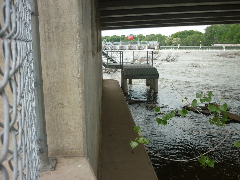
D) Right-side access to the 'Hidden Channel': Drop over the dam just to the left of the large tree on the island which lies to the left of the significant superstructure (as described in B and C above). This has significantly less difficulty/danger than some of the other options, but should still not be taken lightly. Water pours down sloped bedrock alongside the dam (with no real significant ledges or features) then twists downstream into the 'Hidden' or 'Mystery' Channel. (See description in Part III below.)
NOTICE: As of 2015/16, a tree has fallen from the island below so that its branches block part of this flow! While it is possible to 'walk the plank'/'thread the needle' between the branches and the boil from the dam, this is best done by launching from the island (after running Infant Falls) so you can scout before committing to this line!
E) Left-side access to the 'Hidden Channel' While one could drop over the dam in the next stretch to the left, there is generally little to recommend doing so. (It tends to have much more boil back into the dam than the prior access mentioned.)
F) Far left (Mill Channel): At all but the lower flows, it may be difficult to readily determine where the divide-point is between water heading to the right (option E above) versus heading to the left. At the divide-point, there will be very little 'drop' over the dam, but there will nearly always be significant boil to contend with. The further left you go (across this final, left-most part of the dam), the taller the dam/drop is, and the harder the landing would be (as it will land shallow and sheet away in the highest sections). If one were to drop over where it is a relatively short drop, you would be met with water spreading wider and wider (sheeting shallower and shallower) across the sloping bedrock, then jumping off a short (~3') ledge onto a fairly shallow landing. This puts you into the far-left channel (as described further below in Part III). Again, given the other options which are either themselves much more fun and/or put you into channels which have better (best) play, this is an option least likely to be taken nor recommended.
=============== END OF OPTIONS FOR RUNNING LOWER DAM ===============
Location
Other Rapids on This Run (20)
 Rapid
N/A
Rapid
N/A
 Rapid
N/A
Rapid
N/A
 Rapid
N/A
Rapid
N/A
 Rapid
N/A
Rapid
N/A
 Playspot
II
Playspot
II
 Playspot
II+
Playspot
II+
 Rapid
N/A
Rapid
N/A
 Rapid
N/A
Rapid
N/A
 Playspot
II
Playspot
II
 Playspot
II
Playspot
II
 Rapid
N/A
Rapid
N/A
 Hazard
N/A
Hazard
N/A
 Playspot
III
Playspot
III
 Hazard
III+
Hazard
III+
 Playspot
II+
Playspot
II+
 Waterfall
III+
Waterfall
III+
 Playspot
III
Playspot
III
 Playspot
II+
Playspot
II+
 Rapid
N/A
Rapid
N/A
 Rapid
N/A
Rapid
N/A
Current Conditions
5-Day Forecast
American Whitewater