Put-in
MI
Put In
Save this feature with the run it belongs to.
Gauge Conditions
Runnable: 6.2 – 7.0 FT
Almost certainly too low for whitewater run.
Data from American Whitewater & USGS
Description
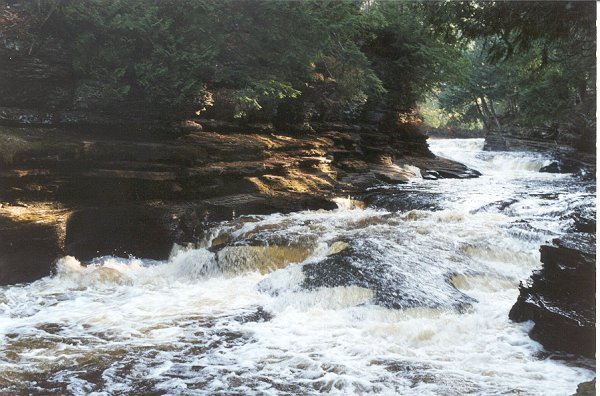
Put-in for this section is at South Boundary Road, just off Presque Isle Road.
The USGS gauge has been at this location since June, 2023.
We do not presently have good info from boaters about best ranges for this section! Please contribute your input by providing a "Trip Report" stating the reported gauge reading, and your impressions of the run: too low (total boat abuse!), low-boatable (somewhat scrapey, but worthwhile), moderate-boatable (the sweet spot of flows), high-boatable (kinda hairy/scary), or too high (for mere mortal boaters).
Location
Interactive river map
Loads as you approach this section.


View Full Run
D) 'Bottom Presque': South Boundary Rd to Lake Superior (1.1 miles)
Presque Isle
IV-V
1.1 mi
Current Conditions
5-Day Forecast
Whitewater data from
American Whitewater
American Whitewater