Rapid
WI
S.Park Street
Save this feature with the run it belongs to.
Gauge Conditions
Runnable: 400.0 – 999.0 CFS
Almost certainly too low to boat.
Data from American Whitewater & USGS
Photo
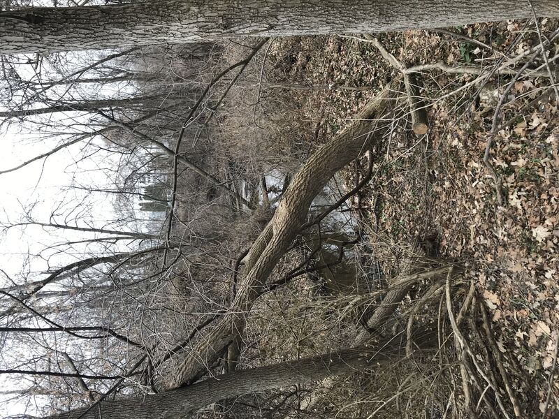
Photo courtesy of American Whitewater
Description
Access from this location would provide a slightly less busy put-in (than either of the other options, cutting off about 2/3rds of a mile from the upper, or adding about 0.22 mile to the lower).
Unfortunately, major wood precludes passage from here to the next listed access point, our reccommended put-in.
Location
Interactive river map
Loads as you approach this section.
Other Rapids on This Run (10)
 Waterfall
N/A
Waterfall
N/A
Sunset Road (CTH.CC)
Rapid
N/A
Drainage Area: 1.4-2.8 square miles
 Rapid
N/A
Rapid
N/A
Put In: S.Ravine Street
 Waterfall
II
Waterfall
II
Opening stretch
Rapid
N/A
End 2017 'remediated' area, begin 2025 'remediated' area.
Rapid
N/A
Left Twist
Rapid
II+
Oakland Avenue (old post-pile)
Rapid
N/A
S.Division Street Jump
Rapid
N/A
Take Out: Milwaukee Avenue
 Hazard
N/A
Hazard
N/A
No Good Choices!
View Full Run
S.Ravine St. to S.Milwaukee St. (0.5 mile)
Mineral Springs Creek
II+
0.5 mi
Current Conditions
5-Day Forecast
Whitewater data from
American Whitewater
American Whitewater