1) Hwy 20 to the Bear Creek Confluence
Gauge Conditions
Runnable: 500.0 – 5,000.0 CFS
Data from American Whitewater & USGS
CDEC Flow Data California
Data from California Data Exchange Center (CDEC)
Run Map
Run Time Estimate
Select put-in and take-out to estimate time.
Plan This Trip
See wind-adjusted speed maps, forecast planning, and detailed time estimates.
Sign in to generate an AI timing estimate for this run.
Whitewater timing varies with scouting, portages, and group pace. Use as a planning baseline.
Description
## Overview
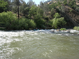
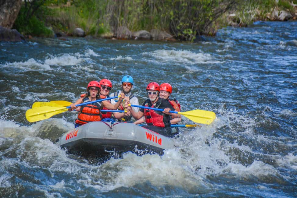
The Cache Creek Wilderness Run offers paddlers a true wilderness experience through 18.9 miles of pristine California chaparral landscape. Located in Lake County, this Class II(III) run flows through the 27,294-acre Cache Creek Wilderness area, managed by the Bureau of Land Management. The run combines scenic beauty with moderate whitewater, making it an excellent choice for intermediate paddlers seeking solitude and wildlife viewing opportunities.
The ecosystem supports a diverse array of wildlife, with paddlers commonly spotting bald eagles, otters, deer, osprey, elk, herons, and wild turkey. The semi-arid landscape features mixed chaparral and interesting geological formations, creating a unique paddling environment distinct from many other California runs.
## Flow Information
There has been confusion online about flow requirements, caused by incorrect gauge references on some websites. This page updated Feb 2025 with definitibe flow details.
The Cache Creek run is a combination of the cold, clear flow from the North Fork, out of Indian Valley Reservoir, and the warm, turbid flow from the Main (South) Fork, out of Clearlake.
The put in for the run is above the confluence, at the Redbud Trailhead, where Highway 20 crosses the North Fork.
### North Fork Flow Beta
To put on on the North Fork, 85 cfs is the absolute minimum to avoid dragging your boat, and once you get to 1000cfs on the North Fork, things get very sketchy with sweepers and wood hazards, and a bridge you have to portage. IK's and Packrafts have been known to put on even lower.
If the North Fork is too high or two low, packrafters can hike 1.5 miles downstream and over the ridge to Baton Flat, on the Main (South) Fork. \[There are class V rapids just above Baton Flat on the South Fork, but nothing else has been written about this section below Cache Creek Dam that this author could find. Please add that here if you have info\]
### Conflence Flow Beta
- Minimum combined flow at the North Fork/Main Cache Creek confluence (Mile 2):
- 400 cfs for inflatable kayaks and packrafts
- 450 cfs for small rafts
- Optimal flows: 550-1000 cfs
- High water: Above 3000 cfs (significantly increased strainer hazards)
- At 650 cfs combined, current moves around 3 MPH
### How to Check Flows
1. Add flows from two sources:
- North Fork release from Indian Valley Reservoir
- Main Cache Creek from Clear Lake
2. To estimate additional inflow from side creeks:
- Take the Rumsey gauge reading
- Subtract the Bear Creek flow
- Subtract the combined North Fork and Main (South) Fork releases
- The remainder indicates approximate side creek contributions Note: The Rumsey gauge has been reported as unreliable in recent years, so use this calculation as a rough estimate only
### Seasonal Flow Patterns
- Winter: Flows from rainfall and dam spillover
- Spring/Summer: Irrigation releases typically begin late March/early April
- Flow ratio between forks varies year to year
- Side creek contributions can be significant after rains
## Run Description
### Put-in to Confluence (Miles 0-2)
The first two miles on the North Fork require careful navigation around strainers and debris. A low bridge about one mile downstream requires caution, especially at high flows. In 2023-2024, the right foundation has partially collapsed - stay left and be prepared to portage if necessary.
### Key Rapids and Features
Patwin Drop (Mile 3.2)
- Class II
- Right turn into drop
- Watch for overhanging tree on river right
- Stay center
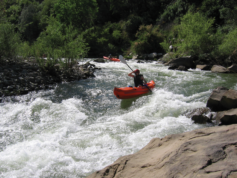
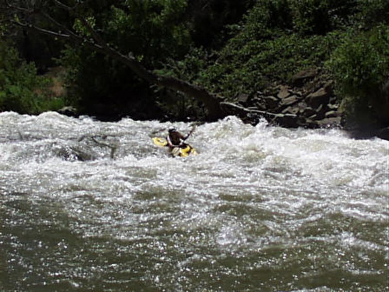
Twist and Shout (Mile 8.2)
- Class II+
- Notable landmark rapid
- Large center rock with routes on both sides
- Left route preferred at most flows
- Long boulder garden at low flows
- Becomes class III at high flows
Rocky Surprise (Mile 8.6)
- Class II+
- Rocky drop with large waves
- Enter right, move left to avoid hidden boulder
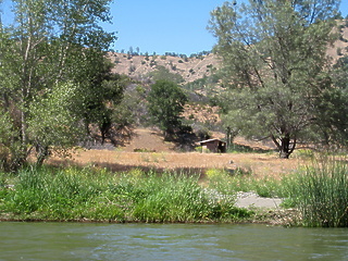
### Camping
Several excellent campsites are available:
- Kennedy Flats area (Mile 9.0) - Good riverside camping with 'Friend of the River' plaque
- Buck Island area (Mile 13.1) - Historic campground with vault toilets
- Multiple primitive sites throughout the run
- Good blackberry picking in season
Mad Mike (Mile 18.3)
- Class III-
- Most significant rapid on the run
- Scout from right
- Main line slightly right of center
- Avoid large hole on left
- Good recovery pool below
### Take-out Options
1. Bear Creek confluence (Mile 18.7)
2. Yolo County access points (Mile 18.8-20)
- Upper site ($3 fee)
- Middle site (public campground)
## Safety Considerations
1. Strainers are the primary hazard
- Dam-controlled flows rarely clear debris
- Several dangerous spots in sharp right bends
- Scout blind corners
2. Remoteness
- No road access for majority of run
- Hiking out is extremely difficult
- Carry emergency gear (lighter, rescue blanket)
- Full day required at normal flows
3. Hunting Activity
- Be aware of hunting seasons
- Wear bright colors during hunting season
- Previous incidents with target shooting in the area
## Trip Planning
- Allow 6-9 hours for the full run at normal flows
- At flows above 3500 cfs, trip time reduces to about 3.5 hours
- Possible to combine with lower run at high flows
- Consider camping at Yolo County's Cache Creek Regional Park for early start
## Shuttle
The shuttle takes approximately one hour round-trip:
- Take-out: Yolo County Park on Highway 16
- Put-in: Highway 20 bridge over North Fork Cache Creek
- Distance: 20 miles one-way
Best access to take-out is via I-505 to Highway 16, then upstream to Yolo County Park. For put-in, continue on Highway 16 to Highway 20, then west to the North Fork bridge.
Rapids in this Run (3)
Playspots (3)
Hazards & Portages (3)
Caution: The following locations may require scouting or portaging. Always check current conditions.
Difficulty
Class II(III)
Length
18.9 mi
Gradient
20 ft/mi
max 30
Rapids
3
3 Hazards
Access Points
Difficulty Classes
I Easy
II Novice
III Intermediate
IV Advanced
V Expert/Extreme
VI Unrunnable
Current Conditions
5-Day Forecast
Whitewater data from
American Whitewater
American Whitewater