B) Grafton Dells: Bridge Street to Lime Kiln Park Landing (PnP or 1.2 miles)
Gauge Conditions
Runnable: ? – ? CFS
Approximate reading: This gauge is 2.6 miles away on Milwaukee. Use as a general reference only.
Data from American Whitewater & USGS
Run Map
Run Time Estimate
Select put-in and take-out to estimate time.
Plan This Trip
See wind-adjusted speed maps, forecast planning, and detailed time estimates.
Sign in to generate an AI timing estimate for this run.
Whitewater timing varies with scouting, portages, and group pace. Use as a planning baseline.
Description
NOTE: Due to problems within the AW system, many 'virtual' gauges are not working correctly. For this section, we normally subtract the flow of Cedar Creek from that of the Milwaukee River Near Cedarburg (downstream of the confluence with Cedar Creek) to roughly approximate flow of Milwaukee River in Grafton.
Note that this does not take into account the lag (difference in time/flow) between the two locations, nor does is take into account that (at the best feature, Lime Kiln Park Wave) the flow is divided by an island, so technically, only something near half the flow is actually passing over the bedrock which forms that wave.
Until AW programmers can bring all virtual gauges back online, this section is reporting the Milwaukee River at Cedarburg flow (after the confluence with Cedar Creek). To compare to past experiences, users will have to look at the flow in Cedar Creek and do the subtraction themselves.
Quick Facts:
Location: Downtown Grafton to south of town.
Put-in: 1357 14th Avenue, Grafton (use street-side parking; do not park in business lots!)
Take-out: 43.3036, -87.9565 (Lime Kiln Park, Grafton, Canoe Landing)
Shuttle Length: 1.3 miles/4 minutes
Put-in is approximately 725' elevation. (Per scan of GoogleEarth data.)
Take-out is just about right at the 690' elevation contour line on topo maps.
Thus elevation change is approximately 35'.
Class/rating is NEVER enough to decide if you should run a river/rapids! Far more important than gradient and class/rating should be other less-quantifiable 'character factors': continuous versus pool/drop, wide-open routes versus constricted technical rapids, wide-channel (with multiple routes) versus narrow channel (with essentially one route), gradual river banks versus rocky shores or steep-walled gorges, et cetera.
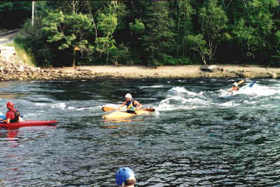
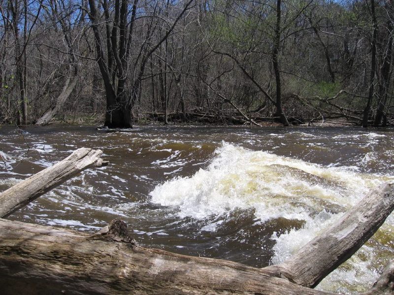
Character: Wide channel, bedrock and cobble bottom, pool/drop, river-wide routes.
River banks: Varies from vertical dolomite to steep rocky or grassy banks. Access/egress possible only at put-in, take-out and Falls Road.
Typical width: 55'-125'
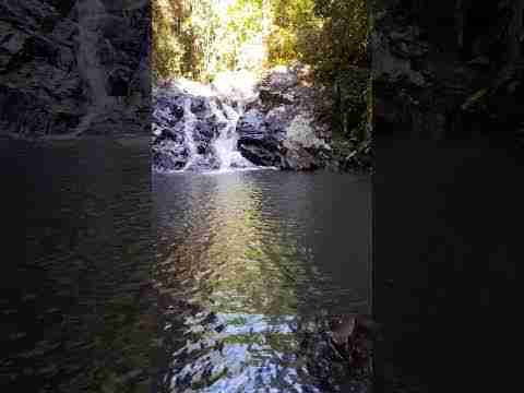
Video: * c* <<< The first 2:34 of this video offers highlights of this run. The remainder of the video shows fine highlights of a run on the very nearby Cedar Creek.
General Overview
At lower water levels (below about 500 cfs), this run may be suitable for beginner/novice paddlers as a whitewater trip and scenic paddle.
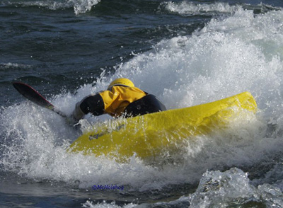
At moderate to higher levels (~700-1300 cfs and beyond), the run offers a fine handful of interesting play options (for those at least mildly experienced in whitewater). *Recreational kayaks (without sprayskirts) should not attempt at these levels! Expect to 'swamp' your boat, and expect to lose your boat and paddle (unless you have enough other experienced boaters along with you)!*
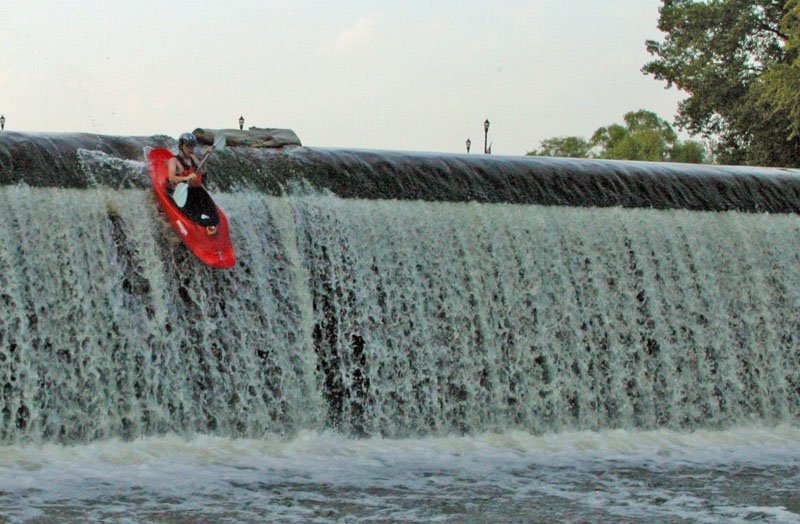
At levels of ~1200-2000 cfs, experienced playboaters often come just to PnP at Lime Kiln Park Wave (LKPW).
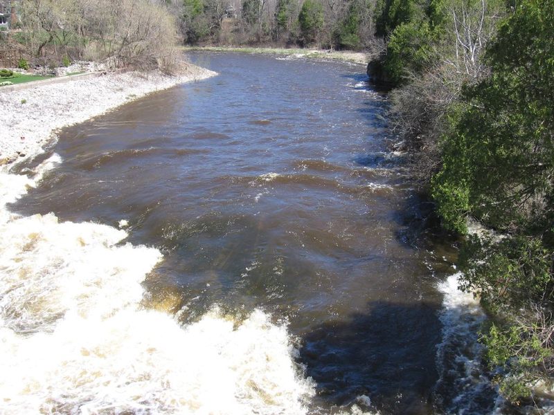
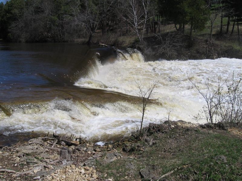
The removal of two dams (January, 2001: 'Chair Factory Dam', just upstream of Falls Road, and winter of 2010/2011: Lime Kiln Park Dam) has improved boating opportunities on this stretch of river. No significant rapids were revealed with either removal -- only some minor shoals and tame waves, as well as a couple great squirt spots (relatively well-defined eddylines with good depth). (Watch for these where the flow is deflected off of rock walls.)
It is important for novice boaters (and not a bad idea even for experienced boaters!) to scout the Falls Road ledges before putting on upstream, to know whether you feel comfortable running them at the water level you have when you are there. The portage (for downstream bypass) at this location IS VERY AWKWARD due to irregular quarried rock on shore and into the water! Since this is not a dam, you DO NOT technically have any rights to set foot on dry land (or rocks on shore)! (See more details in the Rapids' description for 'Falls Road Ledge.') This applies both for portaging down the drop and/or for carrying up to run/rerun the drop multiple times ... it's a no-no!
While you are scouting this ledge, take a little time to read the signage in the green-space (mini-park) at the corner of Falls Road and S.Green Bay Road to learn some local history. Originally the Wisconsin Chair Company occupied this site (powered by a dam, now removed). Later, Paramount Records used the buildings as a studio, an important connection in what was known as 'The Blues Trail'.
Rapids in this Run (7)
Playspots (6)
Hazards & Portages (2)
Caution: The following locations may require scouting or portaging. Always check current conditions.
Difficulty
Class I-II(III)
Length
1.2 mi
Gradient
30 ft/mi
Rapids
7
2 Hazards
Access Points
Shuttle Info
Those looking for the best whitewater play may forgo the shuttle, and just Park-n-Play at Lime Kiln Park (likely parking in/near the 'roundabout'/cul-de-sac before the roadway drops down to the canoe landing).
Since property on both shores at Falls Road is private property, while you can park and scout that area, you can no longer legally carry up to run (to park-and-play) that drop unless you knock on a door to get permission from each/either property owner.
We will note that the default shuttle below goes out to the main road through town. Far more often, we opt to use 13th Ave, 12th Ave, and S.Green Bay Road, allowing scouting of Falls Road en route.
Difficulty Classes
I Easy
II Novice
III Intermediate
IV Advanced
V Expert/Extreme
VI Unrunnable
Current Conditions
5-Day Forecast
Whitewater data from
American Whitewater
American Whitewater