C) Steigers Bridge to South Boundary Road (8.2 miles) Scenic
Gauge Conditions
Runnable: 2.8 – 6.9 FT
Almost certainly too low. Help your fellow boaters! We need input to fine-tune boatable levels. Add a comment or report!
Runnable: 6.2 – 6.6 FT
Almost certainly too low for whitewater run. (We need your input! Add a report to help define/refine these ranges.)
Data from American Whitewater & USGS
Run Map
Put-in
Take-out
Rapids/Hazards
Scenic
Recreational
Description
Aug '04 Access Update
Steiger's bridge (the listed put-in) is privately owned, as are the roads leading in to it. In Spring '04, paddlers were informed that due to liability concerns, the road would be closed to the public, and may be gated. Alternate options are:
A) 'Full' Presque run: doing the Upper Presque at Underwood Tower Road to then continue down this reach. (Total combined length: 15.7 miles.)
B) Doing Copper Creek into the Presque. Unfortunately this comes in below 'the canyon' (Triple Drop and Nakomis).
C) Hiking in (a LONG hike, trespassing on the gated road).
* * *
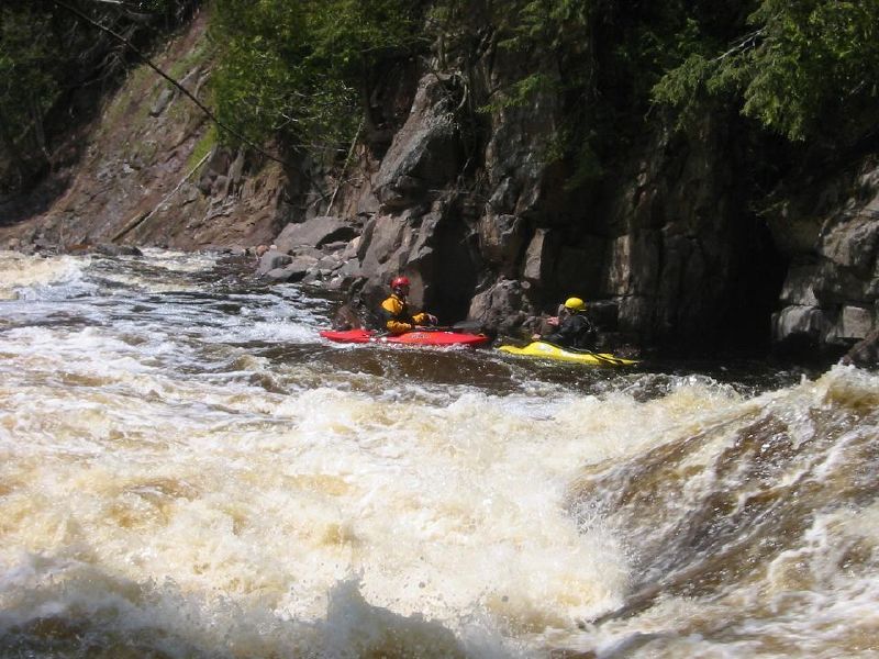
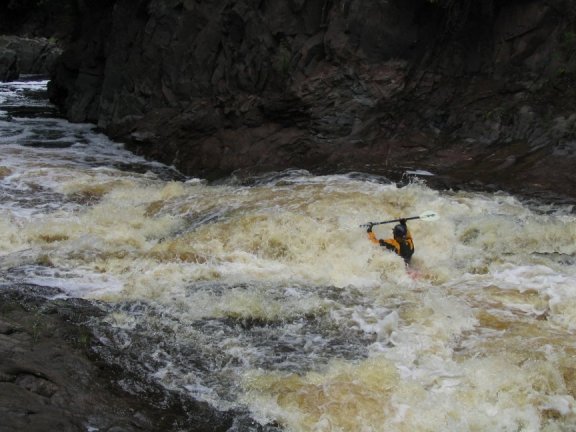
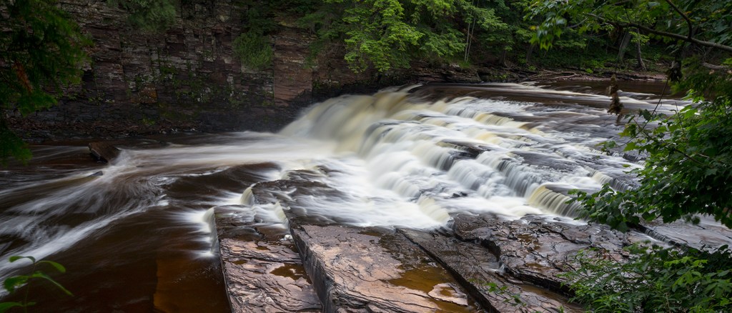
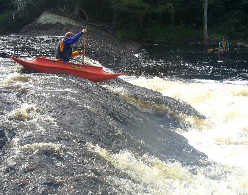
This classic run was once considered 'cutting edge' whitewater. Triple Drop, Nakomis, Lepisto, and Iagoo Falls are the major drops. There is great play water after the gorge, particularly at levels above 7.5', when Triple Drop and Nakomis will likely be portaged.
Historically, most groups took out at South Boundary Road Bridge, however, the final mile to the lake contains interesting, big, runnable (for experts) drops, and is now often done as a 'first choice' run. (See Bottom Presque for description and photos.) Those not choosing to run that bottom mile should at least take time to enjoy the views from overlooks and footbridge in the park.
Click here for Part 1 of an article from the AW Journal, way back in 1981!
Click here for Part 2 of the article.
The article describes the following: Michigan's, Upper Presque Isle, Lower Presque Isle, Middle Black, Lower Black, Upper Silver, Lower Silver, Falls, and Rock; and Wisconsin's Lower Brunsweiler, Montreal Canyon, and West Branch Montreal.
Rapids in this Run (4)
Difficulty
Class III-V
Length
8.5 mi
Gradient
51 ft/mi
max 105
Rapids
4
Access Points
Difficulty Classes
I Easy
II Novice
III Intermediate
IV Advanced
V Expert/Extreme
VI Unrunnable
Current Conditions
5-Day Forecast
Whitewater data from
American Whitewater
American Whitewater