Doyne Park Waves (DPW)
Save this feature with the run it belongs to.
Gauge Conditions
Float trip with (grungy) riffles and rips.
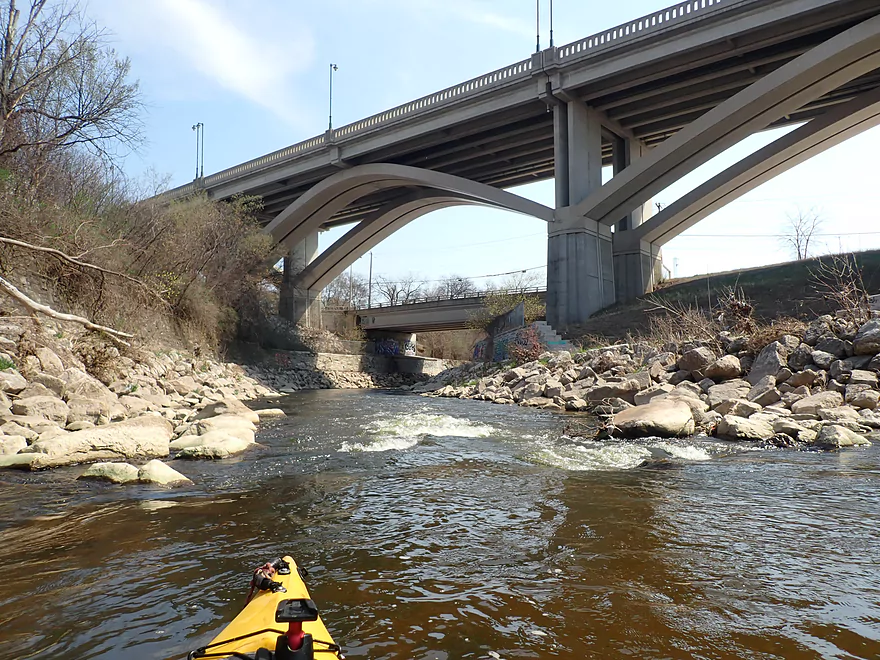
Photo
Description
Too some, DPW means Department of Public Works. For boaters of this river it means D oyne P ark W aves!
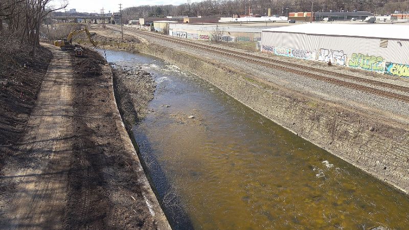
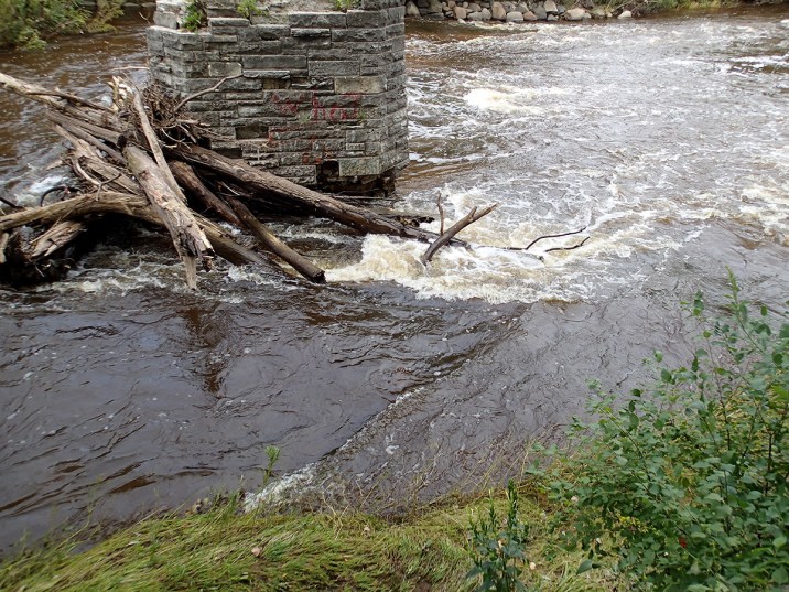
*** These are very significantly modified while the temporary diversion walls are in place, and will likely be affected by the stepped walls (replacing totally vertical walls) on both shores in this area. At present (October, 2025), a temporary wall (to make a drivable 'road' at river-left) creates a sweet wave/hole which gets deep and retentive at high flows (when it will likely be totally catch-on-the-fly). At low flows, it is a fine surf, and may be repeatable if you are aggressive and catch an eddy to paddle back up. ***
===========================================================================================
***The following description is being left intact for now, but will be updated once the project is complete and we have a chance to visit the river at a variety of flows.***
===========================================================================================
Sloping bedrock creates the sweetest set of waves at flows above 1000cfs. There are virtually no eddies so these are catch-on-the-fly.
At 200-400 cfs, expect minor playable features. At 400-900 cfs, you may start to see potential. At 1000+ cfs, SWEET glassy waves appear. Above 2000 it becomes sloshing surging slapping chop! There may be some surf-on-the-fly, but more is chaotic roller-coaster ride!
A group of playboaters wanting to surf these sweet rides will have to do their best to find whatever slackwater along shore as they can, to let each (one-at-a-time) take their turn catching the waves they can. As lead boater(s) drop off the first waves, other boaters slip out of their shoreline micro-eddy to try for their rides. Slackwater at the end of the series allows lead boaters to wait as the rest of the group works their way down.
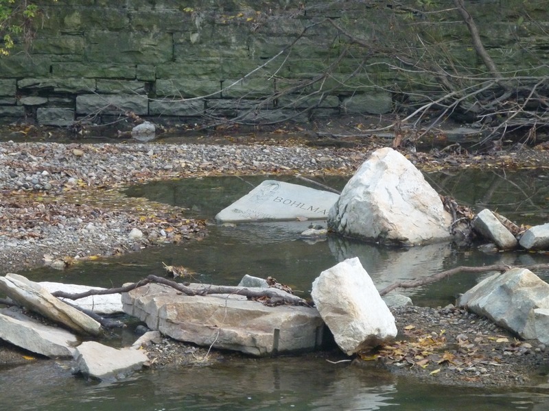
Do not proceed downstream until all boaters have regrouped. Vertical stone walls make rescue or recovery difficult if anyone suffers an 'out-of-boat' experience. About 0.1 mile downstream, the river-left wall has been knocked out to create some flood-plain. Any swimmer and/or their gear which cannot make it to that river-left shore will likely not be recovered until well downstream (perhaps long beyond the take-out).
Location
Other Rapids on This Run (20)
 Hazard
N/A
Hazard
N/A
 Rapid
II
Rapid
II
 Playspot
I
Playspot
I
 Playspot
I
Playspot
I
 Hazard
II+
Hazard
II+
 Playspot
II
Playspot
II
 Playspot
II+
Playspot
II+
 Playspot
N/A
Playspot
N/A
 Playspot
II
Playspot
II
 Hazard
II
Hazard
II
 Playspot
II
Playspot
II
Current Conditions
5-Day Forecast
American Whitewater