C) MenTosa: Hart Park Lane to W.Monarch Place or 4198 W.St.Paul Avenue (2.7 or 3.7 miles)
Gauge Conditions
Runnable: 125.0 – 3,000.0 CFS
Float trip with (grungy) riffles and rips.
Data from American Whitewater & USGS
Run Map
Run Time Estimate
Select put-in and take-out to estimate time.
Plan This Trip
See wind-adjusted speed maps, forecast planning, and detailed time estimates.
Sign in to generate an AI timing estimate for this run.
Whitewater timing varies with scouting, portages, and group pace. Use as a planning baseline.
Description
*WARNING: DO NOT PUT ON AT FLOWS ABOVE 3,800 cfs (or if flows are rising quickly and might possibly go above that)!
Numerous bridges become impassible, and are extremely difficult or impossible to portage!*
Quick Facts:
Location: Wauwatosa/Milwaukee
Put-in: Hart Park
Recommended Shuttle Directions
Put-in elevation is approximately 644'
Take-out elevation is approximately 594'
Total drop is approximately 50'
10/85 Gradient Upstream of Put-in: 8.8 fpm
Percent Developed Upstream of Put-in: 62%
(The higher the above two values, the 'flashier' the stream will be! This is a VERY flashy section, with best flows often 3 hours or less!)
Drainage area at put-in: 112 square miles
Drainage area at take-out: 133 square miles
Drainage increase: 18.8%
Class/rating is NEVER enough to decide if you should run a river/rapids! Far more important than gradient and class/rating should be other less-quantifiable 'character factors': continuous versus pool/drop, wide-open routes versus constricted technical rapids, wide-channel (with multiple routes) versus narrow channel (with essentially one route), gradual river banks versus rocky shores or steep-walled gorges, et cetera.
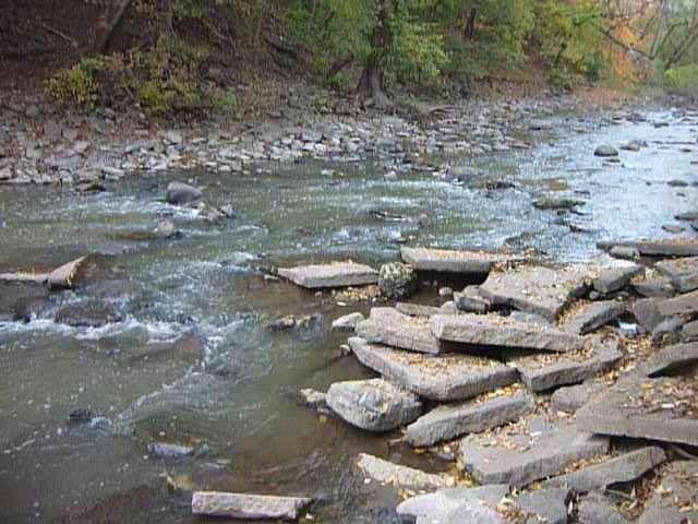
Character: Cobble/rock shoals and compression waves in first half transition to bedrock slides and glassy waves (at high flows) in the mid-portion, then revert to cobble before entering final stretch of 'remediated' quarried-rock bed and banks.
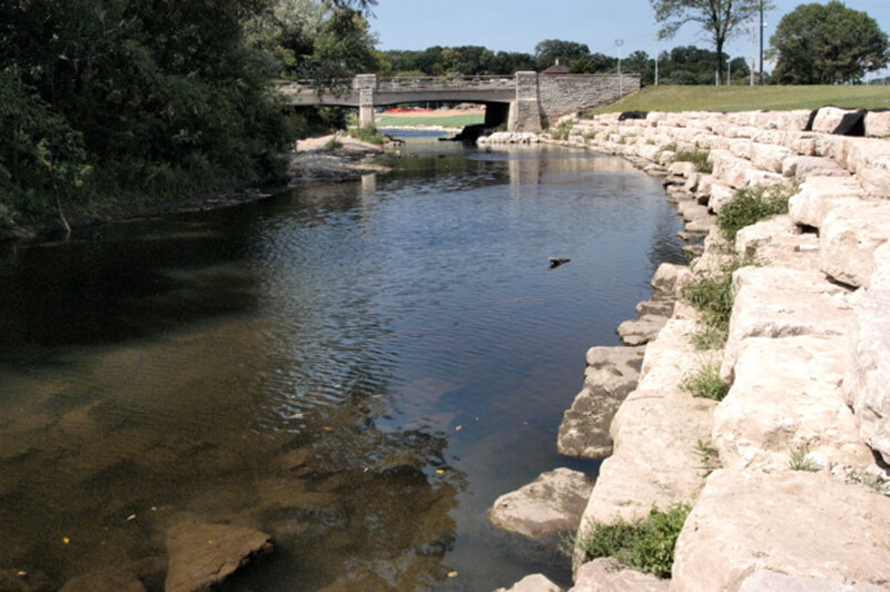
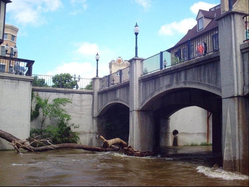
River banks: While the banks in some areas have been laid back, significant areas of the run have vertical rock-wall banks and minimal eddies, making egress nearly impossible. Locations to exit and reload are rather limited!
Typical width: 50-75 ft.
Longest rapids: From bare minimums up to maybe 500-600 cfs, rapids are fairly separate/distinct. At flows of 500-1000 cfs, the half-mile from Trenton is fairly continuous. As flows rise above 1000-1500 cfs, if someone swims it'll take coordinated effort of a solid team of boaters to chase down errant boat and paddle and get them ashore anywhere on that stretch! The swimmer may have to walk 0.5 mile, 1 mile, or more to reunite with gear!
General Overview
This highly 'city-fied' stretch of river has two distinct characteristics. The early-going is mud/gravel/rock riverbed, while the later portion encounters bedrock riverbed. Most of the stretch is fairly confined (steep-banks) channel, allowing it's relatively low gradient to build some impressive river-wide waves when water levels push up, as they regularly do after heavy rains.
Be aware that this is almost entirely an urban watershed. You must be fully aware of water levels and flow patterns, and have a realistic assessment of your skills and ability to handle changing water levels before running this stretch of river. Water quality (especially at times of high runoff during and immediately after rainstorms) can be HORRENDOUS. (There are times that is might best be categorized as a 'city cesspool' of a river, when you would not want to flip or swim!) The lower portion of this run (downstream from Jacobus Park/Hawley Road) lies mostly between vertical stone-wall banks, making exit from the river all but impossible there at moderate-to-high flows.
DO NOT PUT ON DURING HEAVY RAINFALL OR WHEN HEAVY RAIN IS IMMINENT! Water will rise VERY quickly with heavy rains (easily going from 'too low' to 'too high' /DANGEROUS/DEADLY within a half-hour or less!) as water pours off of all the buildings, pavement and other impermeable surfaces. (Wait until the peak of the rain is past before putting on.)
Paddlers are strongly advised not to run with a single craft (just one solo or tandem canoe or kayak). In the event of an 'out of boat experience' (at moderate-to-high flows, 600-1000 cfs and higher), you are not likely to reclaim your boat and any loose gear until it reaches the slackwater of the harbor (or at least somewhere downstream of the baseball stadium, now known as American Family Field).
All boaters on swiftly moving water should be using a Type-1 ( *wearable*) PFD (Personal Floatation Device, that is, a 'life jacket'), *fastened securely*! Do not rely on seat-cushion, 'throwable' floatation, or Type-1 PFD just stowed in the boat!
Access Issues
Access virtually anyplace on this stream *may* be problematic. While many runs of various parts of this river have been done without incident or hassle, we are also aware of groups which have been stopped from putting in.
Milwaukee County code 47.13 provides:
*'No person shall, without written permission of the department of parks, recreation and culture, place upon the lagoons, rivers or any of the waters under the control of the department, any float, boat or other watercraft, nor land or go upon any of the islands of the lagoons or rivers, nor land or touch with a boat upon any part of the shores not designated as a landing place. Non-motorized and non-trailered floats, boats, or other watercraft may be used on rivers controlled by the parks department without written approval of the park director.'*
There are those who suggest that the second sentence ('Non-motorized and non-trailered...') is meant to suggest that canoes and kayaks are NOT restricted and can be used anywhere (I.E., that the first part is intended to only apply to motorized or trailered craft). However, the first part appears quite intentionally all-encompassing ('any float, boat or other watercraft' seems to preclude canoes, kayaks, inner tubes, airmattresses, . . . you name it). This ordinance seems self-contradictory and unenforceable!
Further, to my knowledge, no public record presently exists as to whether or where any 'designated landing places' are located on this river! It is illegal to access the river from any of the (county park) golf courses. Wauwatosa USED TO ban river access from it's city parks (e.g., Hart Park), and was quite aggressive at enforcement. However, at a common council meeting, Sept.1, 2009, Ordinance O-09-17 was passed, DELETING Section 7.65.060 (which prohibited launching boats from City of Wauwatosa parks). (Boaters may do well to memorize this date and those numbers, in case some official attempts to stop your access!)
There are those who suggest that (within Milwaukee County and elsewhere) it is legal to launch within a few feet of any of the 'state highway', such as Capitol Drive (WI-190), Mayfair Road (WI-100), or 76th Street (WI-181). The logic is that the right-of-way for the highway includes its shoulders/ditches/culverts, putting them under state (not city or county) jurisdiction, and the state's charter assures you the right to freely pass from one transportation corridor (the road) to another (the river). Some sources go further to suggest that any public street crossing or public transportation bridge will suffice for carry-in launch (again citing the right to pass from one 'public transportation corridor' to another).
However, I'm not certain that you would be successful using this argument with any official who chose to take issue with your presence. In general, boaters are advised (if and when confronted by any authority) to *calmly and politely* state your position. You might politely ask any officer if they would call their superior officer(s) to verify either your assertion of your right to paddle, or the officer's assertion of his duty to restrict your access. However, if faced by continued challenge, capitulate, move along, and try a different spot, a different time, or move on to a different run. (Do your best not to cause a scene, which can only turn out bad for you, and also reflect badly on ALL paddlers!)
To avoid all the above potential hassles, it is strongly recommended (regardless where you put-in) to use 'Commando-style' put-in, being as quick and 'invisible' as you can be! Change into/out-of boating clothes at the take-out so you are ready to hit the river at the put-in. If possible, shuttle boats inside a vechicle (so you don't 'advertise' your presence any sooner than necessary, having to spend time untieing them). Spend as little time as possible (dilly-dallying and chatting) on shore before putting in. I say this mostly because ... even though the law may now be on our side, there will still be many 'good samaritans' who are likely to not be aware of that, and who will call some official to notify them of your presence. *It's just easier to be quick and not have to deal with explanations and justifications!*
Run Detail
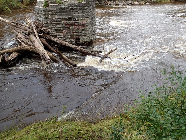
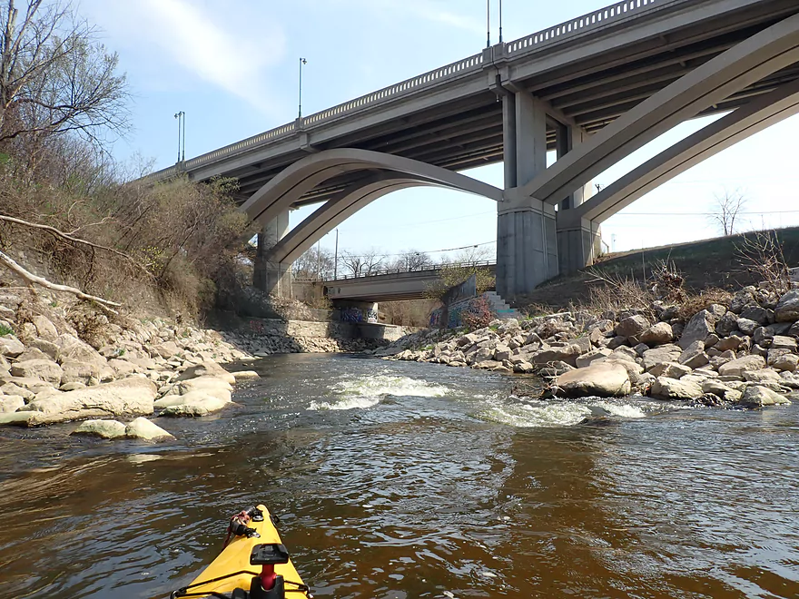
Early in the run one encounters fine waves in a generally uniform width channel. At higher flows, these tend to wash out and become swiftwater choppy waves. Flatwater, minor swifts and shoals will bring you to Jacobus Park. A pair of bridge piers USED to split the flow into three channels. On 2020.05.17, the right pier was swept away in a high-water event. The left pier remains, but is immediately downstream of a gravel-bar/island, so is unlikely to catch the branches and whole trees which used to regularly block this area. *It still may be a good idea to stop along the parkway road while driving shuttle to scout this area before putting on, to be aware of what sort of wave exists and how the currents, swirls, and boils are in the pool downstream.*
From this point the gradient increases, and the sloping bedrock (and a few random large rocks) create more interesting waves. At certain levels, some will be regainable, though more often they tend to be 'surf-on-the-fly'.
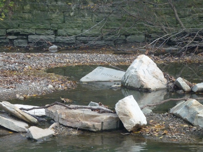
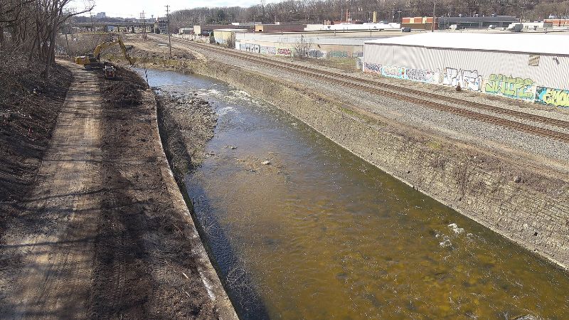
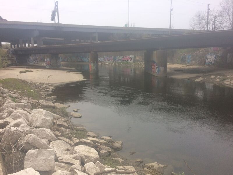
After you pass under the railroad bridge (just beyond the high-overhead freeway stub), the rest of the run has large quarried rock lining the channel. At good boatable flows, the rocks should be well-covered. However, *be aware of foot entrapment concerns if you are out of your boat and still in the water through this area.*
At times of heavy rains, CSO (combined sewer overflow) may affect this reach below Honey Creek / 70th Street or below Jacobus Park. MMSD (Milwaukee Metropolitan Sewerage District) updates their website (supposedly every five minutes!) with information regarding rainfall amounts at various locations in Milwaukee area, quantities in the deep tunnel and various processing sites, as well as with information regarding any CSO which happens in the system. Check it out at: . It should be noted, however, that water quality suffers heavy fecal coliform loads even absent a CSO. Best explanations seem to be contamination from Underwood Creek (and the Milwaukee Zoo), Honey Creek (especially during/after State Fair in early August, as it runs beneath the fairgrounds), as well as pet waste (dog feces) throughout it's watershed.
Rapids in this Run (10)
Rapid
NOTICE!
Rapid
Alternate Put-in #2: Tosa Farmers Market lot
 Rapid
II
Rapid
II
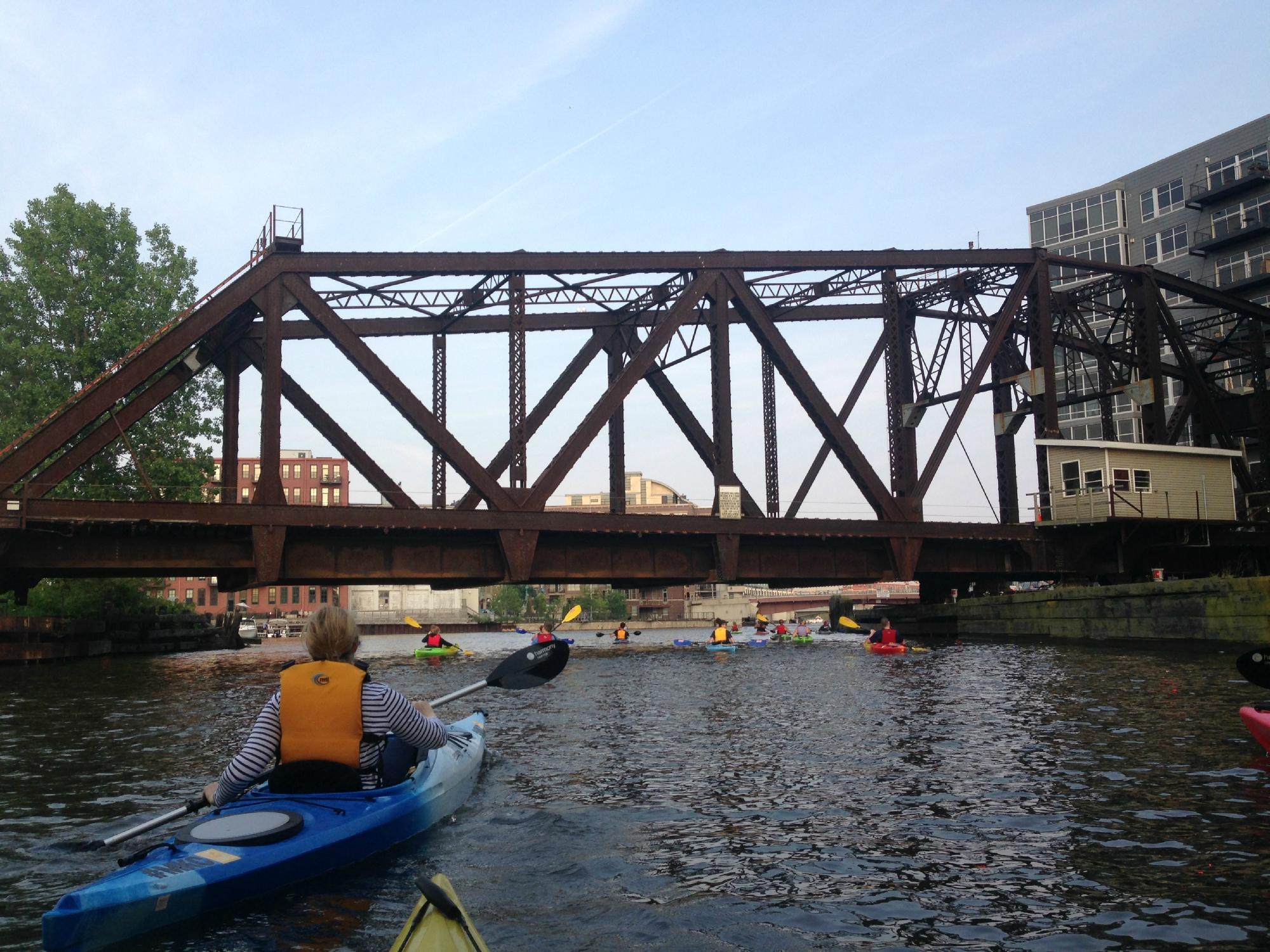
Hart Park Rips (HPR)
Rapid
USGS Gauge: 123 sq.mi.
Rapid
Parkway Access
Rapid
Cleft-Rock
Rapid
Slabs
Rapid
W.Monarch Place / N.43rd Street: Drainage area: ~133 sq.mi.
Rapid
Valley Park *** NEW RECOMMENDED TAKE-OUT ***
Rapid
Hank Aaron State Trail / Selig Drive
Playspots (11)
 Playspot
Bikeway Bridge (Hart Park)
 Playspot
Confluence with Honey Creek (10.3 sq.mi.)
 Playspot
Jacobus Bridge Pier (JBP)
 Playspot
Trenton Waves
 Playspot
Hawley-Wood Hole (HWH)
 Playspot
Little Ender Spot (LES)
 Playspot
Doyne Park Waves (DPW)
 Playspot
Zig Zag Wall Wave
 Playspot
Railroad Rips (RRR)
 Playspot
Remediation Rips
 Playspot
Third (Railroad) Crossing Wave (TCW)
Hazards & Portages (3)
Caution: The following locations may require scouting or portaging. Always check current conditions.
Difficulty
Class II-III
Length
3.7 mi
Gradient
20 ft/mi
max 25
Rapids
10
3 Hazards
Access Points
Shuttle Info
**Take-out:**
Your take-out lies just across the river from the Miller Brewing parking lot.
By car, this is accessed by crossing the 45th Street bridge (south, off of State Street), then bearing left (on Monarch Place, though I've never looked to see if it even has signage indicating the name), passing along essentially a back-alley behind a long set of buildings. Where the buildings end, you'll see a gravel drive, small parking area, and a ramp down to the river.
**Put-in:**
Our recommended put-in (now that numerous MMSD projects have reduced whitewater interest in upper sections of this river) is a short carry to the river from the parking lot at Hart Park.
Many 'alternative' put-ins are avaliable upstream, and are detailed on the description for the prior section of this river.
Difficulty Classes
I Easy
II Novice
III Intermediate
IV Advanced
V Expert/Extreme
VI Unrunnable
Current Conditions
5-Day Forecast
Whitewater data from
American Whitewater
American Whitewater