First Island Falls
Save this feature with the run it belongs to.
Gauge Conditions
Data from American Whitewater & USGS
Photo
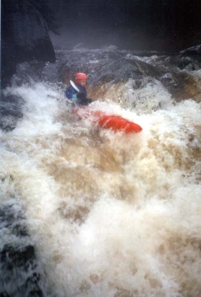
Photo courtesy of American Whitewater
Description
A split in the river signals First Island. The usual line is to the right of the island, where the river enters some light rapids, then turns to the left and drops about 4' down a moderately steep flume, leading to some easy rapids in the run-out.
The left channel also begins with light rapids but the final drop of 4'-5' is a boulder jumble which should be scouted before running. The usual line here is a boof off a rock right-of-center. This channel is prone to catching deadwood, so a strainer may be present here.
Location
Interactive river map
Loads as you approach this section.
Other Rapids on This Run (12)
 Hazard
N/A
Hazard
N/A
**** NOTICE ****
Rapid
N/A
River Road / Besau's Bridge
 Waterfall
N/A
Waterfall
N/A
Boulder Choke
 Waterfall
IV
Waterfall
IV
Suzie's Falls
Rapid
N/A
Confluence W.Br.Red
Rapid
N/A
Town Hall Road / Res.Hwy.22 Wayside (Upstream-most legal access)
Rapid
N/A
USGS gauge location
Rapid
III
Second Island (Bridge) Falls
 Playspot
II
Playspot
II
Farm Dam
Rapid
II+
Surprise
Rapid
II
S-curve
Rapid
N/A
Take Out
View Full Run
A) W.Town Hall Road to Morgan Rd. (3.8 miles) ** ACCESS ISSUES **
Red
I-III(IV)
8.1 mi
Current Conditions
5-Day Forecast
Whitewater data from
American Whitewater
American Whitewater