'Homme Side'/'Sweet Side'
Save this feature with the run it belongs to.
Gauge Conditions
Approximate - nearest available gauge. Use as general reference only.
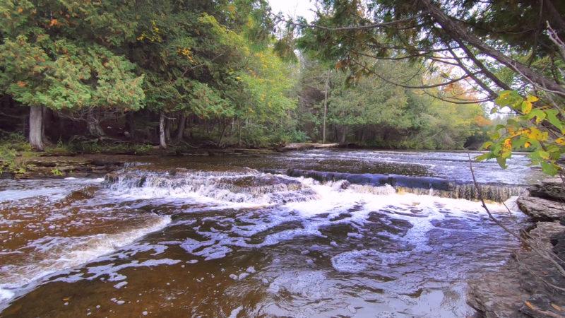
Photo
Description
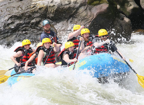
Downstream of the take-out, there is one more drop. Paddle down to where an island splits the flow. Take out on the island to scout both sides of this drop.
River right (at most flows) is a pretty gnarly mess. It has been run, but it is not trivial. I call this the 'Homme Side' (pronounced rather like 'homicide') since it looks to me to be a man-killer. Also in reference to 'Homme', French for 'man', since if you can find a line that you like, you're a better man than I am!
River left is far simpler (though can trick you up). A couple small bedrock intrusions (ledge/waves) twist the current left and right. A shoreline eddy allows you to collect your thoughts and aim toward a good horizon line for a sweet boof. In honor of this, I call this the 'Sweet Side' (often intentionally mispronounced to sound rather like 'suicide', as counterpoint to the other drop). A short boiling pool quickly spills across shallow rock to rejoin flow from the right of the island.
After running whichever side(s) to your heart's content, carry back to the top of the island, and paddle upstream in the slackwater above to get to your vehicle(s) (assuming you have found permission to park somewhere in this area.
Location

Current Conditions
5-Day Forecast
American Whitewater