Rapid
WI
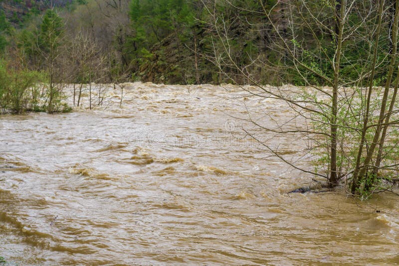
Slim Islands
Save this feature with the run it belongs to.
Gauge Conditions
Runnable: 300.0 – 1,500.0 CFS
Likely a bit low (or way low) for good whitewater.
Data from American Whitewater & USGS
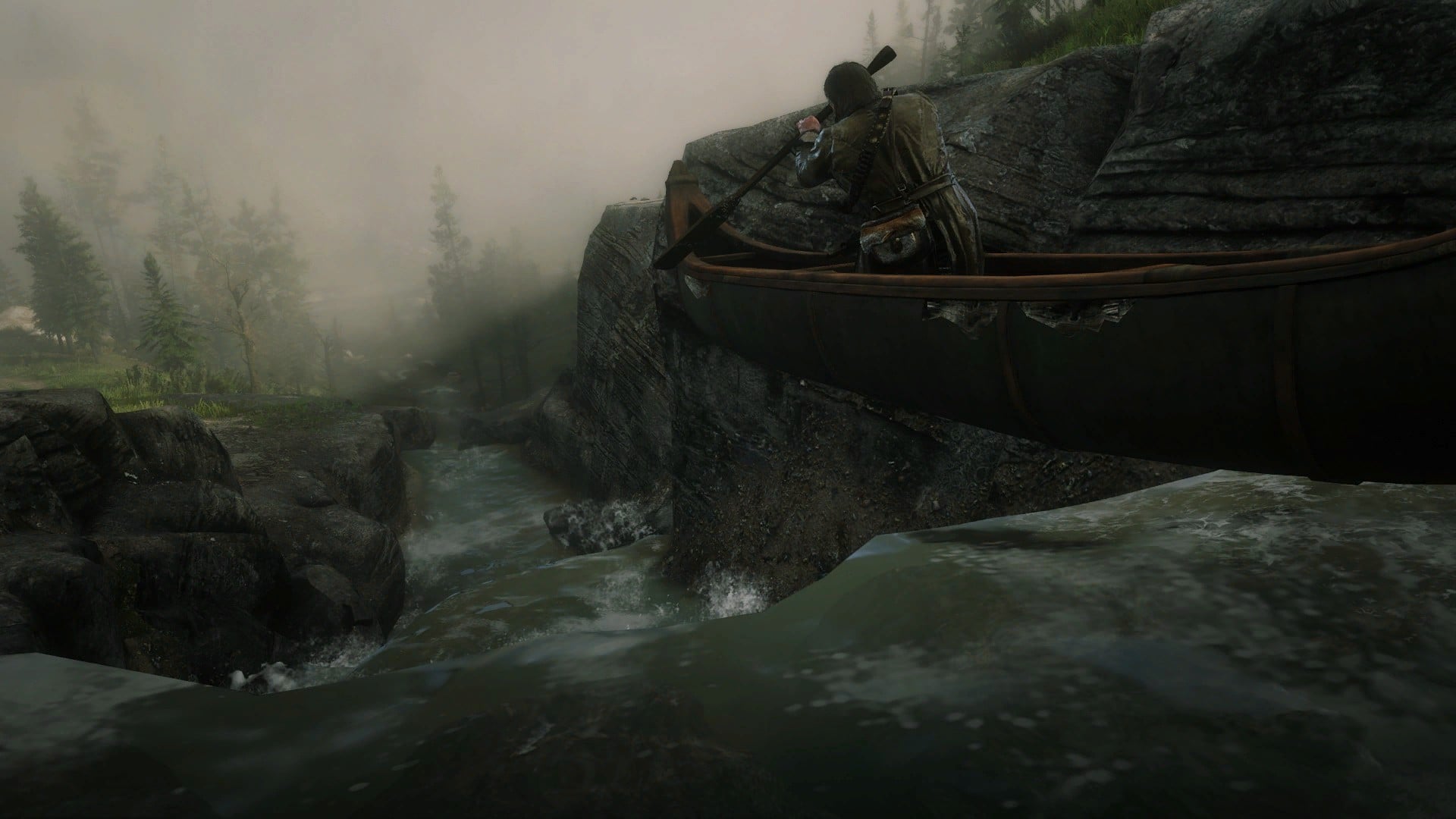
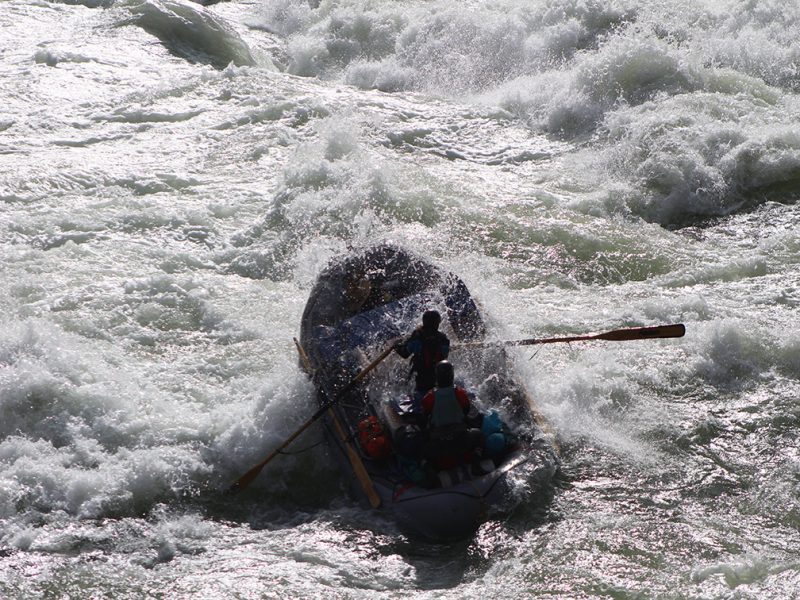
Photo
Photo courtesy of American Whitewater
Description
A couple of narrow islands appear on river-left. (At least as of the date of the aerial photos -- possible, unknown how likely, they could collapse and wash out in floods?) Most of the flow stays in the much wider channel to the right. It may be more impressive to paddle the narrower left channel between the islands and the vertical rock wall shore.
Location
Other Rapids on This Run (18)
 Rapid
N/A
Rapid
N/A
Put In
 Rapid
N/A
Rapid
N/A
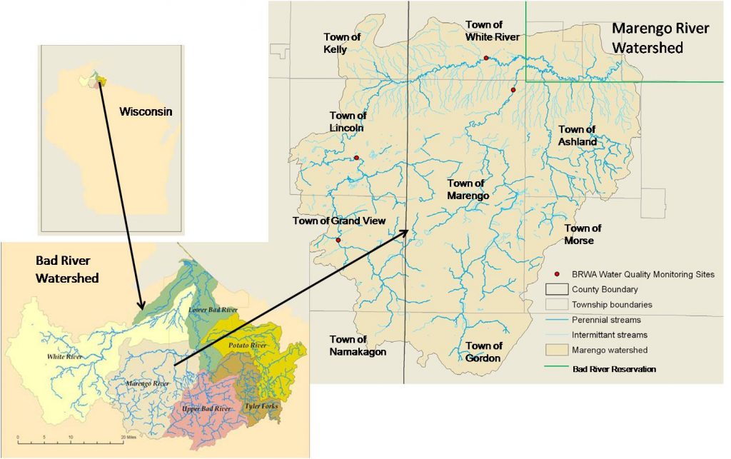
Drainage: 213 sq.mi.
 Rapid
N/A
Rapid
N/A
Ledge/wave
Rapid
N/A
Ledge/wave
Rapid
N/A
Ledge/wave
 Rapid
N/A
Rapid
N/A
High Wall
Rapid
N/A
High Wall
 Rapid
N/A
Rapid
N/A
Possble 'best' egress
Rapid
N/A
Ledge/wave
 Rapid
N/A
Rapid
N/A
Last evident possible egress
Hazard
N/A
Indian Reservation Boundary
 Rapid
N/A
Rapid
N/A
Boulderbed Resumes
 Rapid
N/A
Rapid
N/A
Longer Boulderbed Rapids
 Rapid
N/A
Rapid
N/A
Possible ledge/wave/hole
 Rapid
N/A
Rapid
N/A
Confluence, Marengo River
 Rapid
N/A
Rapid
N/A
Confluence, Potato River
 Rapid
N/A
Rapid
N/A
Railroad
 Rapid
N/A
Rapid
N/A
Elm Hoist Road: 597 sq.mi.
View Full Run
C) Devil's Gate to Elm Hoist Rd (4.3 to 19.5 miles) ** ACCESS ISSUES **
Bad
I-III
4.1 mi
Current Conditions
5-Day Forecast
Whitewater data from
American Whitewater
American Whitewater