3 - Copper Mine to Lumpkin County Park
Gauge Conditions
Runnable: 200.0 – 20,000.0 CFS
Data from American Whitewater & USGS
Run Map
Description
Sources: S. Welander, B. Sehlinger and D. Otey, A Canoeing and Kayaking Guide to Georgia (2004); B. Sehlinger and D. Otey, Northern Georgia Canoeing (1980); Appalachian Outfitters.
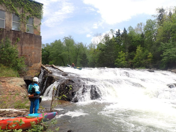
The put-in can be either above or below Copper Mine rapid. _For detailed information re. Copper Mine, see the Chestatee Section 2 page, AW Reach #3388._
Stay to the right of the island shortly below the rapid as the left channel is very shallow.
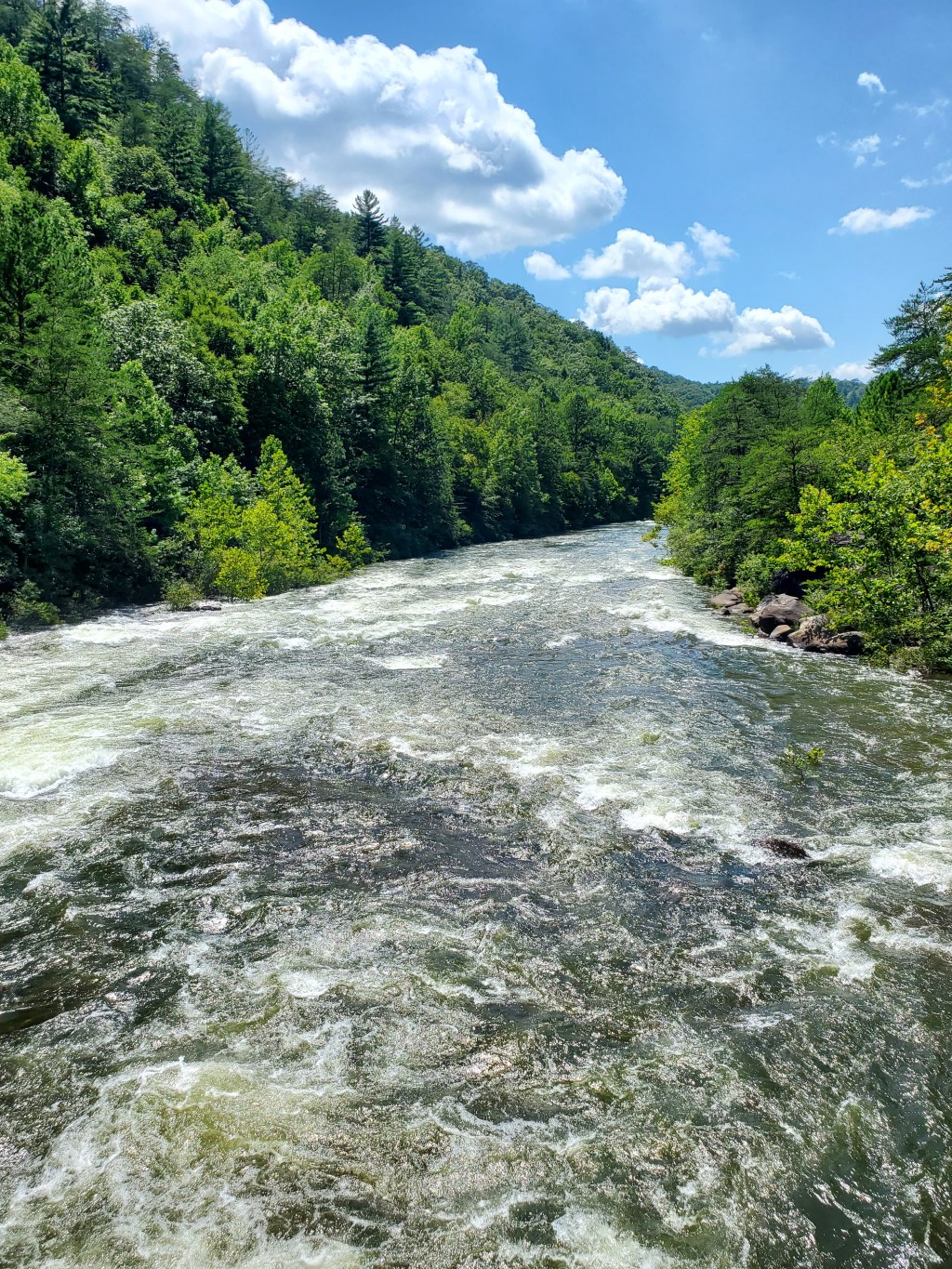
From Copper Mine to Highway 52, the gradient drops to 13 fpm. The scenery is still good, but the number of riverside residences is increasing. The section contains several Class II rapids (including Three Islands, The Rock Gates, Big Sky and Oh, THAT Rock) including Blasted Rock Rapid, named for the sharp, dynamite-blasted rocks that form it. The rocks were used to build a long-collapsed dam that stood at the start of the rapid. Shortly below Blasted Rock Rapid is a working granite quarry on river right. Shortly after the quarry is Highway 52, a short but steep alternate put-in/take-out.
Below Highway 52, the gradient decreases again and the river becomes slower with only Class I rapids. The scenery is still nice and consists of agricultural land and forest being rapidly replaced by development. Just before Highway 60, the river flows through Birch River, an upscale golf and residential development. Four holes require golfers to hit over the river so keep your eyes open for golfers preparing to hit and your ears open for cries of "fore" aka "duck").
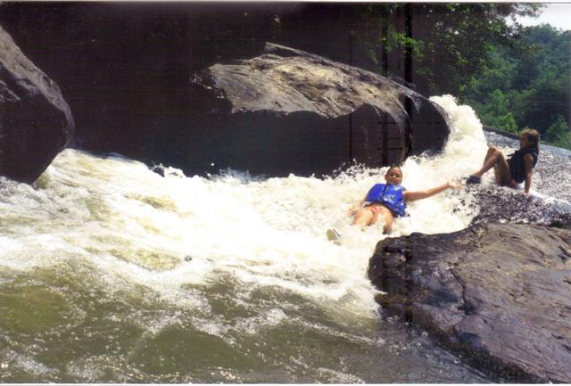
Shortly before the Highway 60 bridge, a long, narrow island (with a par 3 hole on it) splits the river into a narrower left channel and a wider right channel. This split requires a strategic decision: the left channel is nearly blocked by a fallen tree that requires careful maneuvering through small gaps. The right channel has no such obstruction, but ffeds into the shallow right side of Gold Digger Shoals. At lower water levels, the right line through Gold Digger often requires that boats be walked, either across to the deeper water on river left just below the island or over the rocks after getting hung up. Gold Digger Shoals can be avoided by portaging on either side from under bridge, but the walk is shorter and easier on the right (up the path and across the parking lot).
After passing under Highway 60 at Gold Digger Shoals, the river parallels the highway for about a half mile. After passing Appalachian Outfitters and adding flow from Yahoola Creek, the river curves away from the highway to circle a mountain. Once again, the wooded banks are rapidly giving way to residences, but for now the feel is still peaceful. With mild Class I rapids, wildlife (especially turtles and blue heron), a sandy-beach picnic spot shortly after the midway point and outfitter shuttling, the 6-mile section from Highway 60 to Highway 400 is excellent for family day-trips.
Shortly before Highway 400, the river again parallels Highway 60, this time flowing in the opposite direction. The last half mile or so includes three Class I rapids - Yeehaw, Bass in the Boat and Last But Not Least - that require some maneuvering, especially at lower water levels
Most boaters choose to take out at Highway 400: the 3.9 miles from there to Lumpkin County Park is flat water with little to no current, depending on the water level of Lake Lanier. The park is the last reasonable take-out unless you're looking for a long paddle on still water.
DIRECTIONS:
To reach the take-out at Lumpkin County Park, go east from Highway 400 on Lumpkin County Parkway (the intersection has a stoplight and a Ford dealership) and follow the signs. There is a parking lot at the park.
The Highway 400 access can only be reached from the southbound lanes of the highway. If you're northbound, you can no longer do a U-turn at the intersection of Highway 400 and Highway 60: turn left on Highway 60, turn around in the lot at the bank and pull out into the right turn lane to go south on Highway 400. Turn right on the small unmarked road about 100 yards south of the bridge and take the dirt road to the right at the fork. Limited parking is available near the access. Please do not leave vehicles blocking the road or the turn-around.
To reach the Highway 60 accesses, take Highway 60 northwest (left, if coming north on Highway 400) from the intersection of Highways 400 and 60. Gold Digger Shoals begins under the Chestatee River bridge and access is at the fruit stand parking lot on the left just past the bridge. Appalachian Outfitters is on the left just before the Yahoola Creek bridge. Both properties are private, so ask permission before parking or putting in.
To reach the put-in and the Highway 52 access, go north on Long Branch Road (between the two convenience stores) from the intersection of Highways 400 and 60. The next light will be Highway 52. To reach the Highway 52 access, turn left on Highway 52 and then turn right on the dirt road about 50 yards before the bridge. Limited parking is available along the dirt road. The walk from road to river is short, but steep enough to be a challenge for anyone handling a boat alone.
To reach the put-in from the intersection of Highways 60 and 52, continue north on Long Branch Road to the bridge. The dirt road down to river left is now blocked by a fence, so parking is roadside only and is limited. The path to the put-ins above and below Copper Mine rapid begins below the south (river left) end of the bridge. The property downriver of the bridge is private, so its better to put in under the bridge and either run Copper Mine Rapid or take out and put in on river left so as to minimize the trespassing.
Appalachian Outfitters (706-864-7117) offers shuttles and canoe/kayak rentals for the six mile section from its property to Highway 400.
Rapids in this Run (3)

Playspots (1)
Hazards & Portages (2)
Caution: The following locations may require scouting or portaging. Always check current conditions.

Difficulty
Class I-II(III)
Length
28.9 mi
Gradient
10 ft/mi
Rapids
3
2 Hazards
Access Points
Difficulty Classes
I Easy
II Novice
III Intermediate
IV Advanced
V Expert/Extreme
VI Unrunnable
Current Conditions
5-Day Forecast
Whitewater data from
American Whitewater
American Whitewater