Blasted Rock
Save this feature with the run it belongs to.
Gauge Conditions
Data from American Whitewater & USGS
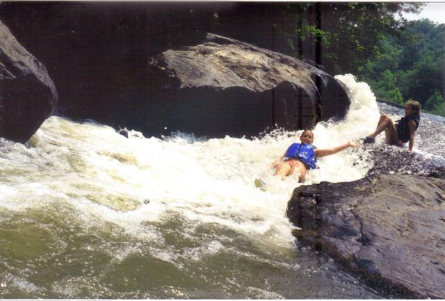
Photo

Photo courtesy of American Whitewater
Description
(For now, distance is map-based estimate.) The rapid is created by sharp, dynamite-blasted rocks that were used in a long-collapsed dam. The narrow island that divides the river can be run on either side, but be careful of deadfall on the left. Class II at moderate water levels, but more challenging with higher water.
Location


View Full Run
3 - Copper Mine to Lumpkin County Park
Chestatee
I-II(III)
28.9 mi
Hazard — Exercise extreme caution in this area.
Current Conditions
5-Day Forecast
Whitewater data from
American Whitewater
American Whitewater