*2025.09.09 Wood Update* Cedarburg Mill to CTH.T (2.3 miles)
Gauge Conditions
Runnable: 100.0 – 1,200.0 CFS
E.L.F.(Extreme Low Flow) beginner/novice: Open boats (canoes or recreational kayaks without skirts), kayaks, rafts; minimal whitewater play.
Data from American Whitewater & USGS
Run Map
Run Time Estimate
Select put-in and take-out to estimate time.
Plan This Trip
See wind-adjusted speed maps, forecast planning, and detailed time estimates.
Sign in to generate an AI timing estimate for this run.
Whitewater timing varies with scouting, portages, and group pace. Use as a planning baseline.
Description
Quick Facts
Location: Downtown Cedarburg to east edge of town.
Put-in: Rebellion Brewing, Cedarburg, WI (street parking)
Take-out: 4900 Lakefield Road, Cedarburg, WI (street parking just west of bridge
Shuttle Length: 0.8 mile, 2 minutes by car, 5 minutes by bike, or walk it in ~17 minutes!
Video Link: **** (link is cued to the putin on Cedar Creek. The Milwaukee-Grafton run is also on the video, which you can watch if you recue to beginning.)
Put-in is approximately 780' elevation, Take-out is approximately 705' elevation, thus total elevation change is approximately 75'. For the 2.2 mile run, that would work out to 34 FPM. Unfortunately, approximately 30' of this is wasted, being backed up by the two dams. This diminishes the *effective/usable gradient* closer to just 20 FPM.
Class/rating is NEVER enough to decide if you should run a river/rapids! Far more important than gradient and class/rating should be other less-quantifiable 'character factors': continuous versus pool/drop, wide-open routes versus constricted technical rapids, wide-channel (with multiple routes) versus narrow channel (with essentially one route), gradual river banks versus rocky shores or steep-walled gorges, et cetera.
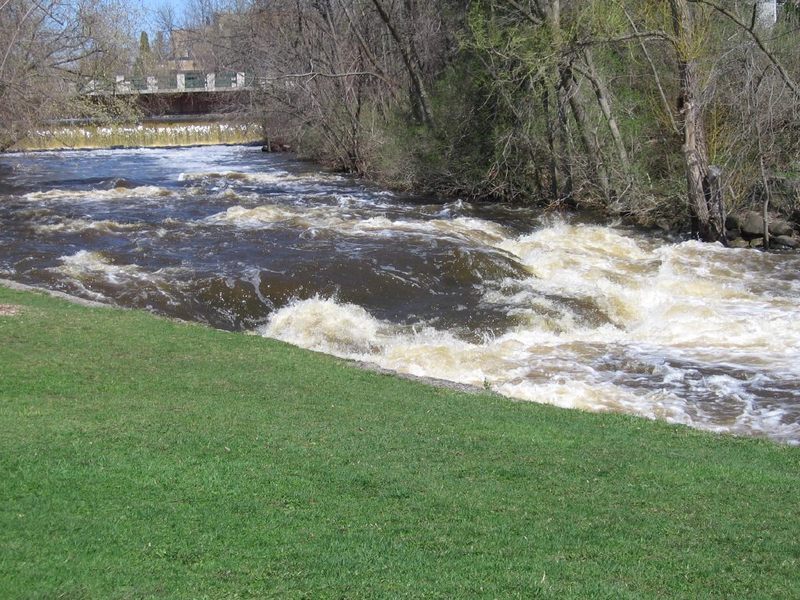
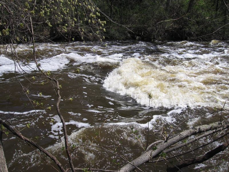
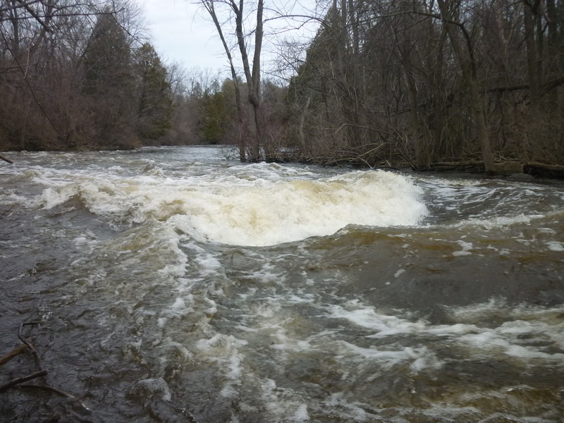
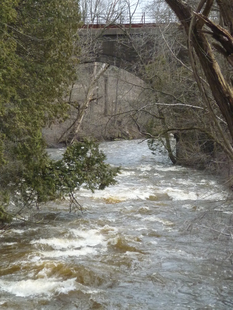
Character: An oxbow in the creek allows paddling 2.3 miles with only a 0.8 mile shuttle! Bedrock ledges and low-angle slides provide a decent assortment of play before gradient peters out in rubble-field shoals.
River banks: (exclusive of the aforementioned mill ponds) vertical walled mini-gorges, steep rocky banks, leading to eroded/vertical/undercut mud banks. Plenty of trees and shrubs (with attendant deadfall, sweepers, strainers, and snags)
Typical width: 30-80 ft. (exclusive of flatwater mill ponds)
Longest rapids (at normal/usual, low-to-moderate flows): maybe 250 feet?
Longest rapids (at higher flows): likely over 1/4 mile.
(NOTE: The last two above are an attempt to represent if a boater were to capsize and swim at the start of the rapids, the distance the swimmer's errant boat and paddle are likely to travel.before one or two paddling companions might be able to corral the gear ashore. Obviously highly subjective!)
Flow Info (using USGS flow data 2015-2025):
Average days per year above 200 cfs: 62
Average days per year above 300 cfs: 28.5
Average days per year above 400 cfs: 18
Average days per year above 500 cfs: 8.5
Average days per year above 600 cfs: 5
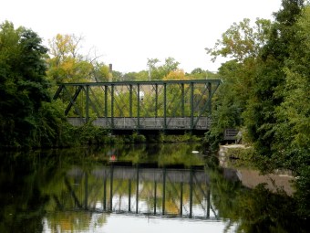
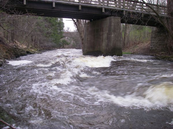
Main playable drops: City Park Ledge, Bank Waves, Estate Bridge, and Railroad Ledges.
Warning**
All Boaters of this creek should be aware there is a regular (nearly constant) problem with deadfall blocking passage at various places on this run. Location and potential impact of the hazard changes from time to time. The difficulty/class/rating listed is for *if/when things are clear*, which they *SELDOM are*! The steep banks and swift current (virtually everywhere other than the two impoundments behind two dams) make getting out of the river (to scout, to portage, or to recover self and gear in the event of an out-of-boat experience) EXTREMELY difficult to nearly impossible in many places! As a result, it is strongly advised that:
1\) While inexperienced, unprepared, novice boaters may make a trip down this, without mishap when all goes well, the bigger issue is being prepared and knowing what to do if and when things go amiss! At levels under 250-300 cfs, novices may be fine, but at higher flows, things will happen faster than a novice can deal with!
2\) Therefore, it would be VERY wise to have a group of at least 2-3 separate boats and boaters for safety and recovery in the event of a mishap, AND to have exposure to, knowledge of, and experience with Swiftwater Rescue techniques and equipment (throw ropes, extraction and recovery techniques, etc).
3\) Because of the somewhat tricky nature of the two portages, and the areas of the run which require skilled maneuvering at almost all flows, it can be VERY helpful to have at least one person in the group who has done this run at least once before (to help guide folks new-to-the-run, and warn/suggest skills and techniques needed in those tricky areas).
4\) Because the location and nature of hazards change quite often, and often can be in locations VERY DIFFICULT to avoid, and because scouting much of this run (either before running or during a run) can be difficult-to-impossible, all boaters are STRONGLY ENCOURAGED to make it a habit to check the 'Alerts' (above) and the 'Trip Reports' (near bottom of page) for the latest updates EACH TIME before running this creek.
General Overview
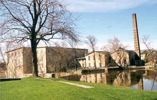
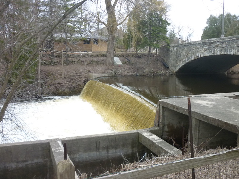
Historic Cedarburg boasts a fun little run, with two short, but rather wicked portages (dropping ~12' and ~18-20') around dams. Mountain goat agility or ropes will help, especially for early season (ice), during/immediately after rains (mud), or in fall (leaves obscuring footing). (A rope with 'biner to assist lowering boats and rapelling down the steep rocky bank might be handy, especially for such conditions.)
The run consists of shallow bedrock rapids, short ledges, and gorge/dells. In the lower reaches of this run (after Estate Bridge and the Railroad Ledges), the gradient has largely 'petered out', but current is still swift. Novice boaters may find themselves in trouble as they navigate bends and negotiate deadfall. (Every few years we see canoes and recreational kayaks wrapped around bridge piers or pressed and mangled around trees or deadfall in the currents ... evidence of people who quite obviously got in over their heads!)
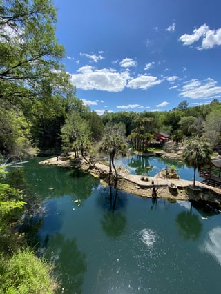
Note: this is one of the later southern Wisconsin streams to 'open up' in spring, due to the ponds (behind the two dams on the run) which do not quickly flush free of ice. Specifically, the second one (above the 'Nail Factory Dam') lies in an East-West stretch of river which tends to be rather sheltered from the sun, so it may remain ice-covered and impassible well after other rivers in the area have flushed free of ice!
Rapids in this Run (8)

Waterfalls (1)
Playspots (9)
Hazards & Portages (3)
Caution: The following locations may require scouting or portaging. Always check current conditions.
Difficulty
Class II-III
Length
2.3 mi
Gradient
20 ft/mi
max 35
Rapids
8
3 Hazards
Access Points
Shuttle Info
This run on Cedar Creek has a marvelously short shuttle since the river does a big ox-bow loop. Some boaters may opt for other put-in locations, forgoing the short ledge-drop in the city park, to avoid the flatwater paddle and first awkward portage.
In fact, one could get the best action (in ~0.53 miles) of this run going 'bank to bank' -- that is, from the BMO Harris Bank (Columbia Road at Highland Drive) to the North Shore Bank - Grafton ('NSB', at Columbia Road at 1st Street), though doing so would involve trespass (to carry in from the street or sidewalk to put in below the dam at Highland, and to carry out at the railroad trestle, across NSB property to get back to Columbia Road).
Difficulty Classes
I Easy
II Novice
III Intermediate
IV Advanced
V Expert/Extreme
VI Unrunnable
Current Conditions
5-Day Forecast
Whitewater data from
American Whitewater
American Whitewater