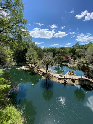
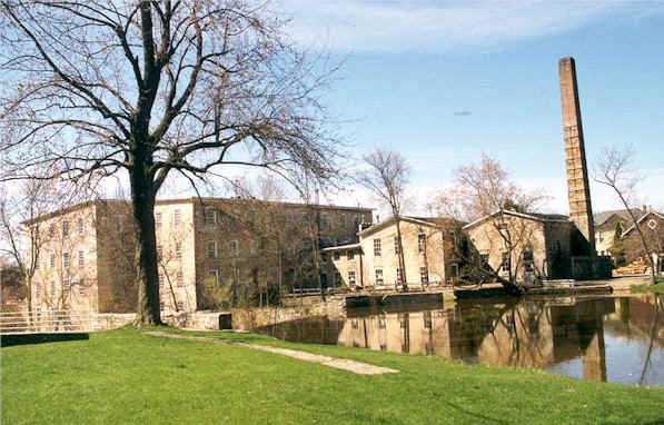
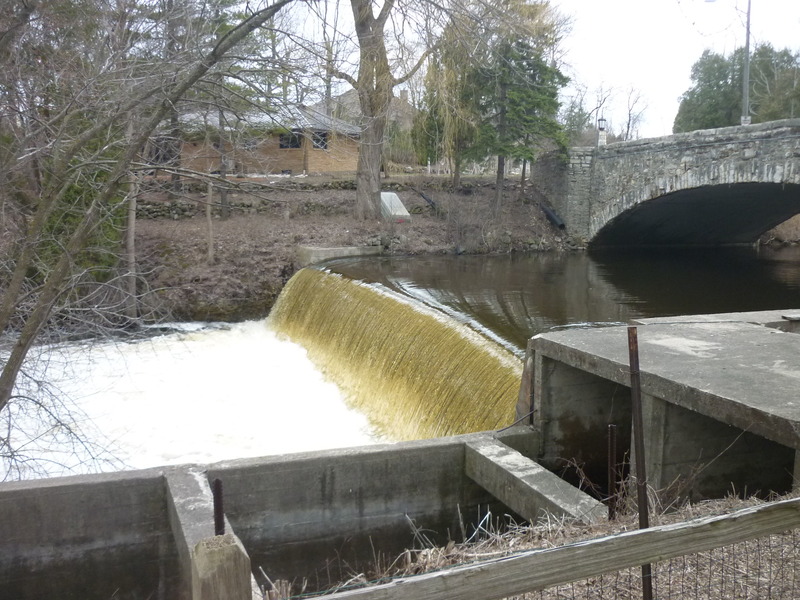
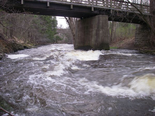
Nail Factory Dam (~18.5')
Save this feature with the run it belongs to.
Gauge Conditions
E.L.F.(Extreme Low Flow) beginner/novice: Open boats (canoes or recreational kayaks without skirts), kayaks, rafts; minimal whitewater play.
Description
Portage: <200', easy carry, but steep rocky chute to return to river.
NOTE: the on-shore 'Environmental Corridor' ends right at the dam. The private property upslope (downstream of the dam) actually extends all the way to the creek (and, in fact, extends across to the other shore once past the realty office downstream of the Nail Factory property)! Wisconsin law specifies we do have the right to portage a dam (and further specifies that the portage must be marked, which this one isn't!), but implicit in that right is to be as respectful of the private property that you are on, practice 'leave no trace' ethics, and do not dally!
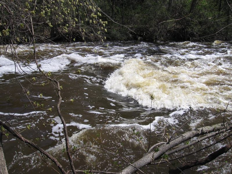
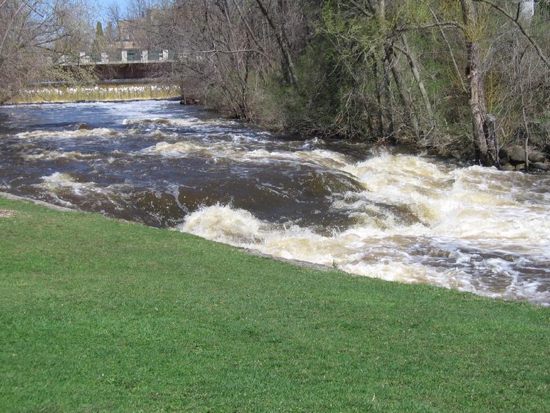
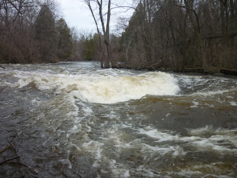
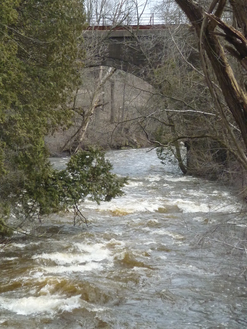
While the dam has been run (I believe nearly always at lower water levels, around 300 cfs, +/-), most boaters will opt to portage, river-right. Pause to have a look at the dam (and it's boil line!), then carry downstream to carefully make your way down a steep bank to get back on stream.
Those with mountain-goat abilities may be able to carefully shoulder/carry boats downslope to the river. Otherwise it may be best to have one person carefully get partway downslope, have the person at the top pass boats down one at a time, so the midslope person can lower them to a stable position next to the creek. Or ... if you have a throw-rope and a carabiner, affix it to your boat to lower it down, then make your way down (using your own skills or the rope, looped around a tree up top).
FOR SAFETY OF ALL IN YOUR GROUP: No one should begin the climb down while someone else is still making their way down! If the upper person were to lose footing and slide down, they would wipe-out the prior paddler downslope, increasing the likelihood of injury to both people.
At moderate-to-high flows, finding a convenient place to re-launch can be a challenge.
For anyone considering running the dam, be aware that the right bank angles in considerably, so you want to be at least 10-15' off the right flank of the dam to avoid a hard piton landing. Rescue would be difficult here since it is not easy for anyone to get near the river at the base of the dam. Anyone caught in the boil-line (at higher flows) would be in serious trouble. A very shallow boulder-field backs up the pool, and sometimes catches wood and debris.
Putting in as far upstream as possible (at the base of the climb down) will allow strong confident paddlers a chance to make a ferry across strong currents to catch an eddy behind a cement wall (at least, at flows up to 400-500 cfs ... above that, water overtops the wall and increasingly washes through the eddy). From this river-left eddy, it can be very interesting to paddle through one of two archways to go under the Nail Factory building and look at the huge timbers which support it, as well as seeing the base of the turbine which turned shafts and gears to power the whole operation. (BTW, technically there's a fine line as to whether this is trespassing. My belief is that as long as you are on the water, you're good ... just don't go ashore under there!)
NOTE: This dam is privately owned by the owner of the house at river-left. The owner is a local (Mke) developer who (according to rumors, anyway) has sworn as long as he owns the property, the dam is not going anywhere. Also, when the properties on river-right upstream of the dam were developed, (again, according to rumors) they were given assurance the dam would remain in place (though none of those properties extend as far as the river banks, thus have no direct stake in the dam).
Location
Other Rapids on This Run (20)
 Rapid
N/A
Rapid
N/A
 Rapid
N/A
Rapid
N/A
 Hazard
N/A
Hazard
N/A
 Rapid
N/A
Rapid
N/A
 Playspot
N/A
Playspot
N/A
 Waterfall
III
Waterfall
III
 Hazard
N/A
Hazard
N/A
 Rapid
N/A
Rapid
N/A
 Playspot
II
Playspot
II
 Playspot
N/A
Playspot
N/A
 Playspot
N/A
Playspot
N/A
 Playspot
II+
Playspot
II+
 Playspot
II
Playspot
II
 Playspot
II
Playspot
II
 Rapid
N/A
Rapid
N/A
 Playspot
N/A
Playspot
N/A
 Rapid
N/A
Rapid
N/A
 Rapid
N/A
Rapid
N/A
 Rapid
N/A
Rapid
N/A
Current Conditions
5-Day Forecast
American Whitewater