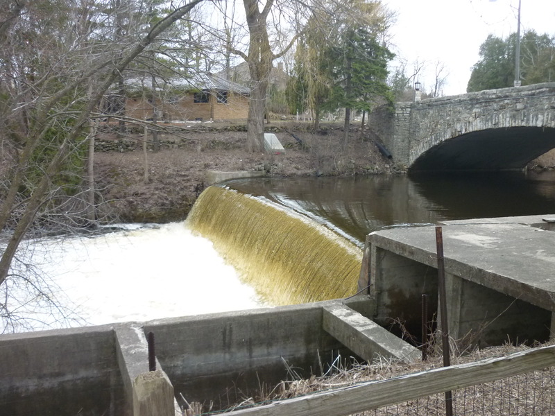
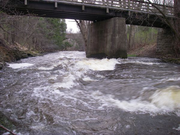
Highland Drive / Columbia Mills Dam (PORTAGE!)
Save this feature with the run it belongs to.
Gauge Conditions
E.L.F.(Extreme Low Flow) beginner/novice: Open boats (canoes or recreational kayaks without skirts), kayaks, rafts; minimal whitewater play.
Photo
Description
***Click "Show Full Descripiton" to read about concerns here!***
Portage: 100', awkward steep slope egress, steep rock chute return to creek.
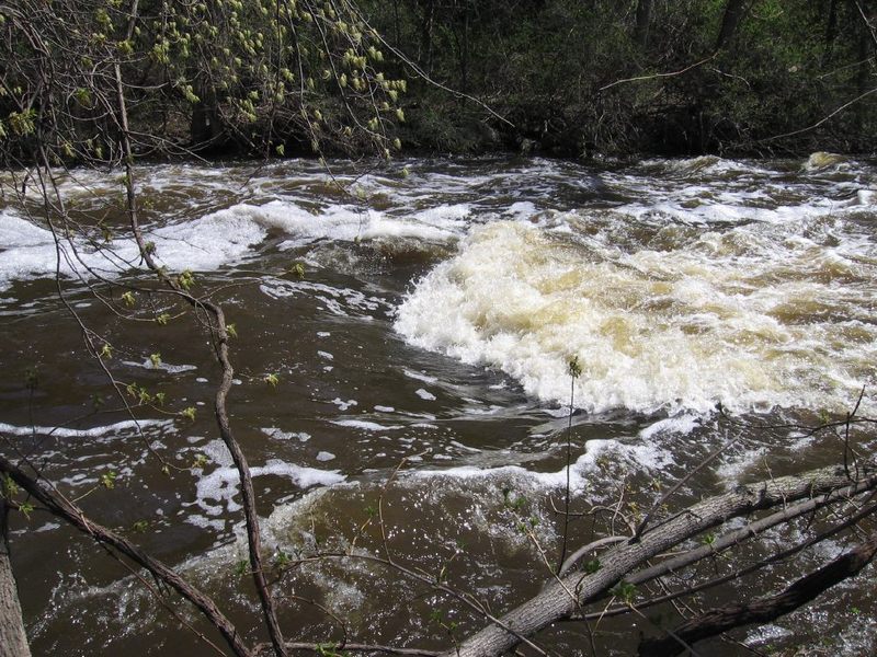
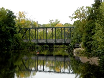
An attractive rock-arch bridge at Highland Drive signals the end of the millpond. Before the bridge, a small park river-right looks inviting to get out and walk a path up to the sidewalk. Across the street, river-right is a residential property and river-left is now a medical building. To carry into either property from the sidewalk is a trespass unless (before you put on) you have secured permission to do so!
Wisconsin law requires an available portage around a dam which must be marked with signage (which is absent here)! You have a legal right to portage as long as you enter the private property directly from the river (creek), spend as little time on shore as possible, and take the shortest distance to return safely to the stream. Be very careful to "leave no trace" of your passing, doing your best not to disturb anything on shore, leaving all landscape (rocks and plantings) as intact as possible.
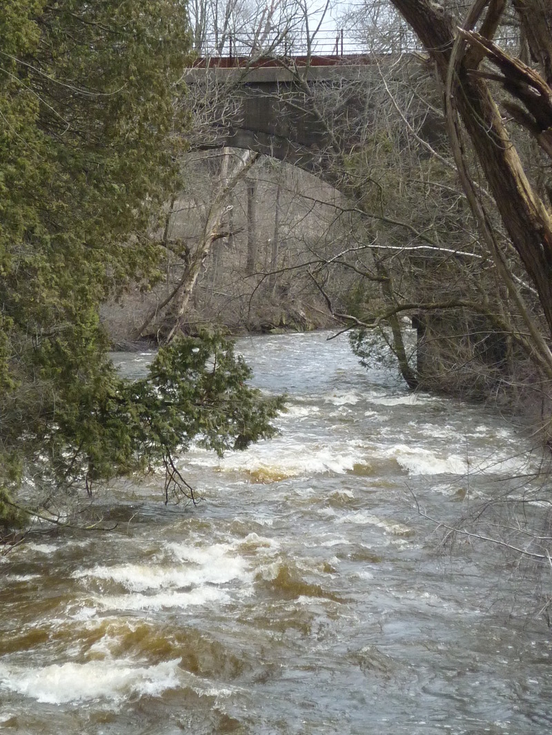
RIVER-RIGHT: Paddle as tight to the right shore as possible as you come out from under the bridge. Beach your boat parallel to the shore (taking advantage of a bit of cement and rockwork in the water immediately below the bridge). Exit your boat, carefully carry upslope, across a short bit of back yard, and find one of two mini-ravines in the steep, ~12' limestone riverbanks. Small, precarious handholds and footholds generally allow a careful climb down to water's edge, though most often you'll find a significant accumulation of plant matter (pine needles and leaves) making footing quite tenuous.
At water level, a large tree stands on the banks. At low-to-moderate flows, a fairly flat, mossy/gravelly patch of land allows easy re-entry to your boat. At higher flows, you will have to do your best to stabilize your boat in the shallow eddy to get in. At higher flows, more advanced paddlers have been known to forego scaling down the wall, instead doing a 'seal launch' from lawn atop the riverbanks! Nail that boof if you try this!
RIVER-LEFT: There used to be viable portage on this side. However, a gated and locked iron fence now stands at the top of the steps (downstream river-left of the bridge). A building (storm drainage system related) now occupies part of this corner of the lot. The capstone 'patio' area spanning the millrace (which formerly allowed dropping down to land and water access) is fenced off. A storm drain outfall with steep loose quarried-rock rubble (which will tip and slide underfoot if you were to try to scramble down it) has been constructed. With lack of use, shrubbery increasingly blocks access to the formerly accessible shoreline.
WE CANNOT RECOMMEND ANY ATTEMPT TO PORTAGE ON RIVER-LEFT!
**NOTES (as of June, 2022)**
Part of the rock wall forming the sidewalk guardrail of the bridge collapsed into the creek. This rocky debris actually makes beaching a boat (at river-right) and exiting the creek a bit easier at flows under 600 cfs! (That rocky debris may catch and hold leaves, twigs, branches and other debris from time to time.)
Returning to water level after your river-right portage, there is a good-sized log (branchless tree) parallel to shore which may slightly hamper paddling out into the current at some flows.
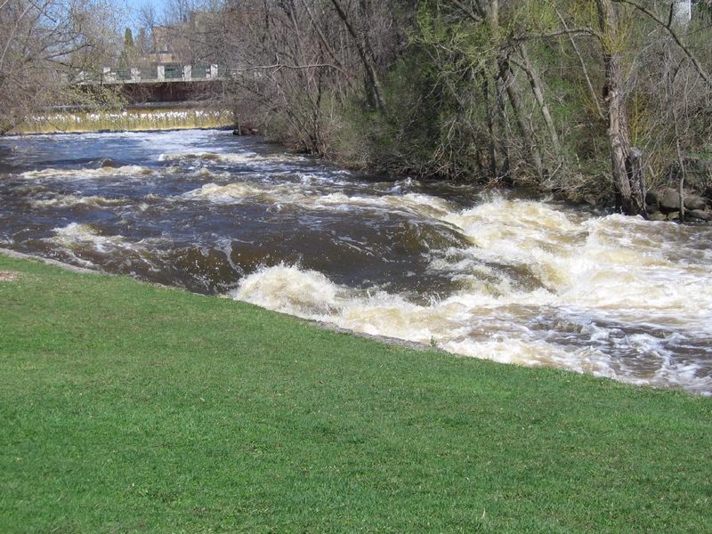
NOTE: This dam is owned by the city (like the 1st dam, at the Woolen Mill). It has been repaired/renovated relatively recently. The millrace has a working release gate which will be used at times of high flows. There are plenty of properties on the pond above (with strong feelings to preserve the 'pond'), and the 'dells' downstream can easily contain flooding flows without risk to adjacent properties. As a result, this dam is not under consideration for removal.
Location
Other Rapids on This Run (20)
 Rapid
N/A
Rapid
N/A
 Rapid
N/A
Rapid
N/A
 Hazard
N/A
Hazard
N/A
 Rapid
N/A
Rapid
N/A
 Playspot
N/A
Playspot
N/A
 Waterfall
III
Waterfall
III
 Rapid
N/A
Rapid
N/A
 Playspot
II
Playspot
II
 Playspot
N/A
Playspot
N/A
 Playspot
N/A
Playspot
N/A
 Playspot
II+
Playspot
II+
 Playspot
II
Playspot
II
 Playspot
II
Playspot
II
 Rapid
N/A
Rapid
N/A
 Playspot
N/A
Playspot
N/A
 Rapid
N/A
Rapid
N/A
 Rapid
N/A
Rapid
N/A
 Rapid
N/A
Rapid
N/A
Current Conditions
5-Day Forecast
American Whitewater