Creek View Court (Alternate Access)
Save this feature with the run it belongs to.
Gauge Conditions
E.L.F.(Extreme Low Flow) beginner/novice: Open boats (canoes or recreational kayaks without skirts), kayaks, rafts; minimal whitewater play.
Photo
Description
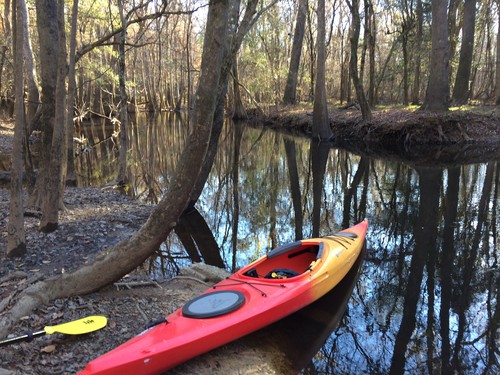
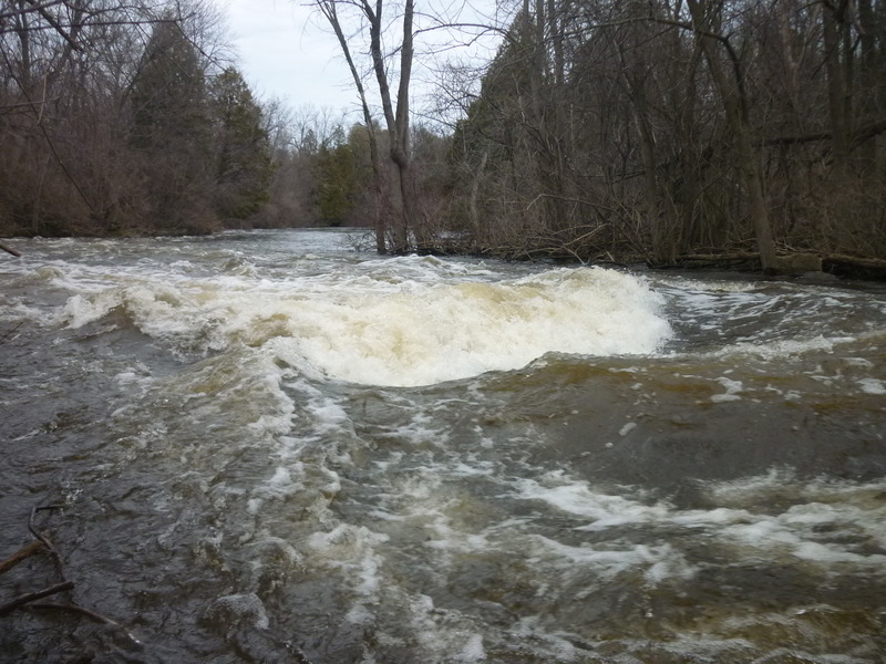
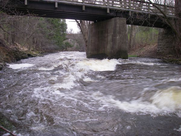
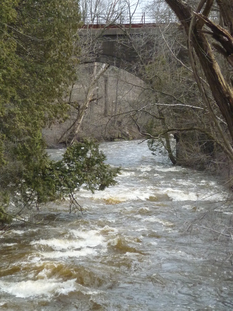
An alternate put-in (skipping the city park ledges, the flatwater paddle of the pond, and the need to portage the first dam) is available at a city-owned park which is accessible from a cul-de-sac on Creek View Court, Cedarburg. (Mapping/routing should work with just that info, or use coordinates 43.2999, -87.9739) On GIS/plat maps, this greenspace is named 'Hoffmann Glen Park' (though I see no on-site signage to that effect, and Google maps and other apps do not recognize that name).
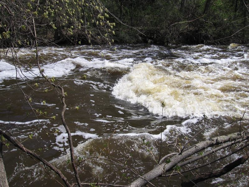
Park in the cul-de-sac adjacent to the path (don't block the path). Follow the path (initially pavement, quickly turning to rocks, dirt, and tree roots -- watch your footing!) about halfway down the slope, looking for minor path off to the left to get to the creek at a fenceline between conservancy property and the private property. Slackwater/eddy should allow peel-out into the current above the Bank Waves.
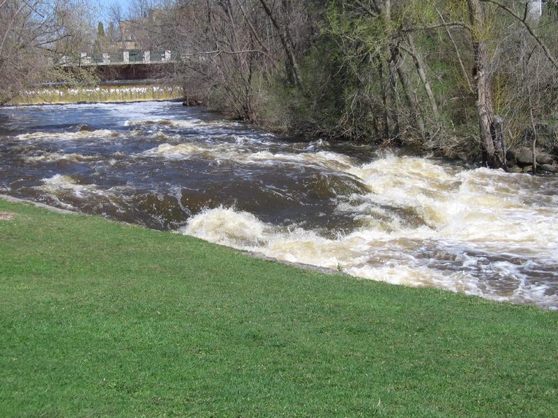
For PnP (park-and-play) of this feature (not doing any distance of the run), or for carry up to re-run the upper Bank Waves, look for low shoreline river-right (at the inside of the bend) immediately downstream of the outflow from these waves. (Not very far downstream, the right bank becomes a vertical wall of rock, not affording any convenient egress until you are nearly to the Nail Factory Dam.) Carry upstream on the conservancy path to either rerun the rapids or to return to your vehicle (to just do a park-and-play of these waves).
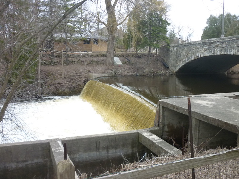
NOTE: According to the GIS/plat for Cedarburg, the park officially extends just down to the Narrows. Right about at that point on shore, you will feel like you are in the back yards of the next seven houses. However, the GIS/plat shows those properties all ending very close behind those buildings, and the remaining distance to the creek (between the Narrows and the dam) is shown as 'Environmental Corridor', so as long as you are respectful of those properties, you should be able to pass without trespass!
Location
Other Rapids on This Run (20)
 Rapid
N/A
Rapid
N/A
 Rapid
N/A
Rapid
N/A
 Hazard
N/A
Hazard
N/A
 Rapid
N/A
Rapid
N/A
 Playspot
N/A
Playspot
N/A
 Waterfall
III
Waterfall
III
 Hazard
N/A
Hazard
N/A
 Playspot
II
Playspot
II
 Playspot
N/A
Playspot
N/A
 Playspot
N/A
Playspot
N/A
 Playspot
II+
Playspot
II+
 Playspot
II
Playspot
II
 Playspot
II
Playspot
II
 Rapid
N/A
Rapid
N/A
 Playspot
N/A
Playspot
N/A
 Rapid
N/A
Rapid
N/A
 Rapid
N/A
Rapid
N/A
 Rapid
N/A
Rapid
N/A
Current Conditions
5-Day Forecast
American Whitewater