confluence of W Br to Cty 550 (10.8 miles) **Access Issues **
Gauge Conditions
Runnable: 50.0 – 300.0 CFS
Best levels unknown. Most of reach is off limits. (From 2005-2012, the highest DAILY MEAN flow at gauge is only 35 cfs.)
Data from American Whitewater & USGS
Run Map
Run Time Estimate
Select put-in and take-out to estimate time.
Plan This Trip
See wind-adjusted speed maps, forecast planning, and detailed time estimates.
Sign in to generate an AI timing estimate for this run.
Whitewater timing varies with scouting, portages, and group pace. Use as a planning baseline.
Description
The Salmon Trout River of Marquette County has long been a 'Holy Grail' of sorts for those who have explored the diverse and challenging whitewater rivers of Michigan's Upper Peninsula ('the U.P.'). Though this reach was likely run many times by the loggers that cut the area in the late 1800s and extensively utilized the river to transport the timber, I am not aware of any runs by modern recreational paddlers. The reason is that much of this reach is contained within the bounds of the Huron Mountain Club (HMC).
In the late 1800s, a large tract of primarily cut-over land was purchased for the creation of a private hunting and fishing reserve. The initial investors in the HMC were men of wealth from the Marquette area but the club began drawing a downstate and east coast patrician clientele as transportation options to the area improved. A measure of the degree of the club's exclusivity may be understood when one realizes that even Henry Ford (founder of the Ford Motor Company and ranking industrialist of his day) was kept on the waiting list for a number of years before gaining entrance, and then only because he was purportedly instrumental in defeating a proposed extension of Michigan State Hwy 35 that would have passed through HMC lands. (To this day, membership is reportedly only 50!)
The HMC has always strongly held to conservative conservation in the style popularized by Theodore Roosevelt. In the 1930s, noted conservationist Aldo Leopold was hired to design a forestry management program for them. They have preserved the remaining old-growth hardwood stands and have endeavored to restore the other lands within their aegis to their natural state. The beauty of the Huron Mountains is such that in the 1950s, there was an attempt to create a National Park in this area, an action which was swiftly and soundly defeated by HMC actions. They continue their private conservation efforts today and encourage scientific research within the unique ecosystems contained within their lands.
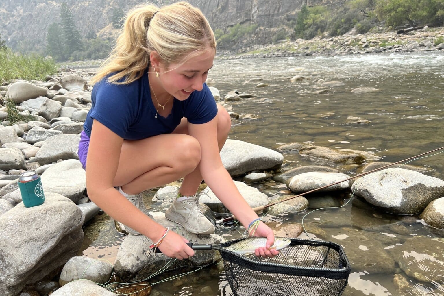
The Salmon Trout River is desirable not only to whitewater paddlers but to fishermen as this is a excellent steelhead stream. The Salmon Trout River is one of only three remaining known spawning grounds within the United States for the 'coaster' brook trout. However, this is a private tract and the HMC goes to some effort to ensure that it stays that way. They employ a private security force and maintain at least two guardhouses along this reach. From conversations with area residents, I understand that the HMC security personnel have a reputation of being very efficient at locating, pursuing, and deterring trespassers within club lands. It must be remembered that Michigan state navigability law is decidedly gray with regard to it's application to recreational paddling. Since the legality of paddling this reach is likely to be contested, _do not attempt this reach without the expressed consent of the Huron Mountain Club_.
Run Description
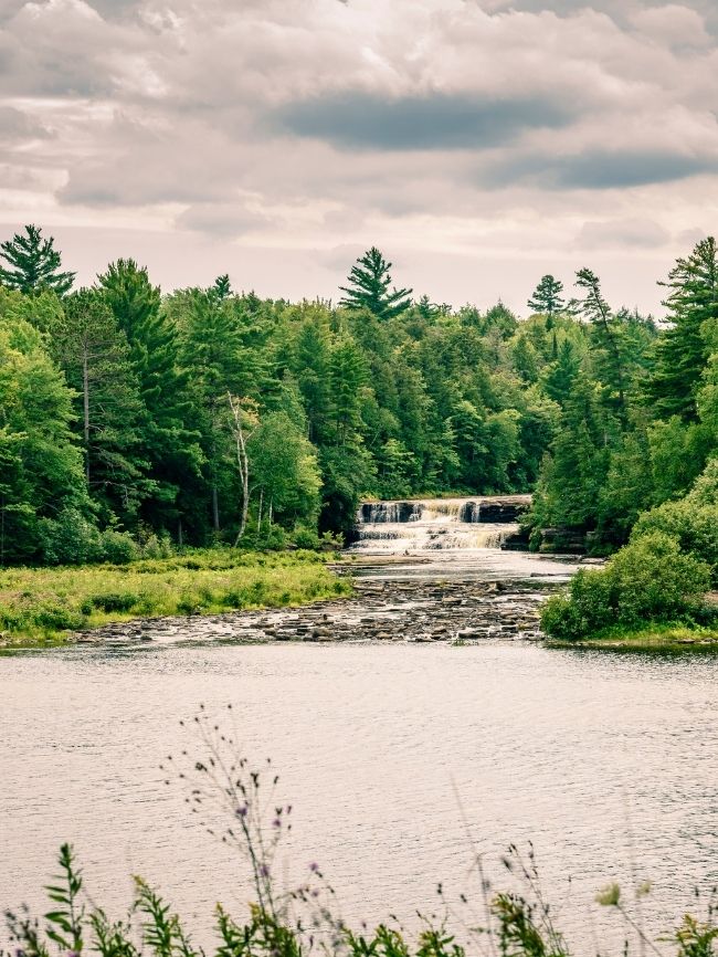
The reach described here begins near Dodge City at the confluence of the Salmon Trout with the West Branch Salmon Trout. Dodge City sits at the foot of the Huron Mountains, and consists of a handful of cabins ('camps' up here) on a logging road which is not maintained by the county during the winter months. Thus access during the prime water season (mid-late April) would probably require some creative shuttle arrangements, as the road will likely still be snowed in. The river is small where it crosses under the road and only becomes reasonably boatable after the confluence with the West Branch.
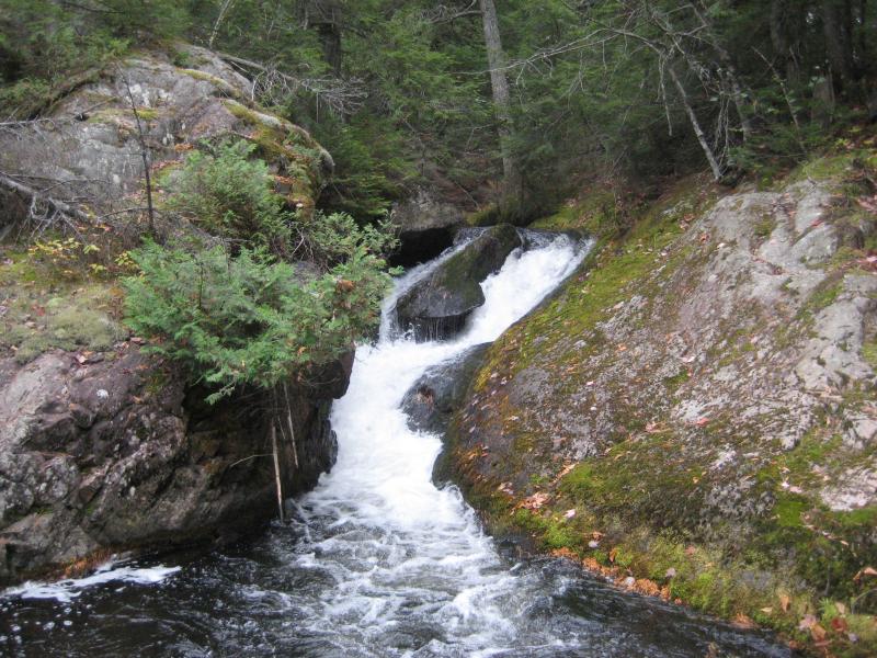
The first 3.2 miles are small enough to be prone to down timber. Gradient is fairly regular through much of this upper section (at 84'/mile average) culminating in the series of drops known as Upper Falls (65' in 0.3 miles). From this point down, the river changes character from the more consistent gradient of above to alternating stretches of flatwater and pronounced gradient below.
At a marshy area, once backwater of a logger's driving dam, the East Branch enters from the right shortly after passing through the Hogback Falls/Twin Falls sequence (75' in 0.3 miles). Ives Hill rises on the left and the river necks down for the next sequence of drops known as Middle Falls (80' in 0.3 miles). This is followed by another stretch of low gradient and then the final sequence of drops is encountered at Lower Falls (60' in 0.3 miles).
The river lies in a deep valley with little gradient for the remaining 2.6 miles the the bridge.
NOTE: Since we have no awareness of modern-day runs, we have no awareness of best runnable flows. Thus, all flow ranges are merely tentative, based on generalities.
Rapids in this Run (1)
Waterfalls (4)
Hazards & Portages (2)
Caution: The following locations may require scouting or portaging. Always check current conditions.
Difficulty
Class III-V
Length
8.9 mi
Gradient
49 ft/mi
max 107
Rapids
1
2 Hazards
Access Points
Difficulty Classes
I Easy
II Novice
III Intermediate
IV Advanced
V Expert/Extreme
VI Unrunnable
Current Conditions
5-Day Forecast
Whitewater data from
American Whitewater
American Whitewater