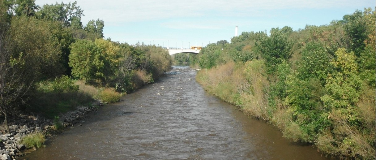
Estabrook Park Rips ("EPR")
Save this feature with the run it belongs to.
Gauge Conditions
Intermediate flow. Perhaps ideal flows for beginner-to-intermediate boaters (full run or PnP at EPL, UPk, TD or North Ave). (See description for details.)
Photo
Description
Width: 175', Length: 40-80'
Those of us who frequent this river tend to just initialize each of the main drops and playspots. You will notice these initializations in parenthesis on the headers and in the descriptions of this feature and most which follow.
===============================
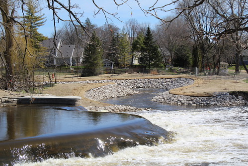
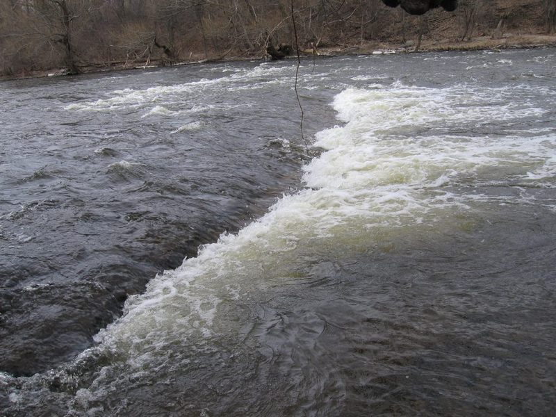
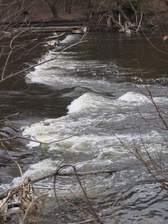
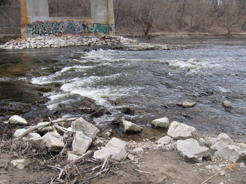
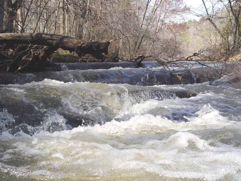
Modification of the riverbed in 2025 (to enhance fish passage for Lake Sturgeon and Northern Pike) has destroyed most of the interest here for whitewater boaters.
Channels have been excavated from well-upstream on both river-left and river-right of the ledge to reduce the vertical jump.
To the right, the bedrock now slopes fairly gradually to meet the bottom pool with no ledge remaining. A few minor riffles and waves may occur at some flows, but canoists, recreational kayakers, and total beginners in whitewater should easily be able to run that side at nearly all boatable flows. (NO NEED TO PORTAGE AS IN THE PAST!)
To the left, the left-most 15' or so of bedrock (alongside the vertical stone wall shore) was untouched, and will be dry shoreline at low flows. Bedrock was removed from the next 30-40' width. A minor wave may occur early in this stretch at low flows, followed by a pool area until where the ledge used to be. A bit of the lip of the falls was left in place, and some sort of waves may occur here at some flows. At high flows, water will be flowing across the higher bedrock along the vertical wall, and may form more of a feature near shore at the remaining ledge there. Be aware that there remains a lot of rocky rubble in the pool below. Anyone upside down or out of a boat will very likely have an unfortunate encounter with some of these rocks.
Rather oddly, between river-left and river-right, they've left a fairly straight, mostly fairly vertical (occasionally slightly 'stepped') dropoff parallel to the flow. At some low flows, this may present some odd play, but mostly it will be shallow/scrapey at low flows (as nearly all water will be in the right channel), and will be awash enough at higher flows as to minimize opportunities. Any features which form upriver (of where the bottom ledge used to be) will be COTF (catch-on-the-fly), 'one shot' play at most flows.
Bottom line ... virtually all the subtle nuanced features which formerly existed (Big Dog, the Micro Wave, Little Dog, ..., as well as the fun short 'boof' off the main drop) are gone. With some bedrock remaining where Beer Garden Chute was, we will have to wait and see how this area shapes up. At some flows, there may be some playable wave or hole, but it'll likely be far different (far less worthwhile) than ever before.
===================
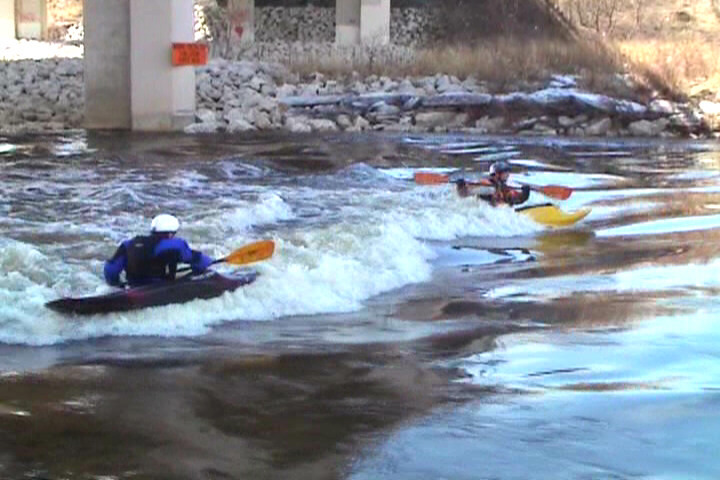
IF it turns out that any good features form at some range of flows ... this location can be done as a park-and-play (PnP), parking in Estabrook Beer Garden lot, carrying down (as described previously), running and playing whatever you may find worthwhile here (multiple times, if desired, carrying up river-right), finishing by coming ashore river-left at the end of the boardwalk, to carry back up the steps to the parking lot. It may also be worth doing a short shuttle (or boat down/carry-up+paddle-up) to catch this area and the next (U-Park Ledge) in a short (0.8 mile) run.
===================
Fishermen have long visited both shores in this area (while the falls were in place, blocking passage at most flows of all but the strongest swimming fish). With destruction of the falls now facilitating passage for nearly all fish at nearly all flows, concentration of fish will diminish significantly. (Concentration of fishermen may eventually diminish a bit, though good parking and good access will still draw them here, especially during seasonal spawning runs of trout and salmon).
My experience has been that summer fishermen (primarily for panfish and bass) tend to be fairly amused by and tolerant of our presence, whereas (with unfortunate regularity) the spring and fall sport fishermen (for trout and salmon) more often tend to be less tolerant, less willing to share the river. We've been told (by fishermen) that WE are breaking the law by "interfering" with their fishing, threatened with calling police or DNR-wardens, been intentionally cast-at with fishing hooks, and had rocks thrown at us. (I'm not saying every sport fisherman is so belligerent, just that some are.)
It should go without saying to try your best to be observant of their lines and avoid interference as much as reasonably possible. Often if you calmly and politely talk with them and 'negotiate' a bit, they'll (willingly, or begrudgingly) share the river. If/when you encounter someone fishing, who seems less willing to share, it may be best to just move on rather than pushing the issue into further conflict and potentially making matters worse, not only for yourself, but for ALL PADDLERS.
Location
Other Rapids on This Run (20)
 Waterfall
N/A
Waterfall
N/A
 Playspot
II
Playspot
II
 Playspot
I
Playspot
I
 Hazard
II
Hazard
II
 Playspot
II
Playspot
II
 Playspot
II+
Playspot
II+
 Playspot
II
Playspot
II
 Hazard
II
Hazard
II
 Rapid
N/A
Rapid
N/A
Current Conditions
5-Day Forecast
American Whitewater